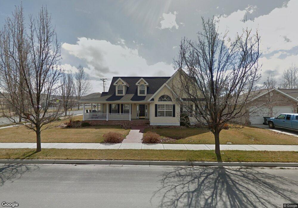
805 Lund Ln Baker City, OR 97814
Estimated Value: $423,528 - $582,000
4
Beds
3
Baths
2,247
Sq Ft
$221/Sq Ft
Est. Value
About This Home
This home is located at 805 Lund Ln, Baker City, OR 97814 and is currently estimated at $496,132, approximately $220 per square foot. 805 Lund Ln is a home located in Baker County with nearby schools including Brooklyn Primary School, Baker Middle School, and Baker High School.
Ownership History
Date
Name
Owned For
Owner Type
Purchase Details
Closed on
Jul 20, 2023
Sold by
Shinn Teodora
Bought by
Hillman Rodney
Current Estimated Value
Purchase Details
Closed on
Nov 24, 2014
Sold by
Vandenbos Trust
Bought by
Shinn Paul R and Shinn Teodora
Home Financials for this Owner
Home Financials are based on the most recent Mortgage that was taken out on this home.
Original Mortgage
$245,000
Interest Rate
4.37%
Mortgage Type
New Conventional
Create a Home Valuation Report for This Property
The Home Valuation Report is an in-depth analysis detailing your home's value as well as a comparison with similar homes in the area
Home Values in the Area
Average Home Value in this Area
Purchase History
| Date | Buyer | Sale Price | Title Company |
|---|---|---|---|
| Hillman Rodney | $400,000 | Amerititle | |
| Shinn Paul R | $285,000 | Amerititle |
Source: Public Records
Mortgage History
| Date | Status | Borrower | Loan Amount |
|---|---|---|---|
| Previous Owner | Shinn Paul R | $245,000 |
Source: Public Records
Tax History Compared to Growth
Tax History
| Year | Tax Paid | Tax Assessment Tax Assessment Total Assessment is a certain percentage of the fair market value that is determined by local assessors to be the total taxable value of land and additions on the property. | Land | Improvement |
|---|---|---|---|---|
| 2025 | $5,478 | $308,760 | $55,548 | $253,212 |
| 2024 | $5,309 | $299,767 | $50,222 | $249,545 |
| 2023 | $5,209 | $291,036 | $48,401 | $242,635 |
| 2022 | $5,065 | $282,560 | $52,947 | $229,613 |
| 2021 | $4,698 | $274,331 | $45,753 | $228,578 |
| 2020 | $4,589 | $266,341 | $46,379 | $219,962 |
| 2019 | $4,424 | $258,584 | $47,679 | $210,905 |
| 2018 | $4,025 | $251,053 | $42,781 | $208,272 |
| 2017 | $3,918 | $243,741 | $41,264 | $202,477 |
| 2016 | $3,913 | $236,642 | $39,864 | $196,778 |
| 2015 | $3,871 | $229,750 | $40,073 | $189,677 |
| 2014 | $3,681 | $223,059 | $38,542 | $184,517 |
| 2013 | -- | $216,563 | $51,033 | $165,530 |
Source: Public Records
Map
Nearby Homes
- 3640 Birch St
- 1 Cedar St
- 885 G St
- 1460 H St
- 3060 Elm St
- 3055 Grove St
- 3385 Kirkway St
- 599 Park Springs Ave
- 607 Park Springs Ave
- 583 Park Springs Ave
- 591 Park Springs Ave
- 2130 Cherry St
- 2615 1st St
- 2909 College St
- 2860 College St
- 2050 Birch St
- 2819 College St
- 1602 Broadway St
- 475 Washington Ave
- 1895 Balm St