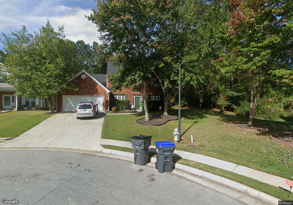
805 Millrace Way Unit 2B Sugar Hill, GA 30518
Estimated Value: $406,000 - $463,000
3
Beds
3
Baths
2,315
Sq Ft
$190/Sq Ft
Est. Value
About This Home
This home is located at 805 Millrace Way Unit 2B, Sugar Hill, GA 30518 and is currently estimated at $440,489, approximately $190 per square foot. 805 Millrace Way Unit 2B is a home located in Gwinnett County with nearby schools including Sycamore Elementary School, Lanier Middle School, and Lanier High School.
Ownership History
Date
Name
Owned For
Owner Type
Purchase Details
Closed on
Jul 17, 2003
Sold by
Rogers William S and Rogers Sally K
Bought by
Bonne James R and Bonne Susan
Current Estimated Value
Home Financials for this Owner
Home Financials are based on the most recent Mortgage that was taken out on this home.
Original Mortgage
$153,600
Interest Rate
6.13%
Mortgage Type
New Conventional
Purchase Details
Closed on
Oct 27, 2000
Sold by
Homeland Legacy Inc
Bought by
Rogers William S and Rogers Sally K
Home Financials for this Owner
Home Financials are based on the most recent Mortgage that was taken out on this home.
Original Mortgage
$162,200
Interest Rate
7.94%
Mortgage Type
FHA
Create a Home Valuation Report for This Property
The Home Valuation Report is an in-depth analysis detailing your home's value as well as a comparison with similar homes in the area
Home Values in the Area
Average Home Value in this Area
Purchase History
| Date | Buyer | Sale Price | Title Company |
|---|---|---|---|
| Bonne James R | $192,000 | -- | |
| Rogers William S | $163,600 | -- |
Source: Public Records
Mortgage History
| Date | Status | Borrower | Loan Amount |
|---|---|---|---|
| Previous Owner | Bonne James R | $153,600 | |
| Previous Owner | Rogers William S | $162,200 |
Source: Public Records
Tax History Compared to Growth
Tax History
| Year | Tax Paid | Tax Assessment Tax Assessment Total Assessment is a certain percentage of the fair market value that is determined by local assessors to be the total taxable value of land and additions on the property. | Land | Improvement |
|---|---|---|---|---|
| 2024 | $5,968 | $158,120 | $32,400 | $125,720 |
| 2023 | $5,968 | $158,120 | $32,400 | $125,720 |
| 2022 | $5,238 | $138,520 | $22,000 | $116,520 |
| 2021 | $4,140 | $105,920 | $18,000 | $87,920 |
| 2020 | $3,994 | $101,240 | $18,000 | $83,240 |
| 2019 | $3,848 | $101,240 | $18,000 | $83,240 |
| 2018 | $2,967 | $76,000 | $14,000 | $62,000 |
| 2016 | $2,575 | $76,000 | $14,000 | $62,000 |
| 2015 | $2,604 | $64,320 | $9,600 | $54,720 |
| 2014 | -- | $64,320 | $9,600 | $54,720 |
Source: Public Records
Map
Nearby Homes
- 5840 Stephens Mill Dr
- 818 Pond View Ct
- 585 Emerald Pkwy
- 5828 Paliser Trace
- 779 Avonley Creek Trace
- 535 Emerald Pkwy
- 561 Wagon Hill Ln
- 684 Old Cumming Rd
- 489 Emerald Lake Ln
- 598 Austin Creek Dr
- 778 Austin Creek Dr
- 5671 Arbor Green Cir
- 5720 Emerald Falls Way
- 465 Emerald Pkwy
- 5431 Cumming Hwy NE
- 5605 Austin Garner Rd
- 815 Millrace Way
- 800 Millrace Way
- 825 Millrace Way Unit 28
- 810 Millrace Way
- 835 Millrace Way
- 820 Millrace Way Unit 2B
- 830 Millrace Way
- 845 Millrace Way Unit 28
- 5740 Orouke Rd
- 0 Orouke Rd Unit 7446789
- 0 Orouke Rd Unit 7131922
- 0 Orouke Rd Unit 8340698
- 0 Orouke Rd Unit 8342193
- 0 Orouke Rd Unit 7546213
- 0 Orouke Rd Unit 7130206
- 0 Orouke Rd
- 5750 Orouke Rd
- 840 Millrace Way
- 855 Millrace Way
- 5744 Orouke Rd