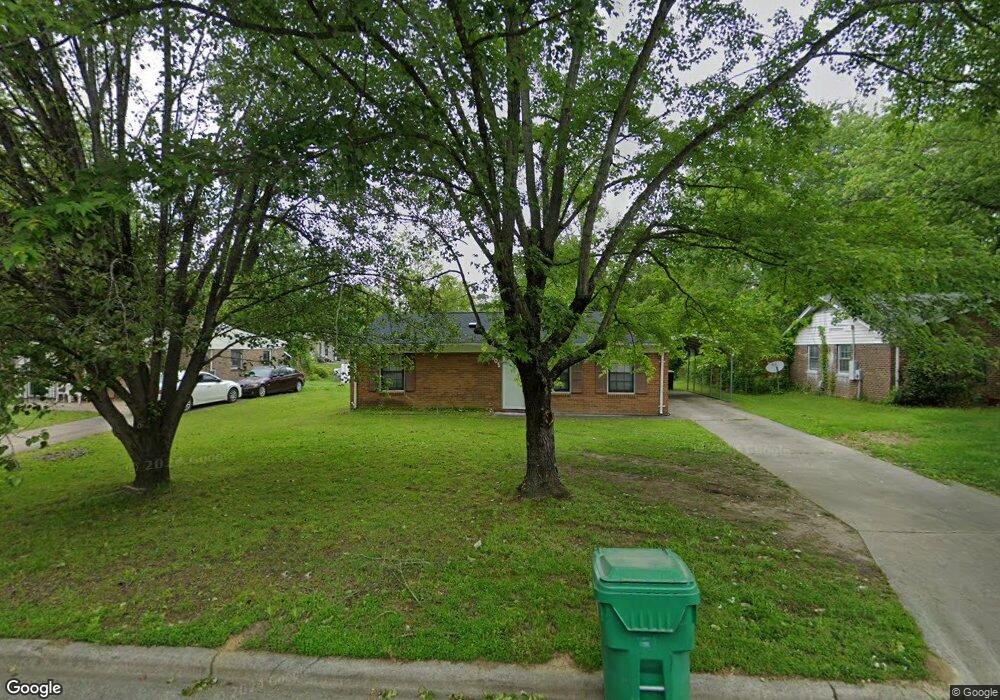
805 Miriam Ave High Point, NC 27263
Greater High Point NeighborhoodEstimated Value: $167,984 - $183,000
3
Beds
2
Baths
1,055
Sq Ft
$166/Sq Ft
Est. Value
About This Home
This home is located at 805 Miriam Ave, High Point, NC 27263 and is currently estimated at $174,996, approximately $165 per square foot. 805 Miriam Ave is a home located in Guilford County with nearby schools including Allen Jay Elementary School, Southern Guilford Middle, and Southern Guilford High School.
Ownership History
Date
Name
Owned For
Owner Type
Purchase Details
Closed on
Jul 28, 2000
Sold by
Berrier Helen H and Harris Stephen
Bought by
Le Hanh and Luu Thuy
Current Estimated Value
Home Financials for this Owner
Home Financials are based on the most recent Mortgage that was taken out on this home.
Original Mortgage
$67,076
Outstanding Balance
$24,338
Interest Rate
8.23%
Mortgage Type
FHA
Estimated Equity
$150,658
Purchase Details
Closed on
Sep 2, 1998
Sold by
Berrier Terry A
Bought by
Berrier Helen H
Create a Home Valuation Report for This Property
The Home Valuation Report is an in-depth analysis detailing your home's value as well as a comparison with similar homes in the area
Home Values in the Area
Average Home Value in this Area
Purchase History
| Date | Buyer | Sale Price | Title Company |
|---|---|---|---|
| Le Hanh | $79,000 | -- | |
| Berrier Helen H | -- | -- |
Source: Public Records
Mortgage History
| Date | Status | Borrower | Loan Amount |
|---|---|---|---|
| Open | Le Hanh | $67,076 |
Source: Public Records
Tax History Compared to Growth
Tax History
| Year | Tax Paid | Tax Assessment Tax Assessment Total Assessment is a certain percentage of the fair market value that is determined by local assessors to be the total taxable value of land and additions on the property. | Land | Improvement |
|---|---|---|---|---|
| 2025 | $1,312 | $95,200 | $20,000 | $75,200 |
| 2024 | $1,312 | $95,200 | $20,000 | $75,200 |
| 2023 | $1,312 | $95,200 | $20,000 | $75,200 |
| 2022 | $1,283 | $95,200 | $20,000 | $75,200 |
| 2021 | $963 | $69,900 | $17,000 | $52,900 |
| 2020 | $963 | $69,900 | $17,000 | $52,900 |
| 2019 | $963 | $69,900 | $0 | $0 |
| 2018 | $0 | $69,900 | $0 | $0 |
| 2017 | $963 | $69,900 | $0 | $0 |
| 2016 | $1,121 | $79,900 | $0 | $0 |
| 2015 | $1,127 | $79,900 | $0 | $0 |
| 2014 | $1,146 | $79,900 | $0 | $0 |
Source: Public Records
Map
Nearby Homes
- 2708 Ernest St
- 2716 Allen Jay Rd
- 1103 Pegram Ave
- 914 Nance Ave
- 2616 Ingram Rd
- 706 E Fairfield Rd
- 926 Norton St
- 921 Norton St
- 600 E Fairfield Rd
- 1846 Sechrest Cir
- 825 Hopewell St
- 2719 Granville St
- 607 Martha Place
- 312 Model Farm Rd
- 400 E Springfield Rd
- 304 E Springfield Rd
- 1640 Kersey Valley Rd
- 10844 N Main St
- 1605 Mossbrook Cir
- 1900-1922 Baker Rd
- 807 Miriam Ave
- 803 Miriam Ave
- 2703 Ernest St
- 809 Miriam Ave
- 801 Miriam Ave
- 814 Spring Oak Ct
- 2701 Ernest St
- 804 Miriam Ave
- 802 Miriam Ave
- 811 Miriam Ave
- 806 Miriam Ave
- 816 Spring Oak Ct
- 800 Miriam Ave
- 2623 Ernest St
- 813 Miriam Ave
- 812 Miriam Ave
- 812 Spring Oak Ct
- 2704 Miriam Ct
- 2711 Ernest St
- 2704 Ernest St