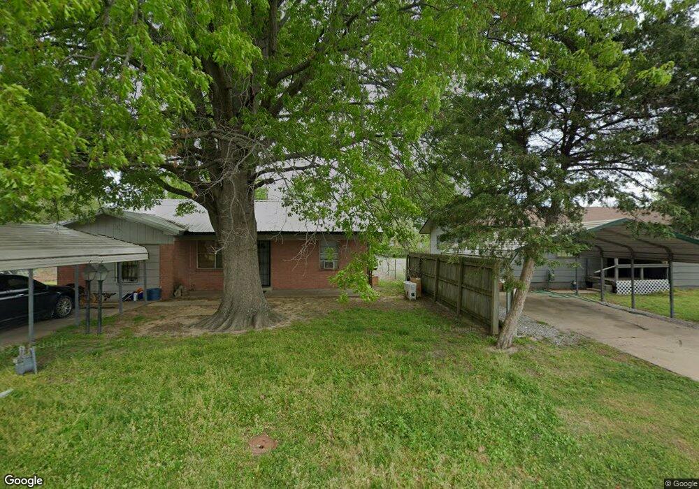
805 Moreland Rd Okmulgee, OK 74447
Estimated Value: $71,127 - $115,000
3
Beds
2
Baths
1,241
Sq Ft
$77/Sq Ft
Est. Value
About This Home
This home is located at 805 Moreland Rd, Okmulgee, OK 74447 and is currently estimated at $95,032, approximately $76 per square foot. 805 Moreland Rd is a home located in Okmulgee County with nearby schools including Okmulgee Primary School, Okmulgee Middle School, and Dunbar Elementary School.
Ownership History
Date
Name
Owned For
Owner Type
Purchase Details
Closed on
Jul 25, 2025
Sold by
Blazek Vicki
Bought by
Bowers John M and Bowers Kasey L
Current Estimated Value
Purchase Details
Closed on
Jan 23, 2018
Sold by
Morris State Bank
Bought by
Blazek Vicki E
Purchase Details
Closed on
Oct 19, 2017
Sold by
Haynes Ryan C and Casselman Lolonda J
Bought by
The Morris State Bank
Purchase Details
Closed on
Nov 18, 2005
Sold by
Haynes Christopher Alan and Haynes Teresa
Bought by
Haynes Ryan and Haynes Lolonda
Home Financials for this Owner
Home Financials are based on the most recent Mortgage that was taken out on this home.
Original Mortgage
$41,485
Interest Rate
6.06%
Mortgage Type
New Conventional
Purchase Details
Closed on
Apr 1, 2002
Sold by
Contruction Contruction D and Contruction T
Bought by
Haynes Christopher and Haynes Wif
Purchase Details
Closed on
Mar 17, 1994
Sold by
1St Nat'L Bank Okm
Bought by
Darrel Brummett
Create a Home Valuation Report for This Property
The Home Valuation Report is an in-depth analysis detailing your home's value as well as a comparison with similar homes in the area
Home Values in the Area
Average Home Value in this Area
Purchase History
| Date | Buyer | Sale Price | Title Company |
|---|---|---|---|
| Bowers John M | $22,500 | None Listed On Document | |
| Blazek Vicki E | $10,000 | None Available | |
| The Morris State Bank | $24,790 | None Available | |
| Haynes Ryan | -- | None Available | |
| Haynes Christopher | $32,000 | -- | |
| Darrel Brummett | $10,000 | -- |
Source: Public Records
Mortgage History
| Date | Status | Borrower | Loan Amount |
|---|---|---|---|
| Previous Owner | Haynes Ryan | $41,485 |
Source: Public Records
Tax History Compared to Growth
Tax History
| Year | Tax Paid | Tax Assessment Tax Assessment Total Assessment is a certain percentage of the fair market value that is determined by local assessors to be the total taxable value of land and additions on the property. | Land | Improvement |
|---|---|---|---|---|
| 2025 | $310 | $3,592 | $372 | $3,220 |
| 2024 | $310 | $3,421 | $372 | $3,049 |
| 2023 | $367 | $4,232 | $372 | $3,860 |
| 2022 | $358 | $4,232 | $372 | $3,860 |
| 2021 | $374 | $4,232 | $372 | $3,860 |
| 2020 | $374 | $4,233 | $372 | $3,861 |
| 2019 | $415 | $4,695 | $372 | $4,323 |
| 2018 | $420 | $4,696 | $372 | $4,324 |
| 2017 | $416 | $4,697 | $372 | $4,325 |
| 2016 | $398 | $4,484 | $372 | $4,112 |
| 2015 | $380 | $4,418 | $332 | $4,086 |
| 2014 | $365 | $4,207 | $316 | $3,891 |
Source: Public Records
Map
Nearby Homes
- 1225 S Delaware Ave
- 1029 S Sioux St
- 820 S Wood Dr
- 806 E 13th St
- 712 E 13th St
- 810 S Severs St
- 4 E 13th St
- 706 S Chickasaw Ave
- 708 S Miami Ave
- 821 S Lake Ave
- 809 S Lake Ave
- 1029 E 12th St
- 403 S Delaware Ave
- 1005 S Okmulgee Ave
- 1313 E 11th St
- 1123 E 9th St
- 916 S Okmulgee Ave
- 322 S Porter Ave
- 1327 E 10th St
- 600 E 7th St
- 707 Moreland Rd
- 716 Emerson Dr
- 801 Moreland Rd
- 718 Emerson Dr
- 714 Emerson Dr
- 701 E Moreland Rd
- 701 Moreland Rd
- 1201 S Rogers Ave
- 800 Moreland Rd
- 802 Moreland Rd
- 702 Moreland Rd
- 1200 S Rogers Ave
- 1206 S Rogers Ave
- 717 Emerson Dr
- 717 E Emerson
- 717 E 20th St
- 715 E 20th St
- 512 Emerson Dr
- 609 Moreland Rd
- 727 E 20 St