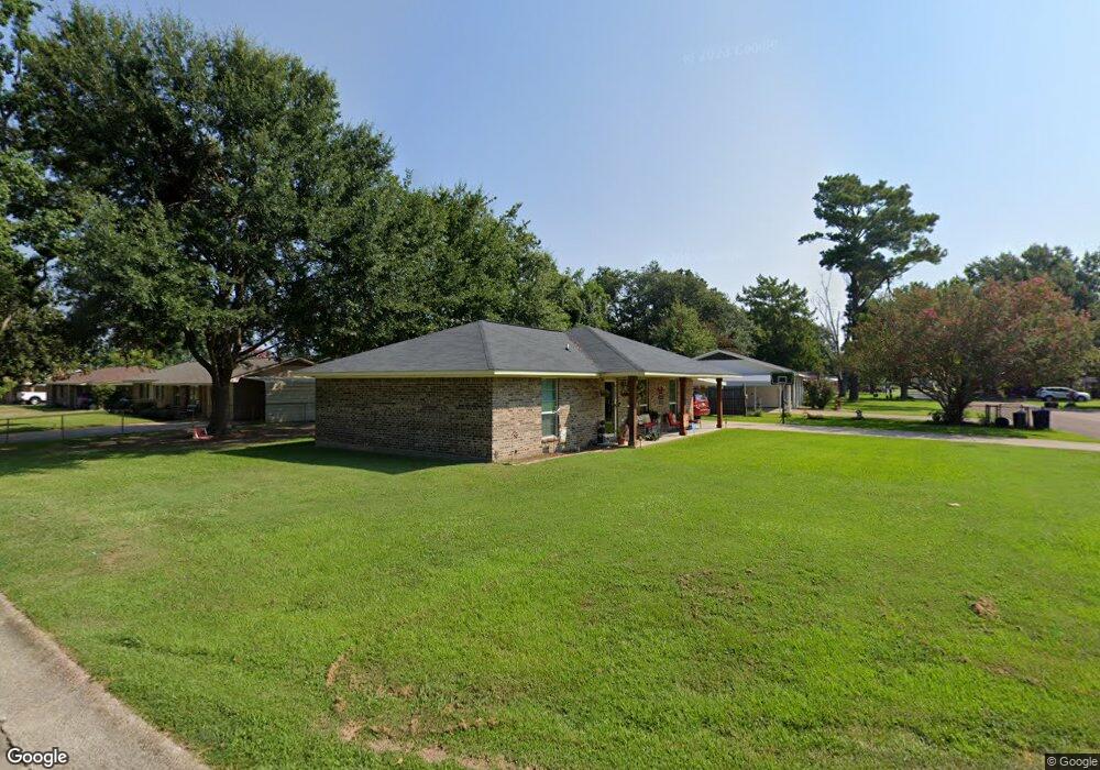
805 Myrtle St Vidalia, LA 71373
Estimated Value: $143,000 - $175,000
--
Bed
--
Bath
--
Sq Ft
9,496
Sq Ft Lot
About This Home
This home is located at 805 Myrtle St, Vidalia, LA 71373 and is currently estimated at $159,333. 805 Myrtle St is a home with nearby schools including Holy Family Early Learning Center, Cathedral School, and Bethel Missionary School.
Ownership History
Date
Name
Owned For
Owner Type
Purchase Details
Closed on
Apr 16, 2015
Sold by
Macon Ridge Community Development Corp
Bought by
Emfinger Terry L
Current Estimated Value
Home Financials for this Owner
Home Financials are based on the most recent Mortgage that was taken out on this home.
Original Mortgage
$140,000
Outstanding Balance
$112,863
Interest Rate
3.84%
Mortgage Type
USDA
Estimated Equity
$46,470
Purchase Details
Closed on
Dec 19, 2013
Sold by
Sybil Sybil and Wroten Tabitha Michelle
Bought by
Macon Ridge Community Development Corpor
Purchase Details
Closed on
Jun 6, 2013
Sold by
Hynum Warner Susie Yvonne and Warner Robert Charles
Bought by
Wroten Sybil J and Wroten Tabitha M
Create a Home Valuation Report for This Property
The Home Valuation Report is an in-depth analysis detailing your home's value as well as a comparison with similar homes in the area
Home Values in the Area
Average Home Value in this Area
Purchase History
| Date | Buyer | Sale Price | Title Company |
|---|---|---|---|
| Emfinger Terry L | $20,000 | -- | |
| Macon Ridge Community Development Corpor | $17,000 | -- | |
| Wroten Sybil J | $3,000 | -- |
Source: Public Records
Mortgage History
| Date | Status | Borrower | Loan Amount |
|---|---|---|---|
| Open | Emfinger Terry L | $140,000 |
Source: Public Records
Tax History Compared to Growth
Tax History
| Year | Tax Paid | Tax Assessment Tax Assessment Total Assessment is a certain percentage of the fair market value that is determined by local assessors to be the total taxable value of land and additions on the property. | Land | Improvement |
|---|---|---|---|---|
| 2024 | $658 | $13,770 | $1,700 | $12,070 |
| 2023 | $669 | $13,770 | $1,700 | $12,070 |
| 2022 | $1,414 | $13,770 | $1,700 | $12,070 |
| 2021 | $1,408 | $13,770 | $1,700 | $12,070 |
| 2020 | $1,407 | $13,770 | $1,700 | $12,070 |
| 2019 | $1,421 | $13,770 | $1,700 | $12,070 |
| 2018 | $1,421 | $13,770 | $1,700 | $12,070 |
| 2017 | $1,424 | $13,770 | $1,700 | $12,070 |
| 2015 | $179 | $1,700 | $1,700 | $0 |
| 2014 | $178 | $1,700 | $1,700 | $0 |
Source: Public Records
Map
Nearby Homes
- 0 Logan Sewell Dr Unit 4098493
- 0 Logan Sewell Dr Unit 4098082
- 902 Myrtle St
- 110 Riverbend Ave
- 1102 Plum St
- 1202 Apple St
- 1210 Palm St
- 1212 Peach St
- 0 U S 84
- 713 Carter St
- 1611 Azalea Dr
- 200 Cedar St
- 1105 Oneal St
- 206 Pine St
- 713 Carter St
- 205 Jefferson St
- 2 E Circle Dr
- 1802 Carter St
- 0 Hwy 84 West D&e Hwy
- 1 Colony Trail