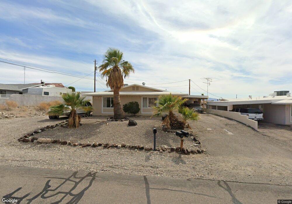
805 Sand Dab Dr Lake Havasu City, AZ 86404
Estimated Value: $334,230 - $413,000
--
Bed
1
Bath
2,449
Sq Ft
$159/Sq Ft
Est. Value
About This Home
This home is located at 805 Sand Dab Dr, Lake Havasu City, AZ 86404 and is currently estimated at $389,058, approximately $158 per square foot. 805 Sand Dab Dr is a home located in Mohave County with nearby schools including Havasupai Elementary School, Thunderbolt Middle School, and Lake Havasu High School.
Ownership History
Date
Name
Owned For
Owner Type
Purchase Details
Closed on
May 11, 2004
Sold by
Leiphardt Maria J
Bought by
Ward Curtis R and Ward Lynnette M
Current Estimated Value
Home Financials for this Owner
Home Financials are based on the most recent Mortgage that was taken out on this home.
Original Mortgage
$147,920
Outstanding Balance
$50,333
Interest Rate
1.62%
Mortgage Type
New Conventional
Estimated Equity
$338,725
Purchase Details
Closed on
Dec 31, 2002
Sold by
Kraus Richard J
Bought by
Leiphardt Maria J
Create a Home Valuation Report for This Property
The Home Valuation Report is an in-depth analysis detailing your home's value as well as a comparison with similar homes in the area
Home Values in the Area
Average Home Value in this Area
Purchase History
| Date | Buyer | Sale Price | Title Company |
|---|---|---|---|
| Ward Curtis R | $184,900 | Capital Title Agency Inc | |
| Leiphardt Maria J | $123,500 | Transnation Title Insurance |
Source: Public Records
Mortgage History
| Date | Status | Borrower | Loan Amount |
|---|---|---|---|
| Open | Ward Curtis R | $147,920 |
Source: Public Records
Tax History Compared to Growth
Tax History
| Year | Tax Paid | Tax Assessment Tax Assessment Total Assessment is a certain percentage of the fair market value that is determined by local assessors to be the total taxable value of land and additions on the property. | Land | Improvement |
|---|---|---|---|---|
| 2026 | $1,648 | -- | -- | -- |
| 2025 | $1,670 | $35,234 | $0 | $0 |
| 2024 | $1,670 | $43,108 | $0 | $0 |
| 2023 | $1,670 | $30,878 | $0 | $0 |
| 2022 | $1,598 | $21,381 | $0 | $0 |
| 2021 | $1,769 | $20,420 | $0 | $0 |
| 2019 | $1,681 | $18,144 | $0 | $0 |
| 2018 | $1,624 | $16,351 | $0 | $0 |
| 2017 | $1,608 | $16,238 | $0 | $0 |
| 2016 | $1,457 | $14,410 | $0 | $0 |
| 2015 | $1,397 | $14,630 | $0 | $0 |
Source: Public Records
Map
Nearby Homes
- 830 Sand Dab Ln
- 820 Sand Dab Dr
- 601 Desert View Dr
- 3100 Winterhaven Dr
- 3150 Sombrero Dr
- 870 Desert View Dr
- 3265 Palm Grove Dr
- 3270 Desert Sage Dr
- 2980 Kiowa Blvd N
- 3260 Fan Palm Dr
- 3132 Leawood Dr
- 3295 Foothill Dr
- 610 Desert View Dr
- 3056 Ironwood Dr
- 3072 Caravan Dr
- 965 Coconut Grove Dr
- 3359 Palo Verde Blvd S
- 3070 Dogwood Dr
- 3000 Mirage Dr
- 980 Coconut Grove Dr
- 830 Sand Dab Ln
- 795 Sand Dab Dr
- 810 Sand Dab Dr
- 815 Sand Dab Dr
- 820 Sand Dab Ln
- 0830 Sand Dab Dr
- 801 Sand Dab Ln Unit A
- 800 Sand Dab Dr
- 785 Sand Dab Dr
- 830 Sand Dab Dr
- 821 Desert View Dr
- 810 Sand Dab Ln
- 810 Sand Dab Ln Unit A
- 790 Sand Dab Dr
- 831 Sand Dab Ln
- 835 Sand Dab Dr
- 840 Sand Dab Dr
- 821 Sand Dab Ln
- 3153 Winterhaven Dr
- 3169 Winterhaven Dr