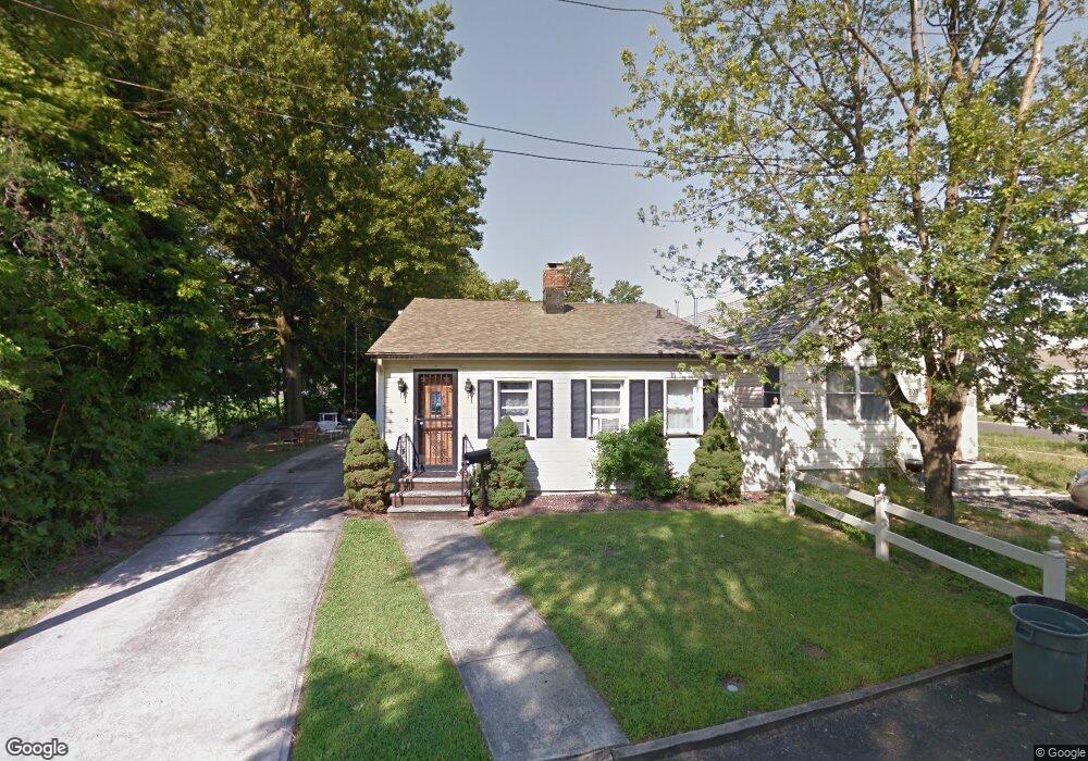
805 Shore Rd Keyport, NJ 07735
Estimated Value: $395,864 - $470,000
3
Beds
1
Bath
1,092
Sq Ft
$392/Sq Ft
Est. Value
About This Home
This home is located at 805 Shore Rd, Keyport, NJ 07735 and is currently estimated at $428,466, approximately $392 per square foot. 805 Shore Rd is a home located in Monmouth County with nearby schools including Memorial School and Baytul-Iman Academy.
Ownership History
Date
Name
Owned For
Owner Type
Purchase Details
Closed on
May 31, 2011
Sold by
Nebel Barbara
Bought by
Seelinger Charles R
Current Estimated Value
Home Financials for this Owner
Home Financials are based on the most recent Mortgage that was taken out on this home.
Original Mortgage
$130,000
Interest Rate
4.58%
Mortgage Type
Stand Alone First
Create a Home Valuation Report for This Property
The Home Valuation Report is an in-depth analysis detailing your home's value as well as a comparison with similar homes in the area
Home Values in the Area
Average Home Value in this Area
Purchase History
| Date | Buyer | Sale Price | Title Company |
|---|---|---|---|
| Seelinger Charles R | $180,000 | Fidelity Natl Title Ins Co |
Source: Public Records
Mortgage History
| Date | Status | Borrower | Loan Amount |
|---|---|---|---|
| Previous Owner | Seelinger Charles R | $130,000 |
Source: Public Records
Tax History Compared to Growth
Tax History
| Year | Tax Paid | Tax Assessment Tax Assessment Total Assessment is a certain percentage of the fair market value that is determined by local assessors to be the total taxable value of land and additions on the property. | Land | Improvement |
|---|---|---|---|---|
| 2025 | $6,543 | $348,500 | $173,700 | $174,800 |
| 2024 | $6,217 | $317,300 | $151,000 | $166,300 |
| 2023 | $6,217 | $290,500 | $131,300 | $159,200 |
| 2022 | $5,516 | $249,700 | $105,100 | $144,600 |
| 2021 | $5,516 | $224,700 | $95,500 | $129,200 |
| 2020 | $5,354 | $212,800 | $92,000 | $120,800 |
| 2019 | $5,215 | $202,200 | $87,000 | $115,200 |
| 2018 | $5,143 | $191,700 | $80,000 | $111,700 |
| 2017 | $5,535 | $198,300 | $84,000 | $114,300 |
| 2016 | $4,995 | $179,100 | $65,800 | $113,300 |
| 2015 | $4,881 | $178,200 | $70,000 | $108,200 |
| 2014 | $4,405 | $132,600 | $76,500 | $56,100 |
Source: Public Records
Map
Nearby Homes
- 715 Park Ave
- 904 Central Ave
- 602 Union Ave
- 825 Lorillard Ave
- 631 Sydney Ave
- 709 Lorillard Ave
- 412 Union Ave
- 641 Morningside Ave
- 1217 Union Ave
- 628 Morningside Ave
- 521 Columbia Ave
- 1319 Union Ave
- 725 Prospect Ave
- 707 Prospect Ave
- 535 Lorillard Ave
- 814 Brook Ave
- 650 Washington Ave
- 1213 Highway 36
- 528 Aumack Ave
- 525 Washington Ave