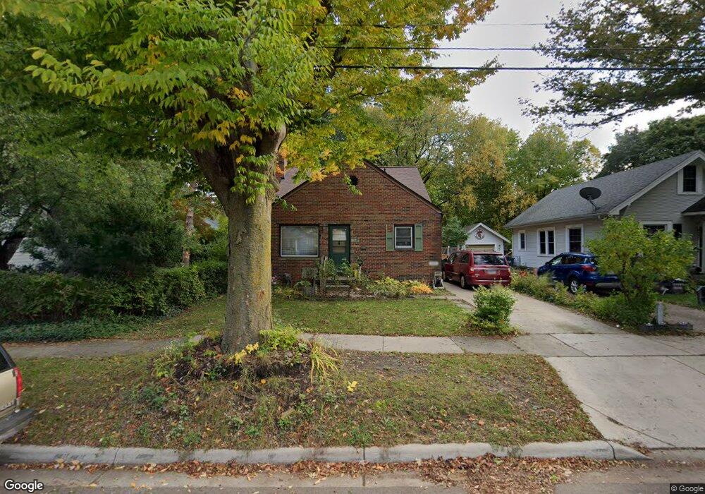
805 Smith Ave Lansing, MI 48910
Moores Park NeighborhoodEstimated Value: $166,010 - $182,000
Studio
1
Bath
1,192
Sq Ft
$145/Sq Ft
Est. Value
About This Home
This home is located at 805 Smith Ave, Lansing, MI 48910 and is currently estimated at $173,253, approximately $145 per square foot. 805 Smith Ave is a home located in Ingham County with nearby schools including Averill Elementary School, Pattengill Academy, and J.W. Sexton High School.
Ownership History
Date
Name
Owned For
Owner Type
Purchase Details
Closed on
Sep 7, 1999
Sold by
Howard Alonzo L and Howard Diane L
Bought by
Beitz Dale Alan
Current Estimated Value
Home Financials for this Owner
Home Financials are based on the most recent Mortgage that was taken out on this home.
Original Mortgage
$76,400
Outstanding Balance
$22,841
Interest Rate
7.93%
Mortgage Type
Purchase Money Mortgage
Estimated Equity
$150,412
Purchase Details
Closed on
Jan 4, 1996
Sold by
Dodge David A and Dodge Rebecca
Bought by
Howard Alonzo and Howard Diane
Purchase Details
Closed on
Sep 1, 1993
Create a Home Valuation Report for This Property
The Home Valuation Report is an in-depth analysis detailing your home's value as well as a comparison with similar homes in the area
Home Values in the Area
Average Home Value in this Area
Purchase History
| Date | Buyer | Sale Price | Title Company |
|---|---|---|---|
| Beitz Dale Alan | $84,900 | -- | |
| Howard Alonzo | $67,000 | -- | |
| -- | $60,000 | -- |
Source: Public Records
Mortgage History
| Date | Status | Borrower | Loan Amount |
|---|---|---|---|
| Open | Beitz Dale Alan | $76,400 |
Source: Public Records
Tax History
| Year | Tax Paid | Tax Assessment Tax Assessment Total Assessment is a certain percentage of the fair market value that is determined by local assessors to be the total taxable value of land and additions on the property. | Land | Improvement |
|---|---|---|---|---|
| 2025 | $3,644 | $80,500 | $8,100 | $72,400 |
| 2024 | $29 | $73,600 | $8,100 | $65,500 |
| 2023 | $3,416 | $66,300 | $8,100 | $58,200 |
| 2022 | $3,077 | $62,300 | $8,400 | $53,900 |
| 2021 | $3,013 | $58,400 | $7,900 | $50,500 |
| 2020 | $2,936 | $54,200 | $7,900 | $46,300 |
| 2019 | $2,816 | $51,100 | $7,900 | $43,200 |
| 2018 | $2,637 | $52,000 | $7,900 | $44,100 |
| 2017 | $2,525 | $52,000 | $7,900 | $44,100 |
| 2016 | $2,415 | $46,900 | $7,900 | $39,000 |
| 2015 | $2,415 | $45,000 | $15,850 | $29,150 |
| 2014 | $2,415 | $43,100 | $18,849 | $24,251 |
Source: Public Records
Map
Nearby Homes
- 815 Smith Ave
- 717 Smith Ave
- 900 W Mount Hope Ave
- 1017 W Barnes Ave
- 712 Lenore Ave
- 612 W Mount Hope Ave
- 1723 Osband Ave
- 1114 Goodrich St
- 1116 George St
- 1917 Osband Ave
- 2001 S Martin Luther King Junior Blvd
- 1400 Pico Ave
- 1319 Pico Ave
- 1824 Davis Ave
- 1312 W Mount Hope Ave
- 1120 Alsdorf St
- 815 Woodbine Ave
- 1309 Hammond St
- 310 W Barnes Ave
- 2421 Stirling Ave
- 1800 S Rundle Ave
- 817 Smith Ave
- 1812 S Rundle Ave
- 1811 Delevan Ave
- 1807 Delevan Ave
- 1815 Delevan Ave
- 1816 S Rundle Ave
- 1817 Delevan Ave
- 1820 S Rundle Ave
- 814 Smith Ave
- 808 Smith Ave
- 806 Smith Ave
- 727 Smith Ave
- 816 Smith Ave
- 1823 Delevan Ave
- 800 Smith Ave
- 901 Smith Ave
- 820 Smith Ave
- 1817 S Rundle Ave
- 1827 Delevan Ave
Your Personal Tour Guide
Ask me questions while you tour the home.