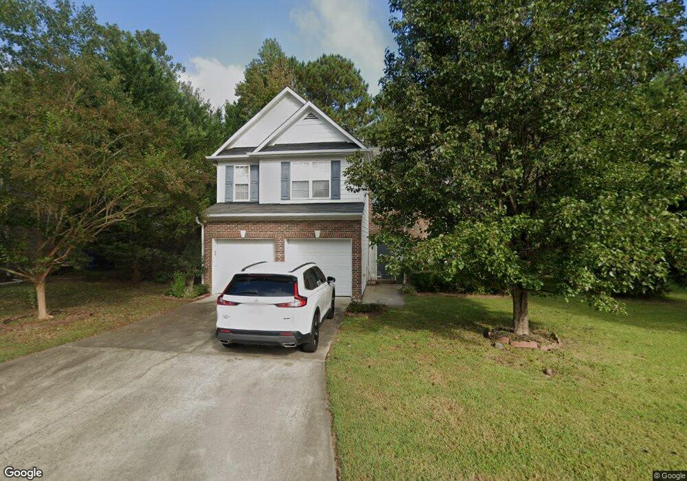
805 Southshore Pkwy Durham, NC 27703
Eastern Durham NeighborhoodEstimated Value: $401,000 - $445,000
4
Beds
3
Baths
2,201
Sq Ft
$193/Sq Ft
Est. Value
About This Home
This home is located at 805 Southshore Pkwy, Durham, NC 27703 and is currently estimated at $424,992, approximately $193 per square foot. 805 Southshore Pkwy is a home located in Durham County with nearby schools including Oak Grove Elementary, John W Neal Middle School, and Southern School of Energy & Sustainability.
Ownership History
Date
Name
Owned For
Owner Type
Purchase Details
Closed on
Aug 29, 2011
Sold by
Grover Kimberly Kappa and Grover Danny S
Bought by
Wall Constance Vanessa
Current Estimated Value
Home Financials for this Owner
Home Financials are based on the most recent Mortgage that was taken out on this home.
Original Mortgage
$162,260
Outstanding Balance
$14,574
Interest Rate
4.54%
Mortgage Type
New Conventional
Estimated Equity
$410,418
Purchase Details
Closed on
Sep 22, 2004
Sold by
D R Horton Inc Torrey
Bought by
Kappa Kimberly
Home Financials for this Owner
Home Financials are based on the most recent Mortgage that was taken out on this home.
Original Mortgage
$131,600
Interest Rate
5.78%
Mortgage Type
Purchase Money Mortgage
Create a Home Valuation Report for This Property
The Home Valuation Report is an in-depth analysis detailing your home's value as well as a comparison with similar homes in the area
Home Values in the Area
Average Home Value in this Area
Purchase History
| Date | Buyer | Sale Price | Title Company |
|---|---|---|---|
| Wall Constance Vanessa | $171,000 | None Available | |
| Kappa Kimberly | $164,500 | -- |
Source: Public Records
Mortgage History
| Date | Status | Borrower | Loan Amount |
|---|---|---|---|
| Open | Wall Constance Vanessa | $162,260 | |
| Previous Owner | Kappa Kimberly | $131,600 |
Source: Public Records
Tax History Compared to Growth
Tax History
| Year | Tax Paid | Tax Assessment Tax Assessment Total Assessment is a certain percentage of the fair market value that is determined by local assessors to be the total taxable value of land and additions on the property. | Land | Improvement |
|---|---|---|---|---|
| 2025 | $4,118 | $415,445 | $62,239 | $353,206 |
| 2024 | $3,315 | $237,664 | $45,525 | $192,139 |
| 2023 | $3,113 | $237,664 | $45,525 | $192,139 |
| 2022 | $3,042 | $237,664 | $45,525 | $192,139 |
| 2021 | $3,028 | $237,664 | $45,525 | $192,139 |
| 2020 | $2,956 | $237,664 | $45,525 | $192,139 |
| 2019 | $2,956 | $237,664 | $45,525 | $192,139 |
| 2018 | $2,663 | $196,286 | $33,385 | $162,901 |
| 2017 | $2,643 | $196,286 | $33,385 | $162,901 |
| 2016 | $2,554 | $196,286 | $33,385 | $162,901 |
| 2015 | $2,712 | $195,879 | $37,535 | $158,344 |
| 2014 | $2,712 | $195,879 | $37,535 | $158,344 |
Source: Public Records
Map
Nearby Homes
- 503 Bellmeade Bay Dr
- 715 Southshore Pkwy
- 128 Leacroft Way
- 537 Crossview Ln
- 615 Southshore Pkwy
- 16 Vestrial Ln
- 1 Kings Grant Ct
- 301 Sylvias Ct
- 208 Lick Creek Ln
- 506 Currin St
- 110 Kindlewood Dr
- 210 Stoney Creek Cir
- 106 Newberry Ln
- 3503 Grimes Ave
- 519 Keith St
- 1107 High Fox Dr
- 10 Autrey Mill Cir
- 406 Robbins Rd
- 402 Robbins Rd
- 622 Sherron Rd
- 803 Southshore Pkwy
- 807 Southshore Pkwy
- 807 Southshore Pkwy
- SS231 Southshore Pkwy
- SS236 Southshore Pkwy
- SS266 Southshore Pkwy
- SS267 Southshore Pkwy
- SS260 Southshore Pkwy
- SS297 Southshore Pkwy
- SS304 Southshore Pkwy
- SS238 Southshore Pkwy
- SS299 Southshore Pkwy
- SS305 Southshore Pkwy
- SS239 Southshore Pkwy
- 9 Marsh Landing Ct
- 801 SOUTHS To Be Added
- 801 SOUTHSHORE To Be Added
- 801 Southshore Pkwy
- 12 Marsh Landing Ct
- 809 Southshore Pkwy