Estimated Value: $516,000 - $631,000
4
Beds
3
Baths
2,379
Sq Ft
$245/Sq Ft
Est. Value
About This Home
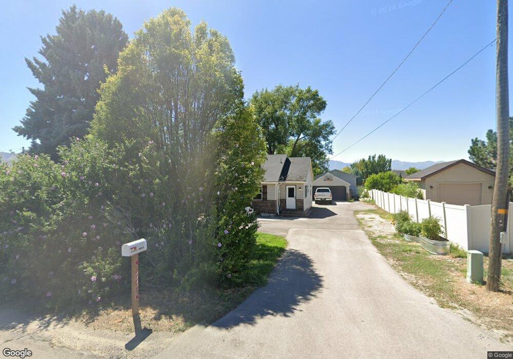
This home is located at 8051 N 9550 W, Lehi, UT 84043 and is currently estimated at $582,588, approximately $244 per square foot. 8051 N 9550 W is a home located in Utah County with nearby schools including Snow Springs Elementary, Willowcreek Middle School, and Lehi High School.
Ownership History
Date
Name
Owned For
Owner Type
Purchase Details
Closed on
Nov 20, 2019
Sold by
Francom Kodie K and Francom Michelle
Bought by
Lighting Rentals Llc
Current Estimated Value
Purchase Details
Closed on
Mar 6, 2003
Sold by
Francom Kodie K
Bought by
Francom Kodie K and Francom Michelle
Home Financials for this Owner
Home Financials are based on the most recent Mortgage that was taken out on this home.
Original Mortgage
$112,500
Interest Rate
5.83%
Purchase Details
Closed on
Aug 20, 1999
Sold by
Lewis Shawn C and Lewis Jennifer R
Bought by
Francom Kodie K and Francom Michelle
Home Financials for this Owner
Home Financials are based on the most recent Mortgage that was taken out on this home.
Original Mortgage
$115,053
Interest Rate
7.63%
Mortgage Type
FHA
Create a Home Valuation Report for This Property
The Home Valuation Report is an in-depth analysis detailing your home's value as well as a comparison with similar homes in the area
Home Values in the Area
Average Home Value in this Area
Purchase History
| Date | Buyer | Sale Price | Title Company |
|---|---|---|---|
| Lighting Rentals Llc | -- | None Available | |
| Francom Kodie K | -- | Horizon Title | |
| Francom Kodie K | -- | Horizon Title | |
| Francom Kodie K | -- | Mountain West Title Co |
Source: Public Records
Mortgage History
| Date | Status | Borrower | Loan Amount |
|---|---|---|---|
| Previous Owner | Francom Kodie K | $112,500 | |
| Previous Owner | Francom Kodie K | $115,053 |
Source: Public Records
Tax History Compared to Growth
Tax History
| Year | Tax Paid | Tax Assessment Tax Assessment Total Assessment is a certain percentage of the fair market value that is determined by local assessors to be the total taxable value of land and additions on the property. | Land | Improvement |
|---|---|---|---|---|
| 2025 | $2,466 | $320,485 | $268,000 | $314,700 |
| 2024 | $2,466 | $288,640 | $0 | $0 |
| 2023 | $2,265 | $287,760 | $0 | $0 |
| 2022 | $2,399 | $295,570 | $0 | $0 |
| 2021 | $2,136 | $397,800 | $132,200 | $265,600 |
| 2020 | $2,013 | $370,600 | $122,400 | $248,200 |
| 2019 | $1,864 | $356,700 | $122,400 | $234,300 |
| 2018 | $1,754 | $317,400 | $113,700 | $203,700 |
| 2017 | $1,559 | $149,930 | $0 | $0 |
| 2016 | $1,536 | $137,060 | $0 | $0 |
| 2015 | $1,467 | $124,245 | $0 | $0 |
| 2014 | $1,379 | $116,160 | $0 | $0 |
Source: Public Records
Map
Nearby Homes
- 811 S 2300 W
- 2190 W Cape Fox Way Unit 219
- 928 Gander Way
- 603 S 2500 W
- 1048 E Scuttlebutt Ln
- 1137 E Commodore Ln
- 1133 E Commodore Ln
- The McKenzie Plan at South Creek
- The Tracie Plan at South Creek
- The Michelle Plan at South Creek
- The Roosevelt Plan at South Creek
- The Avery Plan at South Creek
- The Madison Plan at South Creek
- The Evelyn Plan at South Creek
- The Brandy Plan at South Creek
- The Eleanor Plan at South Creek
- The Christine Plan at South Creek
- 210 S Tamarak Cir
- 453 N Northshore Dr
- 1178 E Trident Dr
- 8039 N 9550 W
- 2311 W 780 S
- 892 S 2300 W
- 2339 W 780 S
- 2367 W 780 S
- 839 S 2300 W
- 839 S 2300 W Unit 10
- 811 S 2300 W Unit 11
- 787 S 2300 W
- 787 S 2300 W Unit 12
- 2391 W 780 S
- 2312 W 780 S
- 761 S 2300 W Unit 13
- 761 S 2300 W
- 2340 W 780 S
- 2419 W 780 S
- 2247 W Pumpkin Patch Ln
- 2247 W Pumpkin Patch Ln
- 2247 W Pumpkin Patch Ln Unit 4
- 2244 W Pumpkin Patch Ln Unit 5