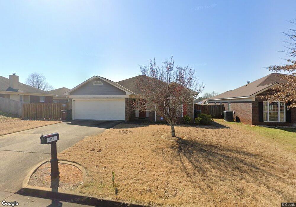
8053 Silverado Dr Columbus, GA 31909
Midland NeighborhoodEstimated Value: $246,000 - $292,049
3
Beds
3
Baths
1,397
Sq Ft
$191/Sq Ft
Est. Value
About This Home
This home is located at 8053 Silverado Dr, Columbus, GA 31909 and is currently estimated at $267,512, approximately $191 per square foot. 8053 Silverado Dr is a home located in Muscogee County with nearby schools including Midland Academy, Blackmon Road Middle School, and Shaw High School.
Ownership History
Date
Name
Owned For
Owner Type
Purchase Details
Closed on
Feb 6, 2017
Sold by
Robert E Perry
Bought by
Smith Fred and Smith Pamela
Current Estimated Value
Home Financials for this Owner
Home Financials are based on the most recent Mortgage that was taken out on this home.
Original Mortgage
$165,176
Outstanding Balance
$136,721
Interest Rate
4.19%
Estimated Equity
$130,791
Purchase Details
Closed on
Feb 25, 2008
Sold by
Grayhawk Homes Inc
Bought by
Perry Robert E and Perry Leah Ann
Home Financials for this Owner
Home Financials are based on the most recent Mortgage that was taken out on this home.
Original Mortgage
$172,750
Interest Rate
5.65%
Mortgage Type
VA
Create a Home Valuation Report for This Property
The Home Valuation Report is an in-depth analysis detailing your home's value as well as a comparison with similar homes in the area
Home Values in the Area
Average Home Value in this Area
Purchase History
| Date | Buyer | Sale Price | Title Company |
|---|---|---|---|
| Smith Fred | -- | -- | |
| Perry Robert E | $169,200 | None Available |
Source: Public Records
Mortgage History
| Date | Status | Borrower | Loan Amount |
|---|---|---|---|
| Open | Smith Fred | $165,176 | |
| Closed | Smith Fred | -- | |
| Previous Owner | Perry Robert E | $172,750 |
Source: Public Records
Tax History Compared to Growth
Tax History
| Year | Tax Paid | Tax Assessment Tax Assessment Total Assessment is a certain percentage of the fair market value that is determined by local assessors to be the total taxable value of land and additions on the property. | Land | Improvement |
|---|---|---|---|---|
| 2025 | $3,326 | $84,976 | $10,768 | $74,208 |
| 2024 | $3,326 | $84,976 | $10,768 | $74,208 |
| 2023 | $3,347 | $84,976 | $10,768 | $74,208 |
| 2022 | $2,874 | $70,384 | $10,768 | $59,616 |
| 2021 | $2,567 | $62,868 | $10,768 | $52,100 |
| 2020 | $2,568 | $62,868 | $10,768 | $52,100 |
| 2019 | $2,576 | $62,868 | $10,768 | $52,100 |
| 2018 | $2,576 | $62,868 | $10,768 | $52,100 |
| 2017 | $2,266 | $55,136 | $13,460 | $41,676 |
| 2016 | $2,241 | $62,543 | $12,800 | $49,743 |
| 2015 | $2,247 | $62,543 | $12,800 | $49,743 |
| 2014 | $2,250 | $62,543 | $12,800 | $49,743 |
| 2013 | -- | $62,543 | $12,800 | $49,743 |
Source: Public Records
Map
Nearby Homes
- 8095 Santee Ct
- 7389 Sorrel Ct
- 8042 Sonoma Pointe Dr
- 6055 Townes Way
- 6036 Townes Way
- 7076 Stoneybrook Dr
- 7056 Stoneybrook Dr
- 7020 Stoneridge Cir
- 7168 Pinewood Ct
- 5135 Midland Trace
- 5110 Midland Trc
- 5110 Midland Trace
- 6454 Patriot Dr
- 6528 Yellow Stone Ct
- 7113 Pinewood Ct
- 209 Plum Ct
- 6222 Goodwin Dr
- 7807 Kolven Cove
- 8051 Chapel Lake Dr
- 7193 Secretariet Dr
- 9029 Scottsdale Ct
- 9033 Scottsdale Ct
- 8049 Silverado Dr
- 9042 Sonoma Pointe Dr
- 9025 Scottsdale Ct
- 8058 Silverado Dr
- 9038 Sonoma Pointe Dr
- 9046 Sonoma Pointe Dr
- 8054 Silverado Dr
- 8050 Silverado Dr
- 9021 Scottsdale Ct
- 9034 Sonoma Pointe Dr
- 0 Silverado Dr
- 8062 Silverado Dr
- 8066 Silverado Dr
- 9030 Sonoma Pointe Dr
- 9017 Scottsdale Ct
- 9032 Scottsdale Ct
- 8070 Silverado Dr
- 9028 Scottsdale Ct