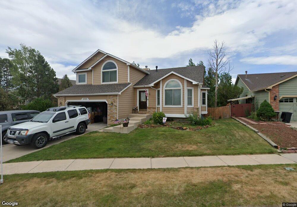
8055 Lorton Dr Colorado Springs, CO 80920
Briargate NeighborhoodEstimated Value: $514,000 - $541,000
3
Beds
3
Baths
2,099
Sq Ft
$249/Sq Ft
Est. Value
About This Home
This home is located at 8055 Lorton Dr, Colorado Springs, CO 80920 and is currently estimated at $522,940, approximately $249 per square foot. 8055 Lorton Dr is a home located in El Paso County with nearby schools including Prairie Hills Elementary School, Timberview Middle School, and Liberty High School.
Ownership History
Date
Name
Owned For
Owner Type
Purchase Details
Closed on
May 4, 2012
Sold by
Plummer Ashbaugh Julie Renee
Bought by
Plummer Ashbaugh Julie Renee
Current Estimated Value
Purchase Details
Closed on
Mar 26, 1999
Sold by
Plummer Julie R
Bought by
Ashbauam Robert Alan and Plummer Julie Renee
Purchase Details
Closed on
May 4, 1995
Sold by
Campbell Corp
Bought by
Plummer Julie R
Home Financials for this Owner
Home Financials are based on the most recent Mortgage that was taken out on this home.
Original Mortgage
$175,440
Interest Rate
8.5%
Mortgage Type
VA
Purchase Details
Closed on
Feb 1, 1995
Sold by
Colrad Development Corp
Bought by
Campbell Corp
Create a Home Valuation Report for This Property
The Home Valuation Report is an in-depth analysis detailing your home's value as well as a comparison with similar homes in the area
Home Values in the Area
Average Home Value in this Area
Purchase History
| Date | Buyer | Sale Price | Title Company |
|---|---|---|---|
| Plummer Ashbaugh Julie Renee | -- | None Available | |
| Ashbauam Robert Alan | -- | -- | |
| Plummer Julie R | $172,595 | -- | |
| Campbell Corp | -- | -- |
Source: Public Records
Mortgage History
| Date | Status | Borrower | Loan Amount |
|---|---|---|---|
| Closed | Plummer Julie R | $175,440 |
Source: Public Records
Tax History Compared to Growth
Tax History
| Year | Tax Paid | Tax Assessment Tax Assessment Total Assessment is a certain percentage of the fair market value that is determined by local assessors to be the total taxable value of land and additions on the property. | Land | Improvement |
|---|---|---|---|---|
| 2025 | $2,176 | $36,270 | -- | -- |
| 2024 | $2,140 | $37,630 | $5,360 | $32,270 |
| 2023 | $2,140 | $37,630 | $5,360 | $32,270 |
| 2022 | $1,748 | $24,770 | $4,340 | $20,430 |
| 2021 | $1,932 | $25,470 | $4,460 | $21,010 |
| 2020 | $1,918 | $23,570 | $3,720 | $19,850 |
| 2019 | $1,899 | $23,570 | $3,720 | $19,850 |
| 2018 | $1,582 | $19,310 | $2,880 | $16,430 |
| 2017 | $1,576 | $19,310 | $2,880 | $16,430 |
| 2016 | $1,568 | $19,190 | $2,930 | $16,260 |
| 2015 | $1,565 | $19,190 | $2,930 | $16,260 |
| 2014 | $1,492 | $18,280 | $2,930 | $15,350 |
Source: Public Records
Map
Nearby Homes
- 5305 Plumstead Dr
- 7543 Potomac Dr
- 5026 Plumstead Dr
- 7820 Swiftrun Rd
- 8405 Andrus Dr
- 8017 Radcliff Dr
- 8313 Scarborough Dr
- 5109 Oyster Bay Dr
- 5002 Herndon Cir
- 8372 Wilmington Dr
- 8352 James Creek Dr
- 7775 Manston Dr
- 7691 Scarborough Dr
- 5408 Cushing Grove
- 5414 Cushing Grove
- 5426 Cushing Grove
- 8387 Snow Cap View
- 8688 Eckberg Heights
- 8030 Chancellor Dr
- 8728 Eckberg Heights
- 5285 Plumstead Dr
- 8035 Lorton Dr
- 8040 Lorton Dr
- 8030 Lorton Dr
- 8025 Lorton Dr
- 5280 Plumstead Dr
- 5290 Plumstead Dr
- 5270 Plumstead Dr
- 5315 Plumstead Dr
- 8020 Lorton Dr
- 5265 Plumstead Dr
- 8015 Lorton Dr
- 5260 Plumstead Dr
- 5325 Plumstead Dr
- 8181 Ferncliff Dr
- 5255 Plumstead Dr
- 8010 Lorton Dr
- 8005 Lorton Dr
- 5250 Plumstead Dr
- 8009 French Rd