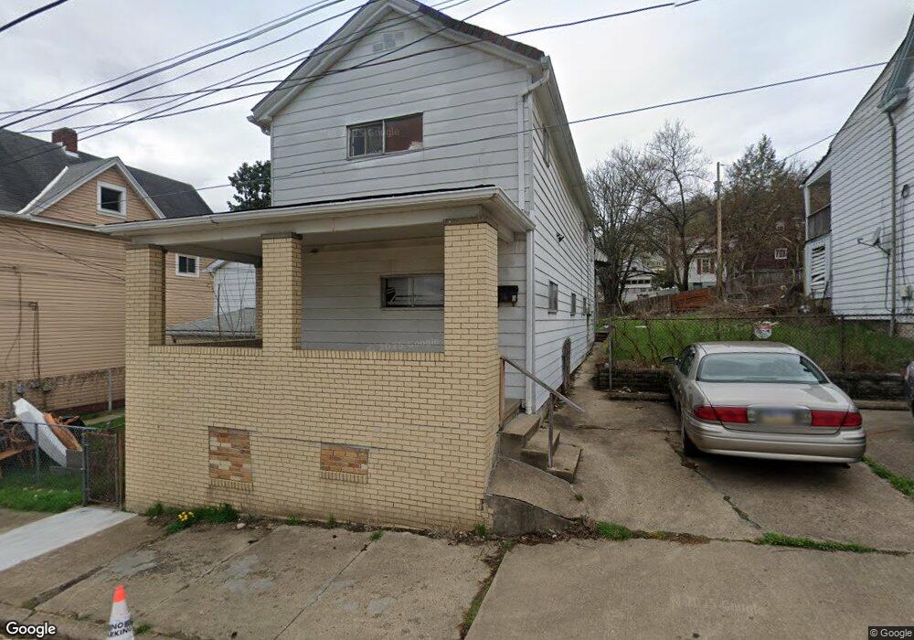
806 10th St Mc Kees Rocks, PA 15136
Estimated Value: $83,248 - $185,000
4
Beds
2
Baths
1,896
Sq Ft
$66/Sq Ft
Est. Value
About This Home
This home is located at 806 10th St, Mc Kees Rocks, PA 15136 and is currently estimated at $125,562, approximately $66 per square foot. 806 10th St is a home located in Allegheny County with nearby schools including Sto-Rox Upper Elementary School, Sto-Rox Primary Center, and Sto-Rox Junior/Senior High School.
Ownership History
Date
Name
Owned For
Owner Type
Purchase Details
Closed on
Jul 7, 2008
Sold by
Schmit Theodore M
Bought by
Devinney Brian F
Current Estimated Value
Home Financials for this Owner
Home Financials are based on the most recent Mortgage that was taken out on this home.
Original Mortgage
$19,600
Outstanding Balance
$12,606
Interest Rate
6.01%
Mortgage Type
New Conventional
Estimated Equity
$112,956
Purchase Details
Closed on
Aug 6, 2007
Sold by
Thomas Glenn D
Bought by
Deutsche Bank
Purchase Details
Closed on
Mar 13, 2006
Sold by
Jay Amba L L C
Bought by
Thomas Glenn D
Home Financials for this Owner
Home Financials are based on the most recent Mortgage that was taken out on this home.
Original Mortgage
$64,000
Interest Rate
6.27%
Mortgage Type
New Conventional
Purchase Details
Closed on
Dec 17, 1999
Sold by
Chichin Alice H and Kapinos Clyde E
Bought by
Kapinos Clyde E
Create a Home Valuation Report for This Property
The Home Valuation Report is an in-depth analysis detailing your home's value as well as a comparison with similar homes in the area
Home Values in the Area
Average Home Value in this Area
Purchase History
| Date | Buyer | Sale Price | Title Company |
|---|---|---|---|
| Devinney Brian F | $115,000 | -- | |
| Deutsche Bank | $1,704 | -- | |
| Thomas Glenn D | $80,000 | -- | |
| Kapinos Clyde E | -- | -- |
Source: Public Records
Mortgage History
| Date | Status | Borrower | Loan Amount |
|---|---|---|---|
| Open | Devinney Brian F | $19,600 | |
| Previous Owner | Thomas Glenn D | $64,000 |
Source: Public Records
Tax History
| Year | Tax Paid | Tax Assessment Tax Assessment Total Assessment is a certain percentage of the fair market value that is determined by local assessors to be the total taxable value of land and additions on the property. | Land | Improvement |
|---|---|---|---|---|
| 2025 | $1,512 | $35,000 | $5,800 | $29,200 |
| 2024 | $1,512 | $35,000 | $5,800 | $29,200 |
| 2023 | $1,454 | $35,000 | $5,800 | $29,200 |
| 2022 | $1,407 | $35,000 | $5,800 | $29,200 |
| 2021 | $166 | $35,000 | $5,800 | $29,200 |
| 2020 | $1,376 | $35,000 | $5,800 | $29,200 |
| 2019 | $1,376 | $35,000 | $5,800 | $29,200 |
| 2017 | $1,344 | $35,000 | $5,800 | $29,200 |
Source: Public Records
Map
Nearby Homes
- 810 10th St
- 1212 Woodward Ave
- 813 13th St
- 813 8th St
- 815 Broadway Ave
- 1131 13th St
- 1406 Broadway Ave
- 712 Broadway Ave
- 1412 Broadway Ave
- 708 Broadway Ave
- 713 Russellwood Ave
- 1144 1/2 Race St
- 802 Lamont St
- 839 Hober Ave
- 822 Lamont St
- 803 Lamont St
- 807 Lamont St
- 204 Mccoy Rd
- 634 Broadway Ave
- 125 Frazier Ave