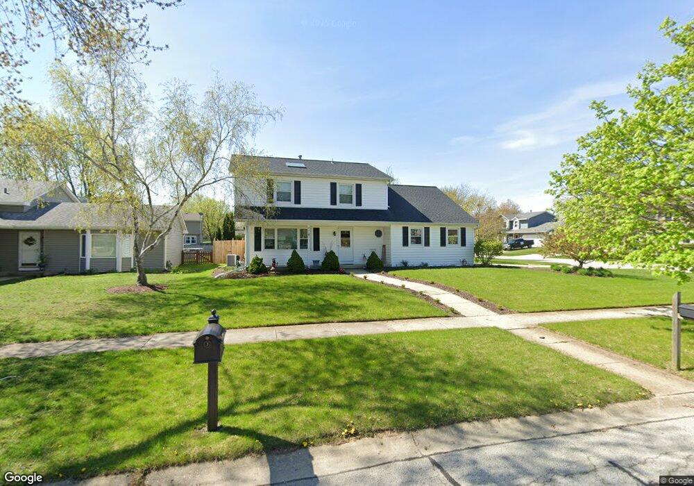
806 Butternut Dr North Aurora, IL 60542
Estimated Value: $389,000 - $422,000
4
Beds
3
Baths
2,036
Sq Ft
$197/Sq Ft
Est. Value
About This Home
This home is located at 806 Butternut Dr, North Aurora, IL 60542 and is currently estimated at $401,505, approximately $197 per square foot. 806 Butternut Dr is a home located in Kane County with nearby schools including Goodwin Elementary School, Jewel Middle School, and West Aurora High School.
Ownership History
Date
Name
Owned For
Owner Type
Purchase Details
Closed on
Nov 30, 2005
Sold by
Cox Dale Russell
Bought by
Banas Christopher M and Banas Carrie E
Current Estimated Value
Home Financials for this Owner
Home Financials are based on the most recent Mortgage that was taken out on this home.
Original Mortgage
$227,700
Outstanding Balance
$128,231
Interest Rate
6.4%
Mortgage Type
Fannie Mae Freddie Mac
Estimated Equity
$273,274
Create a Home Valuation Report for This Property
The Home Valuation Report is an in-depth analysis detailing your home's value as well as a comparison with similar homes in the area
Home Values in the Area
Average Home Value in this Area
Purchase History
| Date | Buyer | Sale Price | Title Company |
|---|---|---|---|
| Banas Christopher M | $253,000 | First American Title |
Source: Public Records
Mortgage History
| Date | Status | Borrower | Loan Amount |
|---|---|---|---|
| Open | Banas Christopher M | $227,700 |
Source: Public Records
Tax History Compared to Growth
Tax History
| Year | Tax Paid | Tax Assessment Tax Assessment Total Assessment is a certain percentage of the fair market value that is determined by local assessors to be the total taxable value of land and additions on the property. | Land | Improvement |
|---|---|---|---|---|
| 2024 | $7,590 | $108,968 | $14,740 | $94,228 |
| 2023 | $7,396 | $98,900 | $13,378 | $85,522 |
| 2022 | $7,142 | $92,430 | $12,503 | $79,927 |
| 2021 | $6,943 | $87,661 | $11,858 | $75,803 |
| 2020 | $6,918 | $85,976 | $11,630 | $74,346 |
| 2019 | $6,994 | $82,932 | $11,218 | $71,714 |
| 2018 | $6,934 | $79,773 | $10,791 | $68,982 |
| 2017 | $6,884 | $77,142 | $10,435 | $66,707 |
| 2016 | $6,869 | $74,895 | $10,131 | $64,764 |
| 2015 | -- | $73,189 | $9,900 | $63,289 |
| 2014 | -- | $70,885 | $9,588 | $61,297 |
| 2013 | -- | $74,345 | $14,244 | $60,101 |
Source: Public Records
Map
Nearby Homes
- 791 Cottonwood Dr
- 438 Mallard Point Dr
- 442 Mallard Point Dr
- 727 Harmony Ct
- 504 Dogwood Ct
- 22 Silver Trail Unit 2
- 302 Pin Oak Dr
- 413 N Sycamore Ln
- 508 Pinewood Dr
- 523 Mallard Point Dr Unit 1
- 341 Pheasant Hill Dr
- 109 E Victoria Cir Unit 7/5
- 503 Redwood Ct
- 6 S Sycamore Ln
- 203 E Victoria Cir Unit 9/2
- 489 Pinewood Dr
- 43 S Juniper Dr Unit 3
- 202 Larchwood Ln
- 426 Prairie Ridge Ln
- 460 Prairie Ridge Ln
- 804 Butternut Dr
- 301 Acorn Dr
- 802 Butternut Dr
- 805 Cottonwood Dr
- 807 Butternut Dr
- 306 Acorn Dr
- 304 Acorn Dr
- 803 Cottonwood Dr
- 308 Acorn Dr
- 302 Acorn Dr
- 800 Butternut Dr
- 801 Cottonwood Dr
- 313 Acorn Dr
- 310 Acorn Dr
- 300 Acorn Dr
- 805 Butternut Dr
- 798 Butternut Dr
- 312 Acorn Dr
- 803 Butternut Dr
- 799 Cottonwood Dr