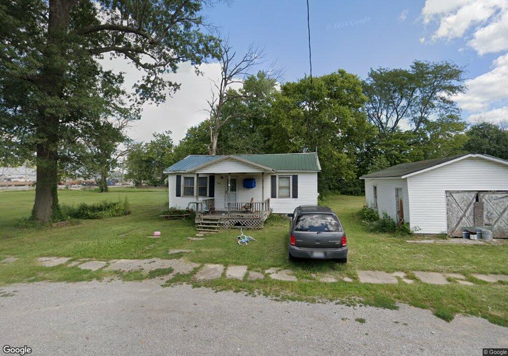
806 N Webster St Harrisburg, IL 62946
Estimated Value: $39,000 - $98,000
--
Bed
--
Bath
--
Sq Ft
0.27
Acres
About This Home
This home is located at 806 N Webster St, Harrisburg, IL 62946 and is currently estimated at $57,291. 806 N Webster St is a home with nearby schools including East Side Intermediate School, Harrisburg Middle School, and Harrisburg High School.
Ownership History
Date
Name
Owned For
Owner Type
Purchase Details
Closed on
Jul 7, 2020
Sold by
Mccarty Aaron
Bought by
Wiese Michael and Wiese Jeannine
Current Estimated Value
Purchase Details
Closed on
May 14, 2019
Sold by
Neely Thomas
Bought by
Mccarty Aaron
Purchase Details
Closed on
Jun 27, 2016
Sold by
Neely Thomas M
Bought by
Webster Trust
Purchase Details
Closed on
Jun 5, 2015
Sold by
Colboth David
Bought by
Neely Thomas
Create a Home Valuation Report for This Property
The Home Valuation Report is an in-depth analysis detailing your home's value as well as a comparison with similar homes in the area
Home Values in the Area
Average Home Value in this Area
Purchase History
| Date | Buyer | Sale Price | Title Company |
|---|---|---|---|
| Wiese Michael | $1,000 | None Available | |
| Mccarty Aaron | -- | None Available | |
| Webster Trust | -- | None Available | |
| Neely Thomas | $4,000 | None Available |
Source: Public Records
Tax History Compared to Growth
Tax History
| Year | Tax Paid | Tax Assessment Tax Assessment Total Assessment is a certain percentage of the fair market value that is determined by local assessors to be the total taxable value of land and additions on the property. | Land | Improvement |
|---|---|---|---|---|
| 2024 | $616 | $6,884 | $2,666 | $4,218 |
| 2023 | $576 | $5,835 | $2,260 | $3,575 |
| 2022 | $568 | $5,500 | $2,130 | $3,370 |
| 2021 | $588 | $5,670 | $2,196 | $3,474 |
| 2020 | $581 | $5,500 | $2,130 | $3,370 |
| 2019 | $592 | $5,500 | $2,130 | $3,370 |
| 2018 | $599 | $5,500 | $2,130 | $3,370 |
| 2017 | $590 | $5,500 | $2,130 | $3,370 |
| 2016 | $6 | $5,500 | $2,130 | $3,370 |
| 2015 | -- | $5,500 | $2,130 | $3,370 |
| 2014 | $545 | $5,500 | $2,130 | $3,370 |
| 2013 | $545 | $5,500 | $2,130 | $3,370 |
| 2012 | $545 | $5,500 | $2,130 | $3,370 |
Source: Public Records
Map
Nearby Homes
- 111 W Midkiff St
- 202 W Poplar St
- 216 W Poplar St
- 204 N Sherman St
- 0 Ron Crank Dr Unit EB441387
- 311 W Poplar St
- 430 W Church St
- 18 S Mill St
- 305 W Church St
- 215 S Jackson St
- 504 W South St
- 210 W Lincoln St
- 305 W Lincoln St
- 1120 Dorris Heights Rd
- 206 W Homer Ave
- 127 W Homer Ave
- 520 S Mckinley St
- 500 W Sloan St
- 618 S Mckinley St
- 827 W Raymond St
- 802 N Webster St
- 812 N Webster St
- 121 Midkiff St Unit n/a
- 121 Midkiff St
- 803 N Webster St
- 805 N Webster St
- 718 N Webster St
- 104 W Midkiff St
- 807 N Webster St
- 109 W Towle St
- 809 N Webster St
- 729 N Webster St
- 115 W Midkiff St
- 710 N Webster St
- 214 Midkiff St
- 102 W Midkiff St
- 100 W Midkiff St
- 715 N Webster St
- 216 W Midkiff St
- 211 W Midkiff St