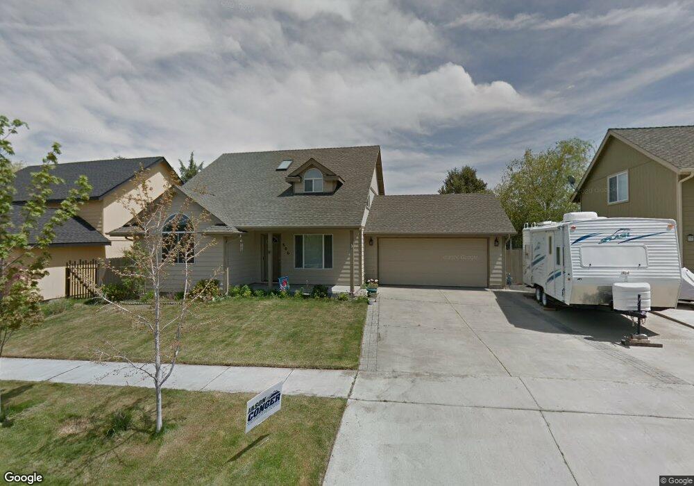
806 NE Robin Ct Bend, OR 97701
Mountain View NeighborhoodEstimated Value: $533,000 - $593,000
3
Beds
3
Baths
1,687
Sq Ft
$331/Sq Ft
Est. Value
About This Home
This home is located at 806 NE Robin Ct, Bend, OR 97701 and is currently estimated at $557,895, approximately $330 per square foot. 806 NE Robin Ct is a home located in Deschutes County with nearby schools including Buckingham Elementary School, Pilot Butte Middle School, and Mountain View Senior High School.
Ownership History
Date
Name
Owned For
Owner Type
Purchase Details
Closed on
Mar 16, 2010
Sold by
Anderson Evelyn
Bought by
Murphy Wendi E
Current Estimated Value
Home Financials for this Owner
Home Financials are based on the most recent Mortgage that was taken out on this home.
Original Mortgage
$172,000
Outstanding Balance
$113,664
Interest Rate
5%
Mortgage Type
VA
Estimated Equity
$444,231
Create a Home Valuation Report for This Property
The Home Valuation Report is an in-depth analysis detailing your home's value as well as a comparison with similar homes in the area
Home Values in the Area
Average Home Value in this Area
Purchase History
| Date | Buyer | Sale Price | Title Company |
|---|---|---|---|
| Murphy Wendi E | $172,000 | Deschutes County Title Co |
Source: Public Records
Mortgage History
| Date | Status | Borrower | Loan Amount |
|---|---|---|---|
| Open | Murphy Wendi E | $172,000 |
Source: Public Records
Tax History
| Year | Tax Paid | Tax Assessment Tax Assessment Total Assessment is a certain percentage of the fair market value that is determined by local assessors to be the total taxable value of land and additions on the property. | Land | Improvement |
|---|---|---|---|---|
| 2025 | $3,015 | $210,020 | -- | -- |
| 2024 | $2,901 | $203,910 | -- | -- |
| 2023 | $2,689 | $197,980 | $0 | $0 |
| 2022 | $2,509 | $186,630 | $0 | $0 |
| 2021 | $2,513 | $181,200 | $0 | $0 |
| 2020 | $2,384 | $181,200 | $0 | $0 |
| 2019 | $2,318 | $175,930 | $0 | $0 |
| 2018 | $2,253 | $170,810 | $0 | $0 |
| 2017 | $2,187 | $165,840 | $0 | $0 |
| 2016 | $2,085 | $161,010 | $0 | $0 |
| 2015 | $2,028 | $156,330 | $0 | $0 |
| 2014 | $1,968 | $151,780 | $0 | $0 |
Source: Public Records
Map
Nearby Homes
- 804 NE Providence Dr
- 21430 E Highway 20
- 1152 NE Locksley Dr
- 21517 O'Connor Way
- 21426 Livingston Dr Unit 18
- 21495 O'Connor Way
- 21505 O'Connor Way
- 21499O 'Connor Way
- 61077 NE Unity Place
- 21432 Livingston Dr
- 21428 Livingston Dr
- 21430 Livingston Dr
- 21446 Livingston Dr
- 21439 Livingston Dr
- 21503 O'Connor Way
- 21444 Livingston Dr
- 21545 NE Gather Place
- 21537 NE Gather Place
- 21501 O'Connor Way
- 21497 O'Connor Way
- 850 NE Robin Ct
- 805 NE Robin Ct
- 783 NE Robin Ct
- 827 NE Robin Ct
- 849 NE Robin Ct
- 698 NE Shirley Ct
- 866 NE Robin Ct
- 697 NE Shirley Ct
- 826 NE Providence Dr
- 3210 NE Hampton Ln
- 865 NE Robin Ct
- 686 NE Shirley Ct
- 848 NE Providence Dr
- 874 NE Robin Ct
- 685 NE Shirley Ct
- 864 NE Providence Dr
- 873 NE Robin Ct
- 664 NE Shirley Ct
Your Personal Tour Guide
Ask me questions while you tour the home.