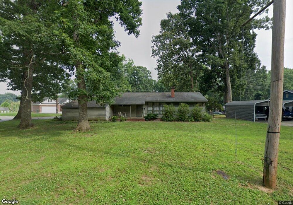
806 Woodside Dr Kings Mountain, NC 28086
Estimated Value: $239,000 - $322,000
--
Bed
--
Bath
1,632
Sq Ft
$170/Sq Ft
Est. Value
About This Home
This home is located at 806 Woodside Dr, Kings Mountain, NC 28086 and is currently estimated at $276,809, approximately $169 per square foot. 806 Woodside Dr is a home located in Cleveland County with nearby schools including East Elementary School, Kings Mountain Middle, and Kings Mountain Intermediate School.
Ownership History
Date
Name
Owned For
Owner Type
Purchase Details
Closed on
Mar 14, 2025
Sold by
Wriston Shannon D and Capps Shannon H
Bought by
Capps Shannon H and Capps Harvey Ray
Current Estimated Value
Purchase Details
Closed on
Feb 15, 2019
Sold by
Smith John Robert and Smith Twyla P
Bought by
Wriston Shannon D
Home Financials for this Owner
Home Financials are based on the most recent Mortgage that was taken out on this home.
Original Mortgage
$111,010
Interest Rate
4.5%
Mortgage Type
New Conventional
Purchase Details
Closed on
Jan 29, 2015
Sold by
Smith John Robert and Smith Betty M
Bought by
Smith John Robert and Smith Ii John Robert
Purchase Details
Closed on
May 28, 2009
Sold by
Reynolds Paul E
Bought by
Reynolds Paul Bradley
Create a Home Valuation Report for This Property
The Home Valuation Report is an in-depth analysis detailing your home's value as well as a comparison with similar homes in the area
Home Values in the Area
Average Home Value in this Area
Purchase History
| Date | Buyer | Sale Price | Title Company |
|---|---|---|---|
| Capps Shannon H | -- | None Listed On Document | |
| Capps Shannon H | -- | None Listed On Document | |
| Wriston Shannon D | $110,000 | None Available | |
| Smith John Robert | $1,000 | None Available | |
| Reynolds Paul Bradley | -- | None Available |
Source: Public Records
Mortgage History
| Date | Status | Borrower | Loan Amount |
|---|---|---|---|
| Previous Owner | Wriston Shannon D | $111,010 |
Source: Public Records
Tax History Compared to Growth
Tax History
| Year | Tax Paid | Tax Assessment Tax Assessment Total Assessment is a certain percentage of the fair market value that is determined by local assessors to be the total taxable value of land and additions on the property. | Land | Improvement |
|---|---|---|---|---|
| 2025 | $1,456 | $142,035 | $30,255 | $111,780 |
| 2024 | $1,590 | $134,006 | $28,238 | $105,768 |
| 2023 | $1,582 | $134,006 | $28,238 | $105,768 |
| 2022 | $1,515 | $134,006 | $28,238 | $105,768 |
| 2021 | $1,523 | $134,006 | $28,238 | $105,768 |
| 2020 | $1,266 | $108,203 | $28,238 | $79,965 |
| 2019 | $1,266 | $108,203 | $28,238 | $79,965 |
| 2018 | $1,265 | $108,203 | $28,238 | $79,965 |
| 2017 | $1,259 | $108,203 | $28,238 | $79,965 |
| 2016 | $1,263 | $108,203 | $28,238 | $79,965 |
| 2015 | $1,157 | $101,612 | $23,532 | $78,080 |
| 2014 | $1,157 | $101,612 | $23,532 | $78,080 |
Source: Public Records
Map
Nearby Homes
- 804 Woodside Dr
- 902 Woodside Dr
- 520 Rhodes Ave Unit 25
- 802 Woodside Dr
- 517 Rhodes Ave
- 805 Woodside Dr
- 518 Rhodes Ave
- 803 Woodside Dr
- 807 Woodside Dr
- 801 Woodside Dr
- 915 Brookwood Dr
- 519 Fallingwood Dr
- 914 Brookwood Dr
- 709 Woodside Dr
- 802 Linwood Rd
- 913 Brookwood Dr
- 516 Rhodes Ave
- 521 Fallingwood Dr
- 804 Linwood Rd
- 714 Linwood Rd