Estimated Value: $292,000 - $335,000
3
Beds
3
Baths
1,024
Sq Ft
$302/Sq Ft
Est. Value
About This Home
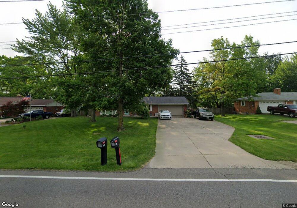
This home is located at 8060 Snider Rd, Mason, OH 45040 and is currently estimated at $309,268, approximately $302 per square foot. 8060 Snider Rd is a home located in Warren County with nearby schools including Mason Intermediate Elementary School, Mason Middle School, and William Mason High School.
Ownership History
Date
Name
Owned For
Owner Type
Purchase Details
Closed on
Jun 8, 1992
Sold by
Davis Davis and Davis Gary V
Bought by
Hooker Hooker and Hooker Kevin L
Current Estimated Value
Purchase Details
Closed on
Dec 18, 1985
Sold by
Weitzel Weitzel and Weitzel Delores A
Bought by
Davis Davis and Davis Gary V
Purchase Details
Closed on
Dec 1, 1978
Sold by
Weitzel Weitzel and Weitzel Joseph B
Create a Home Valuation Report for This Property
The Home Valuation Report is an in-depth analysis detailing your home's value as well as a comparison with similar homes in the area
Home Values in the Area
Average Home Value in this Area
Purchase History
| Date | Buyer | Sale Price | Title Company |
|---|---|---|---|
| Hooker Hooker | $82,500 | -- | |
| Davis Davis | $65,400 | -- | |
| -- | -- | -- |
Source: Public Records
Tax History
| Year | Tax Paid | Tax Assessment Tax Assessment Total Assessment is a certain percentage of the fair market value that is determined by local assessors to be the total taxable value of land and additions on the property. | Land | Improvement |
|---|---|---|---|---|
| 2025 | $3,409 | $80,150 | $26,250 | $53,900 |
| 2024 | $3,409 | $80,150 | $26,250 | $53,900 |
| 2023 | $3,129 | $60,637 | $12,915 | $47,722 |
| 2022 | $3,075 | $60,638 | $12,915 | $47,723 |
| 2021 | $2,924 | $60,638 | $12,915 | $47,723 |
| 2020 | $2,799 | $49,298 | $10,500 | $38,798 |
| 2019 | $2,854 | $49,298 | $10,500 | $38,798 |
| 2018 | $2,603 | $49,298 | $10,500 | $38,798 |
| 2017 | $2,894 | $43,600 | $9,545 | $34,055 |
| 2016 | $2,983 | $43,600 | $9,545 | $34,055 |
| 2015 | $2,532 | $43,600 | $9,545 | $34,055 |
| 2014 | $2,532 | $39,630 | $8,680 | $30,960 |
| 2013 | $2,537 | $47,960 | $10,500 | $37,460 |
Source: Public Records
Map
Nearby Homes
- 7798 Alexandra Dr
- 5673 Dockside Dr
- 5661 Harbourside Dr
- 8284 Lee Ct
- 6266 Trailwood Ct
- 6418 Sherman Terrace Rd
- 6291 Greenwood Ct
- 6545 Quail Lake Unit 3E
- 8845 Suncrest Ln
- 6589 Quail Lake
- 5641 Melbury Ct
- 5576 Winding Cape Way
- 8565 Charleston Valley Dr
- 8606 Charleston Valley Dr
- Winslow Plan at Losh Landing - Masterpiece Collection
- Paxton Plan at Losh Landing - Masterpiece Collection
- Huxley Plan at Losh Landing - Masterpiece Collection
- Pearson Plan at Losh Landing - Masterpiece Collection
- Beckett Plan at Losh Landing - Masterpiece Collection
- Leland Plan at Losh Landing - Masterpiece Collection
- 8040 Snider Rd
- 8080 Snider Rd
- 8047 Birchwood Ct
- 8039 Birchwood Ct
- 8029 Birchwood Ct
- 8051 Birchwood Ct
- 8100 Snider Rd
- 8017 Birchwood Ct
- 8049 Snider Rd
- 8065 Snider Rd
- 8000 Snider Rd
- 8005 Birchwood Ct
- 6015 Snider Rd
- 8029 Snider Rd
- 8050 Birchwood Ct
- 7997 Birchwood Ct
- 8038 Birchwood Ct
- 8105 Snider Rd
- 8022 Birchwood Ct
- 8046 Birchwood Ct