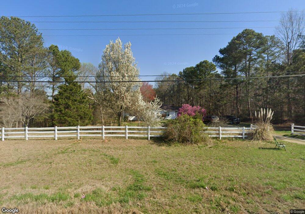
8061 Highway 100 Buchanan, GA 30113
Estimated Value: $117,000 - $180,000
3
Beds
2
Baths
1,856
Sq Ft
$75/Sq Ft
Est. Value
About This Home
This home is located at 8061 Highway 100, Buchanan, GA 30113 and is currently estimated at $138,977, approximately $74 per square foot. 8061 Highway 100 is a home located in Haralson County with nearby schools including Haralson County High School.
Ownership History
Date
Name
Owned For
Owner Type
Purchase Details
Closed on
Jun 30, 2025
Sold by
Robinson Tammy M
Bought by
Southern Tina and Southern Paul
Current Estimated Value
Purchase Details
Closed on
Oct 13, 2023
Sold by
Neumann Shirley E
Bought by
Waldrop James Mark and Waldrop Neysa Dawn
Home Financials for this Owner
Home Financials are based on the most recent Mortgage that was taken out on this home.
Original Mortgage
$322,852
Interest Rate
7.18%
Mortgage Type
New Conventional
Purchase Details
Closed on
Jan 4, 1988
Sold by
Bowman Thelma Mrs
Bought by
Williams John T and Williams Tammy M
Create a Home Valuation Report for This Property
The Home Valuation Report is an in-depth analysis detailing your home's value as well as a comparison with similar homes in the area
Home Values in the Area
Average Home Value in this Area
Purchase History
| Date | Buyer | Sale Price | Title Company |
|---|---|---|---|
| Southern Tina | $115,000 | -- | |
| Waldrop James Mark | $334,000 | -- | |
| Williams John T | $3,000 | -- |
Source: Public Records
Mortgage History
| Date | Status | Borrower | Loan Amount |
|---|---|---|---|
| Previous Owner | Waldrop James Mark | $322,852 |
Source: Public Records
Tax History Compared to Growth
Tax History
| Year | Tax Paid | Tax Assessment Tax Assessment Total Assessment is a certain percentage of the fair market value that is determined by local assessors to be the total taxable value of land and additions on the property. | Land | Improvement |
|---|---|---|---|---|
| 2024 | $1,493 | $57,584 | $4,586 | $52,998 |
| 2023 | $1,657 | $61,783 | $6,403 | $55,380 |
| 2022 | $1,400 | $52,199 | $6,403 | $45,796 |
| 2021 | $1,374 | $49,189 | $6,055 | $43,134 |
| 2020 | $1,416 | $50,476 | $6,055 | $44,421 |
| 2019 | $1,477 | $50,689 | $6,055 | $44,634 |
| 2018 | $1,482 | $50,134 | $5,500 | $44,634 |
| 2017 | $1,436 | $44,148 | $5,500 | $38,648 |
| 2016 | $1,262 | $41,189 | $5,061 | $36,128 |
| 2015 | $1,191 | $40,850 | $5,061 | $35,790 |
| 2014 | $1,195 | $41,596 | $5,061 | $36,535 |
Source: Public Records
Map
Nearby Homes
- 7711 Highway 100
- 0 Cross Roads Church Rd Unit 7629947
- 0 Cross Roads Church Rd Unit 10580810
- 0 Carnes Rd Unit 147233
- 50 + - Acres Off Ga Hwy 78
- 6934 Georgia 100
- 661 Wildcat Rd
- 0 Susie Pope Rd Unit 10499156
- 0 Susie Pope Rd Unit 10399491
- 0 Bethlehem Church Rd Unit 7655973
- 0 Bethlehem Church Rd Unit 7645984
- Tract3 Georgia Highway 100
- 7724 Georgia Highway 100
- 7780 Georgia Highway 100
- 845 Crossroads Church Rd
- 1200 Roy Brown Rd
- 765 Addison Rd
- 767 Addison Rd
- 00001 Haralson County Scenic Byway
- 1870 Tallapoosa Hwy
- 8003 Highway 100
- 8144 Highway 100
- 8070 Highway 100
- 8074 Highway 100
- 8241 Highway 100
- 7959 Highway 100
- 2655 Crossroads Church Rd
- 8265 Highway 100
- 2629 Crossroads Church Rd
- 8284 Highway 100
- 2625 Crossroads Church Rd
- 8263 Highway 100
- 2627 Crossroads Church Rd
- 8072 Highway 100
- 2635 Crossroads Church Rd
- 54 Monroe Mill Rd
- 8381 Georgia 100
- 65 Monroe Mill Rd
- 2522 Cross Roads Church Rd
- 0 Monroe Mill Rd Unit 8461325