Estimated Value: $319,000 - $367,000
3
Beds
1
Bath
1,586
Sq Ft
$216/Sq Ft
Est. Value
About This Home
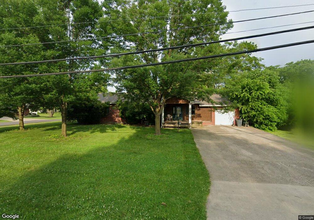
This home is located at 8065 Snider Rd, Mason, OH 45040 and is currently estimated at $342,313, approximately $215 per square foot. 8065 Snider Rd is a home located in Warren County with nearby schools including Mason Intermediate Elementary School, Mason Middle School, and William Mason High School.
Ownership History
Date
Name
Owned For
Owner Type
Purchase Details
Closed on
Sep 16, 1996
Sold by
Robert F Tuelmer
Bought by
March Thomas E
Current Estimated Value
Home Financials for this Owner
Home Financials are based on the most recent Mortgage that was taken out on this home.
Original Mortgage
$111,690
Outstanding Balance
$6,533
Interest Rate
8.29%
Mortgage Type
VA
Estimated Equity
$335,780
Purchase Details
Closed on
Feb 14, 1992
Sold by
Tuemler Robert F and Tuemler Jean
Bought by
Tuemler and Robert Frederick
Purchase Details
Closed on
Jun 4, 1986
Sold by
Ashcraft Leroy and Ashcraft Arlene
Bought by
Tuemler and Tuemler Robert F
Purchase Details
Closed on
Apr 4, 1978
Sold by
Galloway Galloway and Galloway Ellis
Create a Home Valuation Report for This Property
The Home Valuation Report is an in-depth analysis detailing your home's value as well as a comparison with similar homes in the area
Home Values in the Area
Average Home Value in this Area
Purchase History
| Date | Buyer | Sale Price | Title Company |
|---|---|---|---|
| March Thomas E | $111,690 | -- | |
| Tuemler | -- | -- | |
| Tuemler | $70,000 | -- | |
| -- | $54,900 | -- |
Source: Public Records
Mortgage History
| Date | Status | Borrower | Loan Amount |
|---|---|---|---|
| Open | March Thomas E | $111,690 |
Source: Public Records
Tax History
| Year | Tax Paid | Tax Assessment Tax Assessment Total Assessment is a certain percentage of the fair market value that is determined by local assessors to be the total taxable value of land and additions on the property. | Land | Improvement |
|---|---|---|---|---|
| 2025 | $4,006 | $103,980 | $26,250 | $77,730 |
| 2024 | $4,006 | $103,980 | $26,250 | $77,730 |
| 2023 | $3,769 | $81,777 | $12,915 | $68,862 |
| 2022 | $3,704 | $81,778 | $12,915 | $68,863 |
| 2021 | $3,522 | $81,778 | $12,915 | $68,863 |
| 2020 | $3,279 | $66,486 | $10,500 | $55,986 |
| 2019 | $3,297 | $66,486 | $10,500 | $55,986 |
| 2018 | $3,450 | $66,486 | $10,500 | $55,986 |
| 2017 | $3,304 | $59,511 | $9,545 | $49,966 |
| 2016 | $3,404 | $59,511 | $9,545 | $49,966 |
| 2015 | $2,897 | $59,511 | $9,545 | $49,966 |
| 2014 | $2,897 | $54,100 | $8,680 | $45,420 |
| 2013 | $2,903 | $65,460 | $10,500 | $54,960 |
Source: Public Records
Map
Nearby Homes
- 7798 Alexandra Dr
- 6266 Trailwood Ct
- 5661 Harbourside Dr
- 8284 Lee Ct
- 6418 Sherman Terrace Rd
- 6285 Greenwood Ct
- 6291 Greenwood Ct
- 6545 Quail Lake Unit 3E
- 8845 Suncrest Ln
- 6589 Quail Lake
- 5641 Melbury Ct
- 8565 Charleston Valley Dr
- 8606 Charleston Valley Dr
- Winslow Plan at Losh Landing - Masterpiece Collection
- Paxton Plan at Losh Landing - Masterpiece Collection
- Huxley Plan at Losh Landing - Masterpiece Collection
- Pearson Plan at Losh Landing - Masterpiece Collection
- Beckett Plan at Losh Landing - Masterpiece Collection
- Leland Plan at Losh Landing - Masterpiece Collection
- Clay Plan at Losh Landing - Masterpiece Collection
- 8049 Snider Rd
- 6015 Snider Rd
- 8029 Snider Rd
- 8060 Crest Acres Dr
- 8105 Snider Rd
- 8042 Crest Acres Dr
- 6041 Sherman Terrace Dr
- 8024 Crest Acres Dr
- 8060 Snider Rd
- 8080 Snider Rd
- 8009 Snider Rd
- 8040 Snider Rd
- 6055 Sherman Terrace Dr
- 8006 Crest Acres Dr
- 7983 Snider Rd
- 6073 Sherman Terrace Dr
- 8100 Snider Rd
- 8000 Snider Rd
- 7978 Crest Acres Dr
- 8047 Birchwood Ct