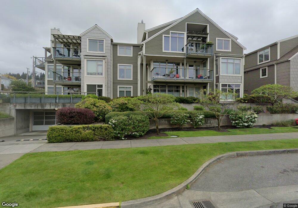
807 10th St Unit 201 Bellingham, WA 98225
South Hill NeighborhoodEstimated Value: $1,131,000 - $1,648,000
2
Beds
3
Baths
2,020
Sq Ft
$713/Sq Ft
Est. Value
About This Home
This home is located at 807 10th St Unit 201, Bellingham, WA 98225 and is currently estimated at $1,439,484, approximately $712 per square foot. 807 10th St Unit 201 is a home located in Whatcom County with nearby schools including Lowell Elementary School, Fairhaven Middle School, and Sehome High School.
Ownership History
Date
Name
Owned For
Owner Type
Purchase Details
Closed on
Feb 17, 2022
Sold by
Taylor Paul N
Bought by
Stoner Joanne M and Stoner Michael G
Current Estimated Value
Purchase Details
Closed on
Mar 20, 2009
Sold by
Taylor Allan T and Taylor Norma E
Bought by
Taylor Allan T and Taylor Norma E
Purchase Details
Closed on
Jul 11, 2006
Sold by
Pacific Crest Partners Llc
Bought by
Taylor Allan T and Taylor Norma E
Create a Home Valuation Report for This Property
The Home Valuation Report is an in-depth analysis detailing your home's value as well as a comparison with similar homes in the area
Home Values in the Area
Average Home Value in this Area
Purchase History
| Date | Buyer | Sale Price | Title Company |
|---|---|---|---|
| Stoner Joanne M | $600,000 | None Listed On Document | |
| Taylor Allan T | -- | None Available | |
| Taylor Allan T | $687,780 | Whatcom Land Title |
Source: Public Records
Tax History Compared to Growth
Tax History
| Year | Tax Paid | Tax Assessment Tax Assessment Total Assessment is a certain percentage of the fair market value that is determined by local assessors to be the total taxable value of land and additions on the property. | Land | Improvement |
|---|---|---|---|---|
| 2024 | $12,088 | $1,554,111 | $220,129 | $1,333,982 |
| 2023 | $12,088 | $1,554,111 | $220,129 | $1,333,982 |
| 2022 | $10,690 | $1,351,369 | $191,412 | $1,159,957 |
| 2021 | $10,068 | $1,145,231 | $162,214 | $983,017 |
| 2020 | $9,605 | $995,813 | $141,050 | $854,763 |
| 2019 | $7,886 | $917,800 | $130,000 | $787,800 |
| 2018 | $8,282 | $755,610 | $117,018 | $638,592 |
| 2017 | $7,567 | $681,240 | $105,480 | $575,760 |
| 2016 | $6,996 | $649,740 | $102,780 | $546,960 |
| 2015 | $6,586 | $625,770 | $98,730 | $527,040 |
| 2014 | -- | $570,000 | $90,000 | $480,000 |
| 2013 | -- | $570,000 | $90,000 | $480,000 |
Source: Public Records
Map
Nearby Homes
- 805 11th St
- 700 11th St Unit C4
- 600 S State St Unit 212
- 600 S State St Unit 204
- 600 S State St Unit 208
- 600 S State St Unit 101
- 903 13th St
- 1014 11th St Unit 302
- 917 13th St
- 522 12th St
- 502 12th St
- 510 S State St Unit 2
- 1100 12th St
- 706 16th St Unit A&B
- 1005 15th St
- 424 14th St Unit 202
- 1315 Mill Ave
- 910 Harris Ave Unit 208
- 910 Harris Ave Unit 304
- 444 S State St Unit 417
- 807 10th St Unit 101
- 807 10th St Unit 204
- 807 10th St Unit 304
- 807 10th St Unit 303
- 807 10th St Unit 302
- 807 10th St Unit 301
- 807 10th St Unit 204
- 807 10th St Unit 203
- 807 10th St Unit 104
- 807 10th St Unit 103
- 807 10th St Unit 102
- 807 10th St Unit 202
- 811 10th St Unit 104
- 811 10th St Unit 203
- 811 10th St Unit 103
- 808 11th St
- 810 11th St
- 812 11th St
- 820 11th St
- 820 11th St