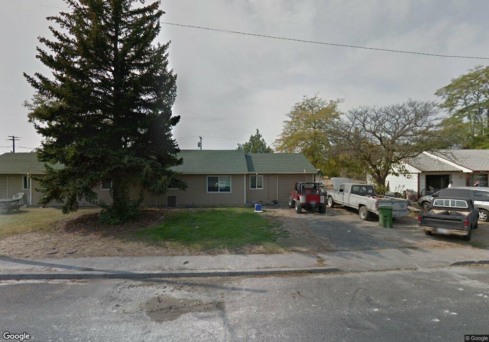
807 809 Lindberg Ln Moses Lake, WA 98837
Estimated Value: $250,000 - $290,328
4
Beds
2
Baths
1,780
Sq Ft
$148/Sq Ft
Est. Value
About This Home
This home is located at 807 809 Lindberg Ln, Moses Lake, WA 98837 and is currently estimated at $263,832, approximately $148 per square foot. 807 809 Lindberg Ln is a home located in Grant County with nearby schools including Larson Heights Elementary School, Endeavor Middle School, and Moses Lake High School.
Ownership History
Date
Name
Owned For
Owner Type
Purchase Details
Closed on
Nov 21, 2022
Sold by
Selm Jason P
Bought by
Selm Properties Iii Llc
Current Estimated Value
Purchase Details
Closed on
Sep 26, 2006
Sold by
Mickel Arthur P and Mickel Judith A
Bought by
Selm Jason P
Home Financials for this Owner
Home Financials are based on the most recent Mortgage that was taken out on this home.
Original Mortgage
$83,200
Interest Rate
6.3%
Mortgage Type
New Conventional
Create a Home Valuation Report for This Property
The Home Valuation Report is an in-depth analysis detailing your home's value as well as a comparison with similar homes in the area
Home Values in the Area
Average Home Value in this Area
Purchase History
| Date | Buyer | Sale Price | Title Company |
|---|---|---|---|
| Selm Properties Iii Llc | -- | None Listed On Document | |
| Selm Jason P | $104,000 | Grant County Title |
Source: Public Records
Mortgage History
| Date | Status | Borrower | Loan Amount |
|---|---|---|---|
| Previous Owner | Selm Jason P | $83,200 |
Source: Public Records
Tax History Compared to Growth
Tax History
| Year | Tax Paid | Tax Assessment Tax Assessment Total Assessment is a certain percentage of the fair market value that is determined by local assessors to be the total taxable value of land and additions on the property. | Land | Improvement |
|---|---|---|---|---|
| 2025 | $2,132 | $197,883 | -- | -- |
| 2024 | $1,742 | $132,919 | -- | -- |
| 2023 | $1,833 | $142,085 | $28,500 | $113,585 |
| 2022 | $1,894 | $142,085 | $28,500 | $113,585 |
| 2021 | $1,623 | $142,085 | $28,500 | $113,585 |
| 2020 | $1,592 | $115,405 | $28,500 | $86,905 |
| 2019 | $1,981 | $136,915 | $20,000 | $116,915 |
| 2018 | $2,261 | $143,435 | $20,000 | $123,435 |
| 2017 | $1,666 | $114,950 | $20,000 | $94,950 |
| 2016 | $1,474 | $99,505 | $20,000 | $79,505 |
| 2013 | -- | $99,505 | $20,000 | $79,505 |
Source: Public Records
Map
Nearby Homes
- 141 Carswell Dr
- 1127 Arlington Dr
- 9035 Forrestal Ln
- 8910 Travis Dr Unit B
- 9023 Mcconnell Dr Unit A
- 9021 Mcconnell Dr Unit A
- 9016 Bong Loop Unit B
- 9008 Bong Loop Unit B
- 410 Biggs Dr NE
- 8958 Tinker Loop Unit A & B
- 205 March Dr NE
- 7613 Cox St NE
- 4926 Shorecrest Dr NE
- 541 Fairchild Loop
- 538 Fairchild Loop
- 4898 Shorecrest Dr NE
- 535 Castle Dr
- 0 22nd Ave NE
- 0 Kopp Ln NE
- 4815 Airway Dr NE Unit 86
- 805 Lindberg Ln
- 811 Lindberg Ln
- 108 Schilling Dr
- 812 Lindberg Ln
- 804 Lindberg Ln
- 813 Lindberg Ln
- 813 & 815 Lindberg Ln
- 1236 Mitchell Ave
- 801 Lindberg Ln Unit 803
- 1235 Mitchell Ave
- 814 Lindberg Ln
- 111 Schilling Dr
- 802 Lindberg Ln
- 1231 Mitchell Ave
- 1231 Mitchell Ave Unit 31/33
- 116 Schilling Dr
- 1230 Doolittle Dr
- 1230 1232 Doolittle Dr
- 115 Schilling Dr
- 113 Schilling Dr