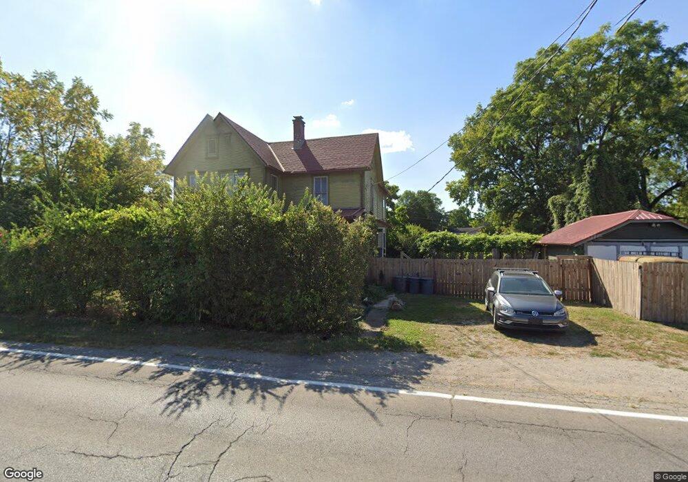
807 Brown Rd Columbus, OH 43223
South Hilltop NeighborhoodEstimated Value: $165,000 - $257,000
3
Beds
2
Baths
1,652
Sq Ft
$126/Sq Ft
Est. Value
About This Home
This home is located at 807 Brown Rd, Columbus, OH 43223 and is currently estimated at $208,380, approximately $126 per square foot. 807 Brown Rd is a home located in Franklin County with nearby schools including Finland Elementary School, Franklin Woods Intermediate School, and Finland Middle School.
Ownership History
Date
Name
Owned For
Owner Type
Purchase Details
Closed on
Jul 13, 2005
Sold by
Tagg Wanda L
Bought by
Puckett Ashley A
Current Estimated Value
Home Financials for this Owner
Home Financials are based on the most recent Mortgage that was taken out on this home.
Original Mortgage
$43,000
Outstanding Balance
$21,915
Interest Rate
5.69%
Mortgage Type
Seller Take Back
Estimated Equity
$186,465
Purchase Details
Closed on
Dec 24, 1998
Sold by
Tagg Ralph W and Tagg Wanda L
Bought by
Tagg Wanda L and Tagg Ralph W
Create a Home Valuation Report for This Property
The Home Valuation Report is an in-depth analysis detailing your home's value as well as a comparison with similar homes in the area
Home Values in the Area
Average Home Value in this Area
Purchase History
| Date | Buyer | Sale Price | Title Company |
|---|---|---|---|
| Puckett Ashley A | $43,000 | -- | |
| Tagg Wanda L | -- | -- |
Source: Public Records
Mortgage History
| Date | Status | Borrower | Loan Amount |
|---|---|---|---|
| Open | Puckett Ashley A | $43,000 |
Source: Public Records
Tax History
| Year | Tax Paid | Tax Assessment Tax Assessment Total Assessment is a certain percentage of the fair market value that is determined by local assessors to be the total taxable value of land and additions on the property. | Land | Improvement |
|---|---|---|---|---|
| 2025 | $2,403 | $46,590 | $9,490 | $37,100 |
| 2024 | $2,403 | $46,590 | $9,490 | $37,100 |
| 2023 | $2,540 | $46,590 | $9,490 | $37,100 |
| 2022 | $4,713 | $37,520 | $17,640 | $19,880 |
| 2021 | $2,811 | $37,520 | $17,640 | $19,880 |
| 2020 | $2,807 | $37,520 | $17,640 | $19,880 |
| 2019 | $2,619 | $31,260 | $14,700 | $16,560 |
| 2018 | $2,035 | $31,260 | $14,700 | $16,560 |
| 2017 | $2,032 | $31,260 | $14,700 | $16,560 |
| 2016 | $1,568 | $18,170 | $3,780 | $14,390 |
| 2015 | $1,460 | $18,170 | $3,780 | $14,390 |
| 2014 | $1,411 | $18,170 | $3,780 | $14,390 |
| 2013 | $864 | $21,350 | $4,410 | $16,940 |
Source: Public Records
Map
Nearby Homes
- 1560 Garling Ave
- 1617 Ransburg Ave
- 1743 Ransburg Ave
- 1557 Safford Ave
- 1642-1644 Elmer St
- 565 Ryan Ave
- 1750 W Mound St
- 537 Ryan Ave
- 550 Helen St
- 574 Townsend Ave
- 1873 Rosemont Ave
- 505-507 Catherine St
- 509 Helen St
- 1556 Walsh Ave
- 635 Clark Ave
- 436 Catherine St
- 1122 Harrisburg Pike
- 401 Catherine St Unit 403
- 1566 Thomas Ave
- 608 Nashoba Ave
- 802 Brown Rd Unit B
- 1552 Garling Ave Unit 1554
- 789 Brown Rd
- 804 Brown Rd Unit A
- 810 Brown Rd Unit D
- 810 Brown Rd Unit F
- 810 Brown Rd Unit C
- 785 Brown Rd
- 1545 Garling Ave Unit 547
- 1553 Garling Ave
- 779 Brown Rd
- 1568 Garling Ave
- 1551 Withers Ave
- 1561 Garling Ave
- 823 Brown Rd
- 1570 Garling Ave
- 1561 Withers Ave
- 1569 Garling Ave
- 839 Brown Rd
- 1567 Withers Ave
Your Personal Tour Guide
Ask me questions while you tour the home.