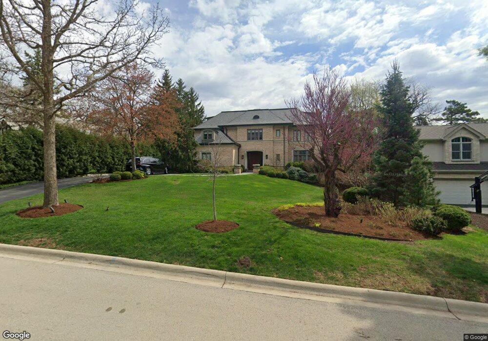
807 The Pines Hinsdale, IL 60521
Estimated Value: $2,222,000 - $2,685,000
--
Bed
2
Baths
5,166
Sq Ft
$478/Sq Ft
Est. Value
About This Home
This home is located at 807 The Pines, Hinsdale, IL 60521 and is currently estimated at $2,469,078, approximately $477 per square foot. 807 The Pines is a home located in DuPage County with nearby schools including Monroe Elementary School, Clarendon Hills Middle School, and Hinsdale Central High School.
Ownership History
Date
Name
Owned For
Owner Type
Purchase Details
Closed on
Aug 24, 1997
Sold by
Lustig Paul J and Lustig Vicki
Bought by
Repicky Rory T and Smith Joanne C
Current Estimated Value
Home Financials for this Owner
Home Financials are based on the most recent Mortgage that was taken out on this home.
Original Mortgage
$596,300
Interest Rate
7.32%
Create a Home Valuation Report for This Property
The Home Valuation Report is an in-depth analysis detailing your home's value as well as a comparison with similar homes in the area
Home Values in the Area
Average Home Value in this Area
Purchase History
| Date | Buyer | Sale Price | Title Company |
|---|---|---|---|
| Repicky Rory T | $663,000 | First American Title |
Source: Public Records
Mortgage History
| Date | Status | Borrower | Loan Amount |
|---|---|---|---|
| Previous Owner | Repicky Rory T | $596,300 |
Source: Public Records
Tax History Compared to Growth
Tax History
| Year | Tax Paid | Tax Assessment Tax Assessment Total Assessment is a certain percentage of the fair market value that is determined by local assessors to be the total taxable value of land and additions on the property. | Land | Improvement |
|---|---|---|---|---|
| 2024 | $35,655 | $695,767 | $150,116 | $545,651 |
| 2023 | $33,923 | $639,610 | $138,000 | $501,610 |
| 2022 | $33,355 | $642,190 | $138,560 | $503,630 |
| 2021 | $32,143 | $634,880 | $136,980 | $497,900 |
| 2020 | $31,418 | $622,310 | $134,270 | $488,040 |
| 2019 | $31,446 | $597,110 | $128,830 | $468,280 |
| 2018 | $29,198 | $574,940 | $128,110 | $446,830 |
| 2017 | $28,148 | $553,250 | $123,280 | $429,970 |
| 2016 | $27,618 | $528,010 | $117,660 | $410,350 |
| 2015 | $27,509 | $496,770 | $110,700 | $386,070 |
| 2014 | $6,253 | $107,630 | $107,630 | $0 |
| 2013 | $12,648 | $226,980 | $107,130 | $119,850 |
Source: Public Records
Map
Nearby Homes
- 216 Bonnie Brae Rd
- 401 Birchwood Rd
- 401 Glendale Ave
- 3801 Madison St
- 527 Kensington Ct
- 539 Kensington Ct
- 531 N York Rd
- 210 W Hickory St
- 719 N Elm St
- 415 N Adams St
- 15 Templeton Dr
- 123 N Vine St
- 118 N Grant St
- 117 N Monroe St
- 3504 York Rd
- 3500 Spring Rd
- 3420 York Rd
- 317 E Walnut St
- 141 Breakenridge Farm
- 735 Phillippa St
- 815 The Pines
- 801 The Pines
- 201 Bonnie Brae Rd
- 821 The Pines
- 751 The Pines
- 15 Bonnie Brae Rd
- 207 Bonnie Brae Rd
- 800 Merrill Woods Rd
- 814 The Pines
- 810 The Pines
- 827 The Pines
- 824 The Pines
- 820 Merrill Woods Rd
- 11 Bonnie Brae Rd
- 200 Bonnie Brae Rd
- 311 Bonnie Brae Rd
- 835 The Pines
- 16 Bonnie Brae Rd
- 300 Bonnie Brae Rd
- 815 Merrill Woods Rd