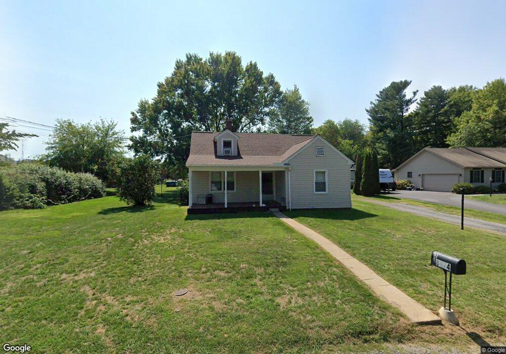
8074 West Ave Waynesboro, PA 17268
Estimated Value: $163,905 - $226,000
--
Bed
--
Bath
904
Sq Ft
$221/Sq Ft
Est. Value
About This Home
This home is located at 8074 West Ave, Waynesboro, PA 17268 and is currently estimated at $199,726, approximately $220 per square foot. 8074 West Ave is a home located in Franklin County with nearby schools including Waynesboro Area Senior High School, St. Andrew Catholic School, and Noah's Ark Christian Child Care Center.
Ownership History
Date
Name
Owned For
Owner Type
Purchase Details
Closed on
Jun 15, 2005
Sold by
Rock Catherine W
Bought by
Landis Shawn E and Landis Kathryn E
Current Estimated Value
Home Financials for this Owner
Home Financials are based on the most recent Mortgage that was taken out on this home.
Original Mortgage
$110,000
Outstanding Balance
$57,316
Interest Rate
5.73%
Mortgage Type
New Conventional
Estimated Equity
$142,410
Create a Home Valuation Report for This Property
The Home Valuation Report is an in-depth analysis detailing your home's value as well as a comparison with similar homes in the area
Home Values in the Area
Average Home Value in this Area
Purchase History
| Date | Buyer | Sale Price | Title Company |
|---|---|---|---|
| Landis Shawn E | $145,000 | None Available |
Source: Public Records
Mortgage History
| Date | Status | Borrower | Loan Amount |
|---|---|---|---|
| Open | Landis Shawn E | $110,000 |
Source: Public Records
Tax History Compared to Growth
Tax History
| Year | Tax Paid | Tax Assessment Tax Assessment Total Assessment is a certain percentage of the fair market value that is determined by local assessors to be the total taxable value of land and additions on the property. | Land | Improvement |
|---|---|---|---|---|
| 2025 | $1,585 | $10,320 | $550 | $9,770 |
| 2024 | $1,539 | $10,320 | $550 | $9,770 |
| 2023 | $1,493 | $10,320 | $550 | $9,770 |
| 2022 | $1,449 | $10,320 | $550 | $9,770 |
| 2021 | $1,408 | $10,320 | $550 | $9,770 |
| 2020 | $1,386 | $10,320 | $550 | $9,770 |
| 2019 | $1,355 | $10,320 | $550 | $9,770 |
| 2018 | $1,311 | $10,320 | $550 | $9,770 |
| 2017 | $296 | $10,320 | $550 | $9,770 |
| 2016 | $296 | $10,320 | $550 | $9,770 |
| 2015 | $276 | $10,320 | $550 | $9,770 |
| 2014 | $276 | $10,320 | $550 | $9,770 |
Source: Public Records
Map
Nearby Homes
- 8258 Sheffield Manor Blvd
- 8800 Jocelyn Dr
- 8328 Thames Ct
- Beacon Pointe Plan at Hickory Pointe
- Juliet Plan at Hickory Pointe
- Revere Plan at Hickory Pointe
- Copper Beech Plan at Hickory Pointe
- Abbey Plan at Hickory Pointe
- 8878 Jocelyn Dr
- Blue Ridge Plan at Hickory Pointe
- Emily Plan at Hickory Pointe
- 8844 Jocelyn Dr
- Brindlee Plan at Hickory Pointe
- 9804 Matthew Ln
- 0 Juliet Plan at Hickory Pointe Unit PAFL2029240
- 9809 Matthew Ln
- 0 Unit PAFL2024590
- 11405 Cross Fields Dr
- 0 Unit PAFL2024592
- 0 Unit PAFL2024618
- 8050 West Ave
- 8096 West Ave
- 11305 Anthony Hwy
- 13388 Cross Field Dr
- 11287 Anthony Hwy
- 11263 Anthony Hwy
- 8030 West Ave
- 11327 Anthony Hwy
- 11251 Anthony Hwy
- 11354 Anthony Hwy
- 11247 Cross St
- 11244 Cross St
- 11308 Anthony Hwy
- 11211 Anthony Hwy
- 11336 Orchard Rd
- 11238 Orchard Rd
- 11197 Anthony Hwy
- 11232 Cross St
- 7980 West Ave
- 11210 Orchard Rd