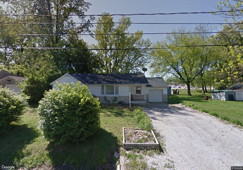
8077 Brosend Rd Newburgh, IN 47630
Estimated Value: $142,000 - $197,000
3
Beds
1
Bath
1,100
Sq Ft
$158/Sq Ft
Est. Value
About This Home
This home is located at 8077 Brosend Rd, Newburgh, IN 47630 and is currently estimated at $174,183, approximately $158 per square foot. 8077 Brosend Rd is a home located in Warrick County with nearby schools including Sharon Elementary School, Castle South Middle School, and Castle High School.
Ownership History
Date
Name
Owned For
Owner Type
Purchase Details
Closed on
Dec 11, 2009
Sold by
Goffinet Max I and Wefel Darlene V
Bought by
Doherty Mary K
Current Estimated Value
Home Financials for this Owner
Home Financials are based on the most recent Mortgage that was taken out on this home.
Original Mortgage
$80,000
Outstanding Balance
$56,966
Interest Rate
4.96%
Mortgage Type
Purchase Money Mortgage
Estimated Equity
$117,217
Create a Home Valuation Report for This Property
The Home Valuation Report is an in-depth analysis detailing your home's value as well as a comparison with similar homes in the area
Home Values in the Area
Average Home Value in this Area
Purchase History
| Date | Buyer | Sale Price | Title Company |
|---|---|---|---|
| Doherty Mary K | -- | None Available |
Source: Public Records
Mortgage History
| Date | Status | Borrower | Loan Amount |
|---|---|---|---|
| Open | Doherty Mary K | $80,000 |
Source: Public Records
Tax History Compared to Growth
Tax History
| Year | Tax Paid | Tax Assessment Tax Assessment Total Assessment is a certain percentage of the fair market value that is determined by local assessors to be the total taxable value of land and additions on the property. | Land | Improvement |
|---|---|---|---|---|
| 2024 | $456 | $95,900 | $9,400 | $86,500 |
| 2023 | $419 | $93,500 | $9,400 | $84,100 |
| 2022 | $384 | $88,900 | $9,400 | $79,500 |
| 2021 | $324 | $80,100 | $9,400 | $70,700 |
| 2020 | $376 | $79,000 | $10,700 | $68,300 |
| 2019 | $431 | $79,100 | $10,700 | $68,400 |
| 2018 | $343 | $74,900 | $10,700 | $64,200 |
| 2017 | $334 | $72,800 | $10,700 | $62,100 |
| 2016 | $326 | $71,200 | $10,700 | $60,500 |
| 2014 | $261 | $71,700 | $10,700 | $61,000 |
| 2013 | $240 | $71,200 | $10,700 | $60,500 |
Source: Public Records
Map
Nearby Homes
- 7844 Meadow Ln
- 7811 Ridgemont Dr
- 7766 Meadow Ln
- 7688 Meadow Ln
- 0 Willow Pond Rd
- 7455 Oak Park Dr
- 8633 Outer Lincoln Ave
- 8634 Briarose Ct
- 5455 E Timberwood Dr
- 7711 Woodland Dr
- 5599 Victoria Ct
- 8855 Hickory Ln
- 8855 Framewood Dr
- 5610 Saint Catherine Ct
- 4333 Hilldale Dr
- 5300 Lenn Rd
- 4949 Live Oak Ct
- 7555 Upper Meadow Rd
- 4300 Hilldale Dr
- 4366 Lenn Rd
- 8055 Brosend Rd
- 8099 Brosend Rd
- 8088 Brosend Rd
- 8033 Brosend Rd
- 8044 Brosend Rd
- 4822 State Route 261
- 8022 Camp Brosend Rd
- 8022 Brosend Rd
- 8101 Alexandra Ln
- 8111 Alexandra Ln
- 8121 Alexandra Ln
- 8011 Brosend Rd
- 8131 Alexandra Ln
- 4899 Brosend Ln
- 8141 Alexandra Ln
- 0 Brosend Ln Unit 202326185
- 0 Brosend Ln
- 8081 Alexandra Ln
- 8077 Alexandra Ln
- 8021 Alexandra Ln