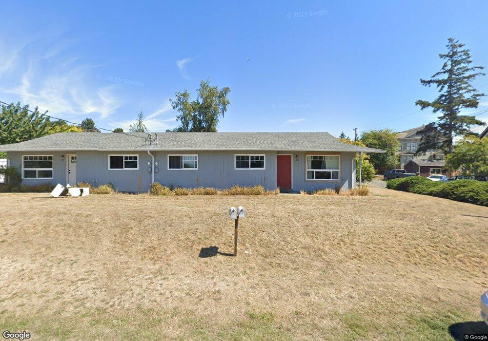
808 Benton St Unit 816 Port Townsend, WA 98368
Estimated Value: $686,000 - $821,798
5
Beds
3
Baths
1,756
Sq Ft
$444/Sq Ft
Est. Value
About This Home
This home is located at 808 Benton St Unit 816, Port Townsend, WA 98368 and is currently estimated at $779,700, approximately $444 per square foot. 808 Benton St Unit 816 is a home located in Jefferson County with nearby schools including Salish Coast Elementary School, Blue Heron Middle School, and Port Townsend High School.
Ownership History
Date
Name
Owned For
Owner Type
Purchase Details
Closed on
Nov 19, 2020
Sold by
Skilling Susan C and Skilling Susan C
Bought by
Prior2hc Llc
Current Estimated Value
Purchase Details
Closed on
Jul 29, 2019
Sold by
Skilling Susan
Bought by
Liv Skilling Susan C and Susan C Skilling Revocable Living Trust
Purchase Details
Closed on
Jul 18, 2017
Sold by
Wickline Patricia L
Bought by
Skilling Susan
Create a Home Valuation Report for This Property
The Home Valuation Report is an in-depth analysis detailing your home's value as well as a comparison with similar homes in the area
Home Values in the Area
Average Home Value in this Area
Purchase History
| Date | Buyer | Sale Price | Title Company |
|---|---|---|---|
| Prior2hc Llc | -- | None Available | |
| Liv Skilling Susan C | -- | None Available | |
| Skilling Susan | $420,000 | First American Title |
Source: Public Records
Tax History Compared to Growth
Tax History
| Year | Tax Paid | Tax Assessment Tax Assessment Total Assessment is a certain percentage of the fair market value that is determined by local assessors to be the total taxable value of land and additions on the property. | Land | Improvement |
|---|---|---|---|---|
| 2024 | $5,762 | $675,789 | $275,000 | $400,789 |
| 2023 | $5,762 | $642,007 | $257,250 | $384,757 |
| 2022 | $4,924 | $592,694 | $240,000 | $352,694 |
| 2021 | $4,715 | $507,595 | $212,700 | $294,895 |
| 2020 | $4,436 | $468,806 | $194,975 | $273,831 |
| 2019 | $3,950 | $430,017 | $177,250 | $252,767 |
| 2018 | $4,112 | $415,717 | $161,500 | $254,217 |
| 2017 | $2,773 | $378,395 | $149,600 | $228,795 |
| 2016 | $2,528 | $272,492 | $149,600 | $122,892 |
| 2015 | $2,500 | $258,312 | $149,600 | $108,712 |
| 2014 | -- | $253,585 | $149,600 | $103,985 |
| 2013 | -- | $230,530 | $136,000 | $94,530 |
Source: Public Records
Map
Nearby Homes
- 1602 Lincoln St
- 543 Van Buren St
- 1930 Lawrence St Unit A31
- 0 St Unit Port Hadlock WA 9836
- 800 Polk St Unit 204C
- 301 E St
- 308 E St
- 1738 Washington St
- 2021 Clay St
- 7 XXX Water St
- 538 Adams St
- 842 Washington St Unit 204
- 717 Franklin St
- 509 Garfield St
- 9999 Maple Parcel A & B St
- 9999 Maple Parcel A St
- 1055 Monroe St
- 537 Jackson St
- 999 Reed St
- 1431 Beech St