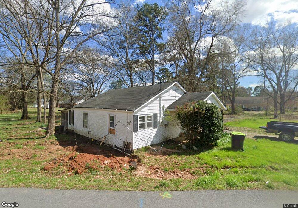
808 Blanche Rd Cedartown, GA 30125
Estimated Value: $258,000 - $384,000
2
Beds
1
Bath
812
Sq Ft
$413/Sq Ft
Est. Value
About This Home
This home is located at 808 Blanche Rd, Cedartown, GA 30125 and is currently estimated at $335,122, approximately $412 per square foot. 808 Blanche Rd is a home located in Polk County with nearby schools including Cedar Christian School and Vineyard Harvester Christian Academy.
Ownership History
Date
Name
Owned For
Owner Type
Purchase Details
Closed on
May 21, 2008
Sold by
English Patsy L
Bought by
P English Properties Llc
Current Estimated Value
Purchase Details
Closed on
Oct 19, 2005
Sold by
Welchel Hugh D
Bought by
English Patsy L
Purchase Details
Closed on
Sep 12, 2005
Sold by
Welchel Hugh D
Bought by
Welchel Arther Cook*
Purchase Details
Closed on
Apr 28, 1942
Sold by
Brock D G
Bought by
Welchel Hugh D
Purchase Details
Closed on
Feb 26, 1904
Bought by
Welchel Hugh D
Create a Home Valuation Report for This Property
The Home Valuation Report is an in-depth analysis detailing your home's value as well as a comparison with similar homes in the area
Home Values in the Area
Average Home Value in this Area
Purchase History
| Date | Buyer | Sale Price | Title Company |
|---|---|---|---|
| P English Properties Llc | -- | -- | |
| English Patsy L | $130,000 | -- | |
| Welchel Arther Cook* | -- | -- | |
| Welchel Hugh D | -- | -- | |
| Welchel Hugh D | -- | -- |
Source: Public Records
Tax History Compared to Growth
Tax History
| Year | Tax Paid | Tax Assessment Tax Assessment Total Assessment is a certain percentage of the fair market value that is determined by local assessors to be the total taxable value of land and additions on the property. | Land | Improvement |
|---|---|---|---|---|
| 2024 | $5,646 | $178,734 | $13,260 | $165,474 |
| 2023 | $4,010 | $115,662 | $13,260 | $102,402 |
| 2022 | $2,372 | $99,970 | $13,260 | $86,710 |
| 2021 | $2,403 | $99,970 | $13,260 | $86,710 |
| 2020 | $2,408 | $99,970 | $13,260 | $86,710 |
| 2019 | $2,280 | $84,907 | $7,260 | $77,647 |
| 2018 | $2,269 | $82,359 | $7,260 | $75,099 |
| 2017 | $2,241 | $82,359 | $7,260 | $75,099 |
| 2016 | $2,242 | $82,404 | $7,260 | $75,144 |
| 2015 | $2,282 | $83,626 | $7,260 | $76,365 |
| 2014 | $2,299 | $83,626 | $7,260 | $76,365 |
Source: Public Records
Map
Nearby Homes
- 812 Blanche Rd
- 207 John Phillips Rd
- 292 Kimwood Dr
- 254 E Girard Ave
- 403 Lakeside Dr
- 362 Oakwood Dr
- 112 College Cir
- 0 Woodlawn Dr Unit 7638056
- 0 Woodlawn Dr Unit 10590789
- 77 Ben Dr W
- 109 Perry St
- 220 Greenbriar Dr
- 462 Oakwood Dr
- 214 Jule Peek Ave
- 607 N College St
- 12 Breckenridge Dr
- 228 Marshall St
- 521 W John Hand Rd
- 408 N College St
- 64 Virginia Cir