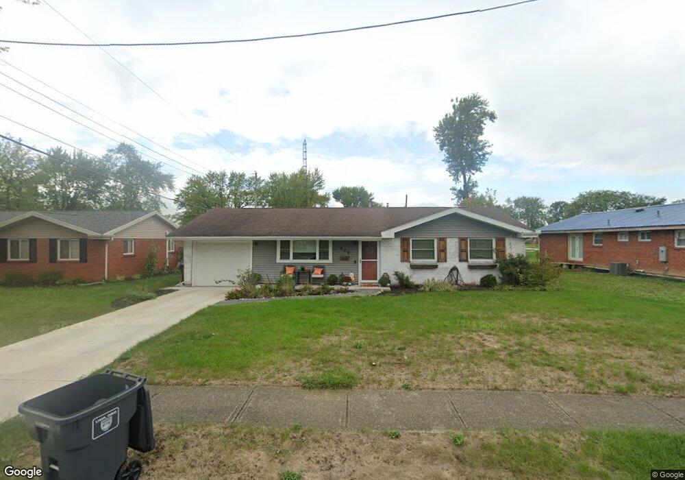
809 Cornell Dr Lima, OH 45805
Westgate NeighborhoodEstimated Value: $150,898 - $184,000
3
Beds
2
Baths
1,304
Sq Ft
$125/Sq Ft
Est. Value
About This Home
This home is located at 809 Cornell Dr, Lima, OH 45805 and is currently estimated at $162,725, approximately $124 per square foot. 809 Cornell Dr is a home located in Allen County with nearby schools including Heritage Elementary School, Lima West Middle School, and Lima North Middle School.
Ownership History
Date
Name
Owned For
Owner Type
Purchase Details
Closed on
Feb 21, 2007
Sold by
Phillips Kelly L
Bought by
Foster Meredith
Current Estimated Value
Home Financials for this Owner
Home Financials are based on the most recent Mortgage that was taken out on this home.
Original Mortgage
$55,250
Outstanding Balance
$37,578
Interest Rate
8.75%
Mortgage Type
Adjustable Rate Mortgage/ARM
Estimated Equity
$125,147
Purchase Details
Closed on
Aug 1, 1972
Bought by
Foster Larry M
Create a Home Valuation Report for This Property
The Home Valuation Report is an in-depth analysis detailing your home's value as well as a comparison with similar homes in the area
Home Values in the Area
Average Home Value in this Area
Purchase History
| Date | Buyer | Sale Price | Title Company |
|---|---|---|---|
| Foster Meredith | $85,000 | Lawyers Title Agency Of Alle | |
| Foster Larry M | $24,000 | -- |
Source: Public Records
Mortgage History
| Date | Status | Borrower | Loan Amount |
|---|---|---|---|
| Open | Foster Meredith | $55,250 |
Source: Public Records
Tax History
| Year | Tax Paid | Tax Assessment Tax Assessment Total Assessment is a certain percentage of the fair market value that is determined by local assessors to be the total taxable value of land and additions on the property. | Land | Improvement |
|---|---|---|---|---|
| 2024 | $1,410 | $39,170 | $6,270 | $32,900 |
| 2023 | $1,187 | $28,390 | $4,550 | $23,840 |
| 2022 | $1,193 | $28,390 | $4,550 | $23,840 |
| 2021 | $1,263 | $28,390 | $4,550 | $23,840 |
| 2020 | $1,212 | $24,120 | $4,340 | $19,780 |
| 2019 | $1,212 | $24,120 | $4,340 | $19,780 |
| 2018 | $1,181 | $24,120 | $4,340 | $19,780 |
| 2017 | $1,172 | $23,170 | $4,340 | $18,830 |
| 2016 | $1,182 | $23,170 | $4,340 | $18,830 |
| 2015 | $1,108 | $23,170 | $4,340 | $18,830 |
| 2014 | $1,108 | $21,390 | $4,590 | $16,800 |
| 2013 | $1,078 | $21,390 | $4,590 | $16,800 |
Source: Public Records
Map
Nearby Homes
- 3 Poulston Place
- 1753 Leland Ave
- 705 Cornell Dr
- 1834 Latham Ave
- 926 Crestwood Dr
- 1605 Hazel Ave
- 1600 Leland Ave
- 102 Charwood Dr
- 541 N Nixon Ave
- 2425 Windsor Dr
- 1918 Oakland Pkwy
- 2530 Windsor Dr
- 1607 W Wayne St
- 1407 Latham Ave
- 1517 Allentown Rd
- 100 Burlington Place
- 1245 Latham Ave
- 1508 Oakland Pkwy
- 37 Beaumont Place
- 52 Beaumont Place
Your Personal Tour Guide
Ask me questions while you tour the home.