Estimated Value: $242,000 - $265,197
3
Beds
1
Bath
1,080
Sq Ft
$235/Sq Ft
Est. Value
About This Home
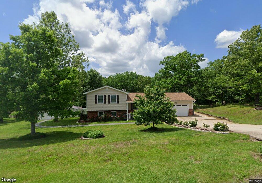
This home is located at 809 Crider Ln, Union, MO 63084 and is currently estimated at $253,599, approximately $234 per square foot. 809 Crider Ln is a home located in Franklin County with nearby schools including Union High School.
Ownership History
Date
Name
Owned For
Owner Type
Purchase Details
Closed on
Sep 15, 2023
Sold by
Kennedy Karen J
Bought by
Melvin Larry and Melvin Nikki
Current Estimated Value
Home Financials for this Owner
Home Financials are based on the most recent Mortgage that was taken out on this home.
Original Mortgage
$294,566
Outstanding Balance
$287,108
Interest Rate
6.9%
Mortgage Type
New Conventional
Estimated Equity
-$33,509
Purchase Details
Closed on
Jun 30, 2014
Sold by
Kennedy Karen J and Kennndy Tommy L
Bought by
Kennedy Karen J
Purchase Details
Closed on
May 15, 2014
Sold by
Gildehaus Jamie L and Gildehaus Nicholas V
Bought by
Kennedy Tommy L and Kennedy Karen J
Purchase Details
Closed on
Sep 16, 2009
Sold by
Kennedy Tommy L and Kennedy Karen J
Bought by
Kennedy Tommy L and Kennedy Karen J
Create a Home Valuation Report for This Property
The Home Valuation Report is an in-depth analysis detailing your home's value as well as a comparison with similar homes in the area
Home Values in the Area
Average Home Value in this Area
Purchase History
| Date | Buyer | Sale Price | Title Company |
|---|---|---|---|
| Melvin Larry | -- | None Listed On Document | |
| Kennedy Karen J | -- | -- | |
| Kennedy Tommy L | -- | -- | |
| Kennedy Tommy L | -- | None Available |
Source: Public Records
Mortgage History
| Date | Status | Borrower | Loan Amount |
|---|---|---|---|
| Open | Melvin Larry | $294,566 |
Source: Public Records
Tax History
| Year | Tax Paid | Tax Assessment Tax Assessment Total Assessment is a certain percentage of the fair market value that is determined by local assessors to be the total taxable value of land and additions on the property. | Land | Improvement |
|---|---|---|---|---|
| 2025 | $1,829 | $34,629 | $0 | $0 |
| 2024 | $1,829 | $31,022 | $0 | $0 |
| 2023 | $1,656 | $31,022 | $0 | $0 |
| 2022 | $1,488 | $27,811 | $0 | $0 |
| 2021 | $1,485 | $27,704 | $0 | $0 |
| 2020 | $1,374 | $25,261 | $0 | $0 |
| 2019 | $1,370 | $25,261 | $0 | $0 |
| 2018 | $1,252 | $24,471 | $0 | $0 |
| 2017 | $1,257 | $24,471 | $0 | $0 |
| 2016 | $1,242 | $23,562 | $0 | $0 |
| 2015 | $1,220 | $23,562 | $0 | $0 |
| 2014 | $1,237 | $23,789 | $0 | $0 |
Source: Public Records
Map
Nearby Homes
- 000 Shawneetown Ford Spur 4` Unit Lot
- 000 Shawneetown Ford Spur Unit Lot 2
- 1864 N Bend Rd
- 2518 N Bend Loop
- 0 Cardinal Ln Unit MIS25045226
- 498 Beck Meadow Rd
- 154 Joel Ave
- 702 Clearview Dr Unit 1
- 26 & 30 Ridge Point Meadows
- 613 S Jefferson Ave
- 0 Lot 4 Clearview Dr Unit 19010507
- 0 Lot 6 Clearview Dr Unit 19010511
- 0 Clearview Unit 19010495
- 0 Lot 5 Clearview Dr Unit 19010510
- 0 Lot 3 Clearview Dr Unit MIS26011988
- 605 S Jefferson Ave
- 413 Rosedale Ave
- 408 Hall Ave
- 751 S Highway 47
- 626 Lindsey Dr
Your Personal Tour Guide
Ask me questions while you tour the home.