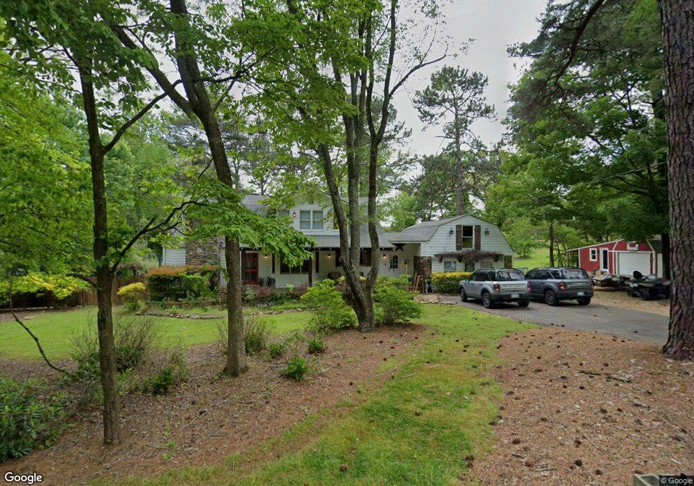
809 Debbie Ln Woodstock, GA 30188
Union Hill NeighborhoodEstimated Value: $389,000 - $418,000
3
Beds
3
Baths
1,989
Sq Ft
$201/Sq Ft
Est. Value
About This Home
This home is located at 809 Debbie Ln, Woodstock, GA 30188 and is currently estimated at $400,105, approximately $201 per square foot. 809 Debbie Ln is a home located in Cherokee County with nearby schools including Arnold Mill Elementary School, Mill Creek Middle School, and River Ridge High School.
Ownership History
Date
Name
Owned For
Owner Type
Purchase Details
Closed on
Nov 24, 1998
Sold by
Rogers John E
Bought by
Rogers John E and Rogers Nicola J
Current Estimated Value
Home Financials for this Owner
Home Financials are based on the most recent Mortgage that was taken out on this home.
Original Mortgage
$125,100
Outstanding Balance
$27,248
Interest Rate
6.84%
Mortgage Type
FHA
Estimated Equity
$372,857
Create a Home Valuation Report for This Property
The Home Valuation Report is an in-depth analysis detailing your home's value as well as a comparison with similar homes in the area
Home Values in the Area
Average Home Value in this Area
Purchase History
| Date | Buyer | Sale Price | Title Company |
|---|---|---|---|
| Rogers John E | -- | -- | |
| Rogers John E | $142,500 | -- |
Source: Public Records
Mortgage History
| Date | Status | Borrower | Loan Amount |
|---|---|---|---|
| Open | Rogers John E | $125,100 |
Source: Public Records
Tax History Compared to Growth
Tax History
| Year | Tax Paid | Tax Assessment Tax Assessment Total Assessment is a certain percentage of the fair market value that is determined by local assessors to be the total taxable value of land and additions on the property. | Land | Improvement |
|---|---|---|---|---|
| 2025 | $2,998 | $114,172 | $18,760 | $95,412 |
| 2024 | $2,723 | $104,784 | $12,080 | $92,704 |
| 2023 | $2,785 | $107,156 | $12,080 | $95,076 |
| 2022 | $1,904 | $72,448 | $12,080 | $60,368 |
| 2021 | $1,752 | $61,700 | $12,080 | $49,620 |
| 2020 | $1,626 | $57,240 | $12,680 | $44,560 |
| 2019 | $1,590 | $55,960 | $12,080 | $43,880 |
| 2018 | $1,544 | $54,000 | $12,080 | $41,920 |
| 2017 | $1,574 | $136,600 | $21,160 | $33,480 |
| 2016 | $1,437 | $123,400 | $18,160 | $31,200 |
| 2015 | $1,394 | $118,500 | $15,560 | $31,840 |
| 2014 | $1,314 | $111,500 | $13,400 | $31,200 |
Source: Public Records
Map
Nearby Homes
- 414 Spring View Dr
- 124 Riverside Ln
- 202 Little River Way
- 585 Arnold Mill Rd
- 4006 N Arnold Mill Rd
- 208 Windfield Dr Unit I
- 321 Burdock Trace
- 236 Persimmon Dr
- 4020 N Arnold Mill Rd
- 338 Westover Dr
- 624 Arnold Mill Rd
- 436 Silver Brook Dr
- 0 O Hara Dr Unit 8443973
- 0 O Hara Dr Unit 6064833
- 200 Dahlia Dr
- 632 Arnold Mill Rd
- 907 Andover Ct
- 636 Arnold Mill Rd
- 522 Watercress Dr
- 0 Debbie Ln Unit 8186790
- 0 Debbie Ln Unit 8133850
- 0 Debbie Ln
- 805 Debbie Ln
- 808 Debbie Ln
- 1567 Barnes Rd
- 1563 Barnes Rd
- 813 Debbie Ln
- 456 Spring View Dr
- 454 Spring View Dr
- 458 Spring View Dr
- 452 Spring View Dr
- 460 Spring View Dr
- 1569 Barnes Rd
- 450 Spring View Dr
- 450 Spring View Dr
- 462 Spring View Dr
- 448 Spring View Dr Unit 448
- 448 Spring View Dr
- 58 Farmington Dr