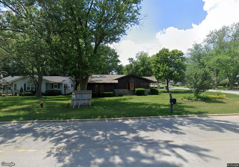
809 S Cedar Rd New Lenox, IL 60451
Estimated Value: $236,363 - $380,000
Studio
--
Bath
--
Sq Ft
12,632
Sq Ft Lot
About This Home
This home is located at 809 S Cedar Rd, New Lenox, IL 60451 and is currently estimated at $291,841. 809 S Cedar Rd is a home located in Will County with nearby schools including Bentley Elementary School, Arnold J Tyler School, and Alex M Martino Jr High School.
Ownership History
Date
Name
Owned For
Owner Type
Purchase Details
Closed on
Mar 10, 2021
Sold by
Barnhart Ted
Bought by
Mccure Betty J and Betty J Mccure Trust
Current Estimated Value
Purchase Details
Closed on
Jan 7, 2019
Sold by
Richards Tony
Bought by
Richards Tony
Purchase Details
Closed on
Jan 17, 2017
Sold by
Barnhart Ted
Bought by
Richards Tony and Richards Amanda
Purchase Details
Closed on
Feb 22, 2007
Sold by
Mccure Ronald L
Bought by
Barnhart Ted and Barnhart Deborah
Home Financials for this Owner
Home Financials are based on the most recent Mortgage that was taken out on this home.
Original Mortgage
$197,925
Interest Rate
6.23%
Mortgage Type
FHA
Purchase Details
Closed on
May 31, 2000
Sold by
Aden Mccure Frances I
Bought by
Mccure Ronald L
Create a Home Valuation Report for This Property
The Home Valuation Report is an in-depth analysis detailing your home's value as well as a comparison with similar homes in the area
Home Values in the Area
Average Home Value in this Area
Purchase History
| Date | Buyer | Sale Price | Title Company |
|---|---|---|---|
| Mccure Betty J | $137,000 | First American Title | |
| Richards Tony | -- | Attorney | |
| Richard Amanda | -- | Attorney | |
| Richards Tony | -- | Attorney | |
| Barnhart Ted | $250,000 | Ticor Title | |
| Mccure Ronald L | -- | -- |
Source: Public Records
Mortgage History
| Date | Status | Borrower | Loan Amount |
|---|---|---|---|
| Previous Owner | Barnhart Ted | $197,925 |
Source: Public Records
Tax History
| Year | Tax Paid | Tax Assessment Tax Assessment Total Assessment is a certain percentage of the fair market value that is determined by local assessors to be the total taxable value of land and additions on the property. | Land | Improvement |
|---|---|---|---|---|
| 2024 | $4,804 | $77,402 | $24,035 | $53,367 |
| 2023 | $4,804 | $70,558 | $21,910 | $48,648 |
| 2022 | $4,504 | $68,311 | $20,184 | $48,127 |
| 2021 | $4,922 | $64,244 | $18,982 | $45,262 |
| 2020 | $4,773 | $61,952 | $18,305 | $43,647 |
| 2019 | $4,559 | $60,031 | $17,737 | $42,294 |
| 2018 | $4,444 | $57,961 | $17,125 | $40,836 |
| 2017 | $4,212 | $56,295 | $16,633 | $39,662 |
| 2016 | $4,082 | $54,788 | $16,188 | $38,600 |
| 2015 | $3,918 | $53,063 | $15,678 | $37,385 |
| 2014 | $3,918 | $52,407 | $15,484 | $36,923 |
| 2013 | $3,918 | $53,114 | $15,693 | $37,421 |
Source: Public Records
Map
Nearby Homes
- 289 Osage Ln
- 1787 Lakes Park Dr
- 3126 Timberlake Ave
- 2970 Timberlake Ave
- 3000 Timberlake Ave
- 3003 Timberlake Ave
- 2930 Amaranth Ct
- 270 Osage Ln
- 3024 Timberlake Ave
- 250 Teerling Cir
- 1801 Lakes Park Dr
- 1777 Lakes Park Dr
- 2951 Amaranth Ct
- 2920 Amaranth Ct
- 3174 Waterwood Ln
- 2940 Amaranth Ct
- 295 Osage Ln
- 3114 Timberlake Ave
- 3122 Goldberry Ct
- 3198 Waterwood Ln
- 811 S Cedar Rd
- 813 S Cedar Rd Unit 3
- 120 W Woodlawn Rd
- 101 W Woodlawn Rd
- 105 W Woodlawn Rd
- 808 S Cedar Rd
- 815 S Cedar Rd
- 39 E Woodlawn Rd
- 810 S Cedar Rd
- 109 W Woodlawn Rd
- 812 S Cedar Rd
- 817 S Cedar Rd
- 737 S Cedar Rd
- 126 W Woodlawn Rd
- 115 E Woodlawn Rd Unit 1
- 115 E Woodlawn Rd
- 821 S Cedar Rd
- 816 S Cedar Rd
- 736 S Cedar Rd
- 820 S Cedar Rd
Your Personal Tour Guide
Ask me questions while you tour the home.