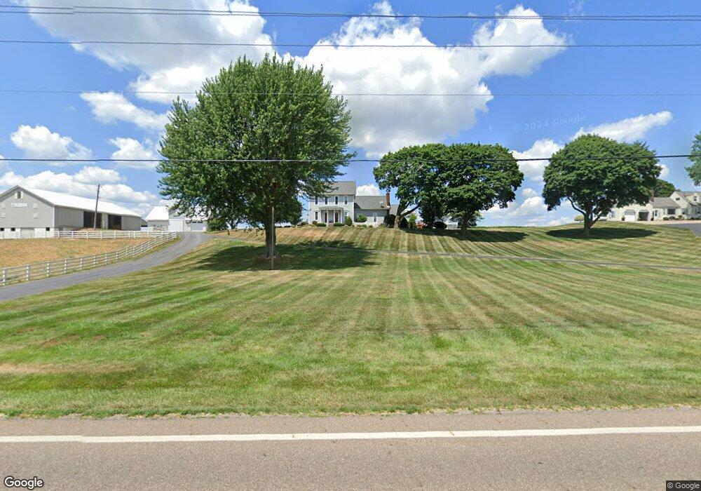
8099 State St NE Louisville, OH 44641
Estimated Value: $333,145 - $377,000
4
Beds
3
Baths
2,550
Sq Ft
$141/Sq Ft
Est. Value
About This Home
This home is located at 8099 State St NE, Louisville, OH 44641 and is currently estimated at $358,715, approximately $140 per square foot. 8099 State St NE is a home located in Stark County with nearby schools including Marlington High School.
Ownership History
Date
Name
Owned For
Owner Type
Purchase Details
Closed on
Jan 27, 2025
Sold by
Royer Timothy Melvin and Royer Cheryl
Bought by
Royer Timothy M and Royer Cheryl J
Current Estimated Value
Purchase Details
Closed on
Nov 9, 2016
Sold by
Benton Properties Ltd
Bought by
Carmel Properties Llc
Home Financials for this Owner
Home Financials are based on the most recent Mortgage that was taken out on this home.
Original Mortgage
$1,472,500
Interest Rate
3.42%
Mortgage Type
Purchase Money Mortgage
Purchase Details
Closed on
Mar 29, 2011
Sold by
Royer Timothy Melvin and Royer Cheryl
Bought by
Royer Timothy Melvin and Royer Cheryl
Purchase Details
Closed on
Jan 7, 1991
Create a Home Valuation Report for This Property
The Home Valuation Report is an in-depth analysis detailing your home's value as well as a comparison with similar homes in the area
Home Values in the Area
Average Home Value in this Area
Purchase History
| Date | Buyer | Sale Price | Title Company |
|---|---|---|---|
| Royer Timothy M | -- | None Listed On Document | |
| Carmel Properties Llc | $1,462,600 | None Available | |
| Royer Timothy Melvin | -- | Attorney | |
| -- | -- | -- |
Source: Public Records
Mortgage History
| Date | Status | Borrower | Loan Amount |
|---|---|---|---|
| Previous Owner | Carmel Properties Llc | $1,472,500 |
Source: Public Records
Tax History Compared to Growth
Tax History
| Year | Tax Paid | Tax Assessment Tax Assessment Total Assessment is a certain percentage of the fair market value that is determined by local assessors to be the total taxable value of land and additions on the property. | Land | Improvement |
|---|---|---|---|---|
| 2025 | -- | $119,250 | $15,190 | $104,060 |
| 2024 | -- | $119,250 | $15,190 | $104,060 |
| 2023 | $3,209 | $87,230 | $12,220 | $75,010 |
| 2022 | $3,220 | $87,230 | $12,220 | $75,010 |
| 2021 | $3,231 | $87,230 | $12,220 | $75,010 |
| 2020 | $2,876 | $71,160 | $10,290 | $60,870 |
| 2019 | $2,855 | $71,170 | $10,300 | $60,870 |
| 2018 | $2,727 | $71,170 | $10,300 | $60,870 |
| 2017 | $2,596 | $62,700 | $8,970 | $53,730 |
| 2016 | $2,597 | $62,700 | $8,970 | $53,730 |
| 2015 | $2,601 | $62,700 | $8,970 | $53,730 |
| 2014 | $449 | $54,610 | $7,810 | $46,800 |
| 2013 | $1,198 | $54,610 | $7,810 | $46,800 |
Source: Public Records
Map
Nearby Homes
- 7844 Morningstar Dr
- 6052 N Nickelplate St
- 6079 Eastlawn St NE
- 6285 California Ave
- 7875 Bentler Ave NE
- 5700 Glena St
- 6150 Pilot View Cir
- 5495 Meese Rd NE
- 5990 Meese Rd NE
- 5474 Ravenna Ave
- 12200 Marlboro Ave NE
- 3580 Brookridge Ave Lot 15
- 5765 Maplegrove St
- 316 E Reno Dr
- 0 Glenbar St
- 0 Brookridge Ave
- 524 Glenbar St
- 0 Pilot Knob Ave NE
- 614 Reno Dr
- 910 Crosswyck Cir
- 8101 State St NE
- 0 State St NE Unit 5076017
- 0 State St NE Unit 4503225
- 0 State St NE
- 8022 State St
- 8010 State St
- 8450 State St NE
- 7835 State St NE
- 7841 State St NE
- 8980 Paris Ave
- 8575 State St NE
- 9298 Paris Ave
- 9260 French Ave
- 7730 State St NE
- 8675 State St NE
- 8936 Paris Ave
- 9338 Paris Ave
- 9275 French Ave
- 8844 Paris Ave