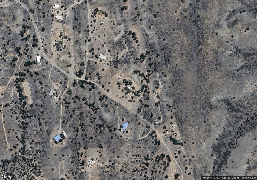
81 Apache Trail Sonoita, AZ 85637
Estimated Value: $596,000 - $726,000
5
Beds
3
Baths
2,822
Sq Ft
$242/Sq Ft
Est. Value
About This Home
This home is located at 81 Apache Trail, Sonoita, AZ 85637 and is currently estimated at $682,354, approximately $241 per square foot. 81 Apache Trail is a home located in Santa Cruz County with nearby schools including Elgin Elementary School and Patagonia Union High School.
Ownership History
Date
Name
Owned For
Owner Type
Purchase Details
Closed on
Nov 16, 2022
Sold by
Obrien Edward W and Obrien Katherine D
Bought by
Obrien Edward W and Obrien Katherine D
Current Estimated Value
Purchase Details
Closed on
Feb 2, 2015
Sold by
Fannie Mae
Bought by
Obrien Edward W and Obrien Katherine D
Home Financials for this Owner
Home Financials are based on the most recent Mortgage that was taken out on this home.
Original Mortgage
$222,400
Interest Rate
3.71%
Mortgage Type
New Conventional
Purchase Details
Closed on
Dec 30, 2014
Sold by
Schuetta Craig and Schuetta Jacqueline
Bought by
Federal National Mortgage Association
Home Financials for this Owner
Home Financials are based on the most recent Mortgage that was taken out on this home.
Original Mortgage
$222,400
Interest Rate
3.71%
Mortgage Type
New Conventional
Purchase Details
Closed on
Sep 20, 2011
Sold by
Schuetta Jacqueline
Bought by
Schuetta Craig Joseph and Schuetta Craig Joseph
Create a Home Valuation Report for This Property
The Home Valuation Report is an in-depth analysis detailing your home's value as well as a comparison with similar homes in the area
Home Values in the Area
Average Home Value in this Area
Purchase History
| Date | Buyer | Sale Price | Title Company |
|---|---|---|---|
| Obrien Edward W | -- | None Listed On Document | |
| Obrien Edward W | -- | Servicelink | |
| Federal National Mortgage Association | $445,376 | None Available | |
| Schuetta Craig Joseph | -- | None Available |
Source: Public Records
Mortgage History
| Date | Status | Borrower | Loan Amount |
|---|---|---|---|
| Previous Owner | Obrien Edward W | $222,400 |
Source: Public Records
Tax History Compared to Growth
Tax History
| Year | Tax Paid | Tax Assessment Tax Assessment Total Assessment is a certain percentage of the fair market value that is determined by local assessors to be the total taxable value of land and additions on the property. | Land | Improvement |
|---|---|---|---|---|
| 2025 | $4,592 | $44,122 | $5,408 | $38,714 |
| 2024 | $4,592 | $43,057 | $3,255 | $39,802 |
| 2023 | $4,340 | $35,331 | $3,938 | $31,393 |
| 2022 | $4,187 | $30,232 | $3,413 | $26,819 |
| 2021 | $4,014 | $29,253 | $3,413 | $25,840 |
| 2020 | $4,099 | $29,779 | $3,413 | $26,366 |
| 2019 | $3,917 | $27,873 | $3,413 | $24,460 |
| 2018 | $3,852 | $27,144 | $3,413 | $23,731 |
| 2017 | $3,681 | $27,840 | $3,413 | $24,427 |
| 2016 | $6,907 | $26,088 | $3,098 | $22,990 |
| 2015 | $3,056 | $24,222 | $0 | $0 |
Source: Public Records
Map
Nearby Homes
- 58 Apache Trail
- 77 Terry Ln
- 74 Terry Ln
- 1 Pinto Trail
- 92 Holbrook Dr
- 131 Boyd Rd
- 36 Collie Dr
- 26&36 Colt Trail
- 98 Paint Trail
- 58 Mustang Trail
- 102 Papago Springs Rd
- 92 Cayuse Trail
- 0 Ranch Oasis Ct Unit 8
- 56 Cayuse Trail
- 78 Harvest Dr
- 8 Black Oak Dr Unit 28
- 25 Coyote Ct
- 67 Wagon Wheel Ln
- 4 Mustang Trail
- 17 Cayuse Trail
- 85 Apache Trail
- 80 Apache Trail
- 37 Toledo Rd
- 93 Apache Trail
- 33 Toledo Rd
- 55 Apache Trail Unit 1
- 55 Apache Trail
- 100 Terry Ln
- 66 Apache Trail
- 0 Apache Trail Unit 20908714
- 0 Apache Trail
- 00 Apache Trail
- 26 Toledo Rd
- 27 Toledo Rd
- 84 Terry Ln
- 16 Toledo Rd Unit 6
- 108 Apache Trail
- 24 Toledo Rd
- 68 Terry Ln
- 80 Terry Ln
