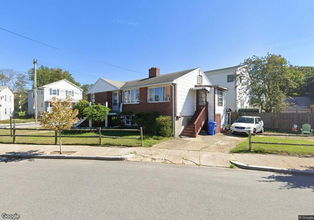
81 Banks St Winthrop, MA 02152
Downtown Winthrop NeighborhoodEstimated Value: $594,000 - $652,000
2
Beds
2
Baths
1,212
Sq Ft
$518/Sq Ft
Est. Value
About This Home
This home is located at 81 Banks St, Winthrop, MA 02152 and is currently estimated at $627,510, approximately $517 per square foot. 81 Banks St is a home located in Suffolk County with nearby schools including William P. Gorman/Fort Banks Elementary School, Arthur T. Cummings Elementary School, and Winthrop Middle School.
Ownership History
Date
Name
Owned For
Owner Type
Purchase Details
Closed on
Aug 9, 2021
Sold by
Hunter Ft
Bought by
Hunter Helen
Current Estimated Value
Purchase Details
Closed on
Aug 29, 2019
Sold by
Hunter Helen
Bought by
Hunter Ft
Create a Home Valuation Report for This Property
The Home Valuation Report is an in-depth analysis detailing your home's value as well as a comparison with similar homes in the area
Home Values in the Area
Average Home Value in this Area
Purchase History
| Date | Buyer | Sale Price | Title Company |
|---|---|---|---|
| Hunter Helen | -- | None Available | |
| Hunter Ft | -- | -- |
Source: Public Records
Tax History Compared to Growth
Tax History
| Year | Tax Paid | Tax Assessment Tax Assessment Total Assessment is a certain percentage of the fair market value that is determined by local assessors to be the total taxable value of land and additions on the property. | Land | Improvement |
|---|---|---|---|---|
| 2025 | $5,831 | $565,000 | $333,000 | $232,000 |
| 2024 | $5,778 | $554,500 | $320,000 | $234,500 |
| 2023 | $5,186 | $484,700 | $292,900 | $191,800 |
| 2022 | $5,106 | $434,200 | $261,700 | $172,500 |
| 2021 | $5,058 | $398,900 | $233,600 | $165,300 |
| 2020 | $4,928 | $390,500 | $233,600 | $156,900 |
| 2019 | $4,809 | $364,900 | $215,300 | $149,600 |
| 2018 | $4,857 | $343,000 | $184,800 | $158,200 |
| 2017 | $4,490 | $311,600 | $163,700 | $147,900 |
| 2016 | $4,460 | $290,200 | $142,300 | $147,900 |
| 2015 | $4,338 | $302,500 | $138,200 | $164,300 |
| 2014 | $4,283 | $274,900 | $128,500 | $146,400 |
Source: Public Records
Map
Nearby Homes
- 50-52 Wilshire St
- 441 Winthrop St
- 426 Winthrop St
- 800 Governors Dr Unit 6
- 1100 Governors Dr Unit 6
- 800 Governors Dr Unit 30
- 1000 Governors Dr Unit 25
- 9 Atlantic St Unit 2
- 19 Pleasant Park Rd
- 14 Pleasant Park Rd
- 87 Hermon St
- 9 Marshall St
- 56 Main St
- 550 Pleasant St Unit 11D
- 550 Pleasant St Unit 506
- 41 Summit Ave
- 80 Shirley St
- 70 Edgehill Rd
- 2 Deane Ave
- 144 Quincy Ave
- 64 Wilshire St Unit 66
- 64 Wilshire St Unit 1
- 66 Wilshire St Unit 1
- 66 Wilshire St Unit 2
- 66 Wilshire St
- 76 Banks St
- 74 Banks St Unit 1
- 55 Banks St
- 55 Banks St Unit A
- 55 Banks St Unit B
- 55 Banks St Unit 2
- 65 Wilshire St
- 70 Banks St
- 67 Wilshire St
- 61 Wilshire St
- 71 Wilshire St
- 71 Wilshire St Unit 2
- 51 Banks St
- 50 Wilshire St Unit 52
- 48 Wilshire St