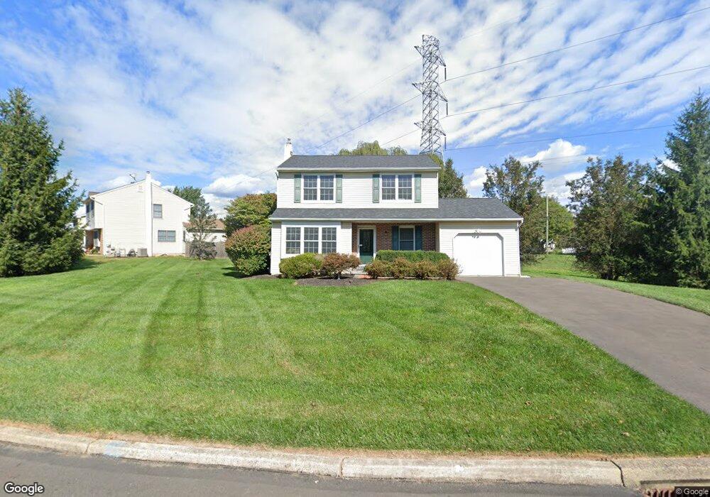
81 Barnsbury Rd Langhorne, PA 19047
Estimated Value: $525,436 - $624,000
3
Beds
3
Baths
1,508
Sq Ft
$380/Sq Ft
Est. Value
About This Home
This home is located at 81 Barnsbury Rd, Langhorne, PA 19047 and is currently estimated at $572,859, approximately $379 per square foot. 81 Barnsbury Rd is a home located in Bucks County with nearby schools including Pearl S. Buck Elementary School, Maple Point Middle School, and Neshaminy High School.
Ownership History
Date
Name
Owned For
Owner Type
Purchase Details
Closed on
Jul 9, 2007
Sold by
Dani Shashi M and Dani Chandini S
Bought by
Mariakis Michael and Mariakis Denise
Current Estimated Value
Home Financials for this Owner
Home Financials are based on the most recent Mortgage that was taken out on this home.
Original Mortgage
$276,000
Outstanding Balance
$174,571
Interest Rate
6.73%
Mortgage Type
Purchase Money Mortgage
Estimated Equity
$398,288
Purchase Details
Closed on
Nov 9, 1981
Bought by
Dani Shashi M and Dani Chandini S
Create a Home Valuation Report for This Property
The Home Valuation Report is an in-depth analysis detailing your home's value as well as a comparison with similar homes in the area
Home Values in the Area
Average Home Value in this Area
Purchase History
| Date | Buyer | Sale Price | Title Company |
|---|---|---|---|
| Mariakis Michael | $345,000 | None Available | |
| Dani Shashi M | $74,200 | -- |
Source: Public Records
Mortgage History
| Date | Status | Borrower | Loan Amount |
|---|---|---|---|
| Open | Mariakis Michael | $276,000 |
Source: Public Records
Tax History Compared to Growth
Tax History
| Year | Tax Paid | Tax Assessment Tax Assessment Total Assessment is a certain percentage of the fair market value that is determined by local assessors to be the total taxable value of land and additions on the property. | Land | Improvement |
|---|---|---|---|---|
| 2025 | $6,705 | $30,800 | $6,960 | $23,840 |
| 2024 | $6,705 | $30,800 | $6,960 | $23,840 |
| 2023 | $6,599 | $30,800 | $6,960 | $23,840 |
| 2022 | $6,426 | $30,800 | $6,960 | $23,840 |
| 2021 | $6,426 | $30,800 | $6,960 | $23,840 |
| 2020 | $6,349 | $30,800 | $6,960 | $23,840 |
| 2019 | $6,207 | $30,800 | $6,960 | $23,840 |
| 2018 | $6,093 | $30,800 | $6,960 | $23,840 |
| 2017 | $5,937 | $30,800 | $6,960 | $23,840 |
| 2016 | $5,937 | $30,800 | $6,960 | $23,840 |
| 2015 | $6,333 | $30,800 | $6,960 | $23,840 |
| 2014 | $6,333 | $30,800 | $6,960 | $23,840 |
Source: Public Records
Map
Nearby Homes
- 273 Shady Brook Dr Unit 243
- 120 Shady Brook Dr Unit 89
- 354 Shady Brook Dr Unit 180
- 210 Shady Brook Dr
- 175 Shady Brook Dr Unit 122
- 187 Shady Brook Dr Unit 129
- 510 Pin Oak Dr
- 462 Scott Ct
- 1988 Knight Cir
- 1102 Waterford Rd Unit 1
- 0 Route 413 Bypass Unit PABU2010042
- 770 Atkinson Ln
- 1948 Satter Ct
- 1835 Windflower Ln
- 1839 Windflower Ln
- 1819 Windflower Ln
- 2908 Sterling Rd Unit 175
- 2904 Sterling Rd Unit 179
- 1707 Lynbrooke Dr Unit 120
- 660 Bayberry Ln Unit T5
- 95 Barnsbury Rd
- 88 Barnsbury Rd
- 107 Barnsbury Rd
- 100 Barnsbury Rd
- 114 Barnsbury Rd
- 119 Barnsbury Rd
- 45 Barnsbury Rd
- 126 Barnsbury Rd
- 2490 Village Rd
- 131 Barnsbury Rd
- 15 Dawson Rd
- 33 Barnsbury Rd
- 138 Barnsbury Rd
- 27 Dawson Rd
- 145 Barnsbury Rd
- 39 Dawson Rd
- 144 Barnsbury Rd
- 21 Barnsbury Rd
- 51 Dawson Rd
- 38 Basil Rd