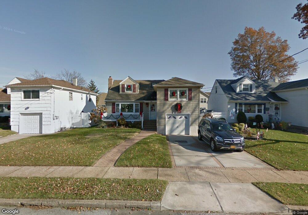
81 Branch Ave Freeport, NY 11520
Estimated Value: $594,415 - $691,000
Studio
2
Baths
1,514
Sq Ft
$425/Sq Ft
Est. Value
About This Home
This home is located at 81 Branch Ave, Freeport, NY 11520 and is currently estimated at $642,708, approximately $424 per square foot. 81 Branch Ave is a home located in Nassau County with nearby schools including Columbus Avenue School, Caroline G. Atkinson Intermediate School, and John W Dodd Middle School.
Ownership History
Date
Name
Owned For
Owner Type
Purchase Details
Closed on
Apr 24, 2021
Sold by
Holt Richard
Bought by
Holt Richard C and Meade Holt Simone
Current Estimated Value
Home Financials for this Owner
Home Financials are based on the most recent Mortgage that was taken out on this home.
Original Mortgage
$240,000
Outstanding Balance
$216,656
Interest Rate
2.99%
Mortgage Type
New Conventional
Estimated Equity
$426,052
Purchase Details
Closed on
Feb 9, 2005
Sold by
Thompson Lin
Bought by
Holt Richard
Create a Home Valuation Report for This Property
The Home Valuation Report is an in-depth analysis detailing your home's value as well as a comparison with similar homes in the area
Home Values in the Area
Average Home Value in this Area
Purchase History
| Date | Buyer | Sale Price | Title Company |
|---|---|---|---|
| Holt Richard C | -- | Titlevest | |
| Holt Richard | $330,000 | -- |
Source: Public Records
Mortgage History
| Date | Status | Borrower | Loan Amount |
|---|---|---|---|
| Open | Holt Richard C | $240,000 |
Source: Public Records
Tax History
| Year | Tax Paid | Tax Assessment Tax Assessment Total Assessment is a certain percentage of the fair market value that is determined by local assessors to be the total taxable value of land and additions on the property. | Land | Improvement |
|---|---|---|---|---|
| 2025 | $8,332 | $428 | $150 | $278 |
| 2024 | $904 | $409 | $143 | $266 |
Source: Public Records
Map
Nearby Homes
- 463 S Bayview Ave
- 173 Cedar St
- 160 Saint Marks Ave
- 119 S Bay Ave
- 48 Saint Marks Ave
- 403 S Bayview Ave
- 267 Roosevelt Ave
- 265 Roosevelt Ave
- 153 Westend Ave
- 587 S Bayview Ave
- 210 Westend Ave Unit 8B
- 210 Westend Ave Unit 8A
- 31 Anchor St Unit Y
- 525 Ray St
- 8 Florence Ave Unit 16C
- 77 Hampton Place
- 116 Westend Ave Unit 8
- 28 Florence Ave
- 310 Miller Ave
- 322 Miller Ave
- 77 Branch Ave
- 85 Branch Ave
- 118 Saint Marks Ave
- 73 Branch Ave
- 89 Branch Ave
- 114 Saint Marks Ave
- 122 Saint Marks Ave
- 110 Saint Marks Ave
- 76 Branch Ave
- 126 Saint Marks Ave
- 93 Branch Ave
- 211 Cedar St
- 2 Prato Ct
- 82 Branch Ave
- 106 Saint Marks Ave
- 130 Saint Marks Ave
- 97 Branch Ave
- 3 Prato Ct
- 86 Branch Ave
- 4 Prato Ct
Your Personal Tour Guide
Ask me questions while you tour the home.