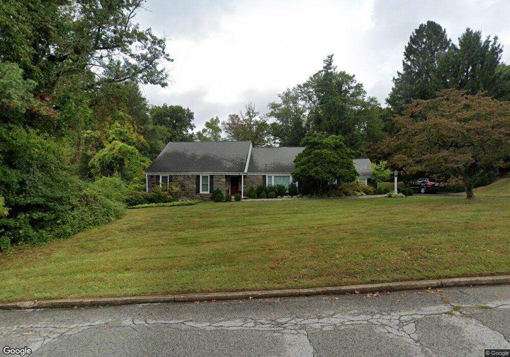
81 Brennan Dr Bryn Mawr, PA 19010
Estimated Value: $909,000 - $964,000
4
Beds
3
Baths
2,799
Sq Ft
$335/Sq Ft
Est. Value
About This Home
This home is located at 81 Brennan Dr, Bryn Mawr, PA 19010 and is currently estimated at $938,243, approximately $335 per square foot. 81 Brennan Dr is a home located in Delaware County with nearby schools including Coopertown Elementary School, Haverford Middle School, and Haverford Senior High School.
Ownership History
Date
Name
Owned For
Owner Type
Purchase Details
Closed on
Dec 17, 2004
Sold by
Hayes Brian and Hayes Bernadette
Bought by
Mccahon Brendan and Mccahon Cynthia Corr
Current Estimated Value
Home Financials for this Owner
Home Financials are based on the most recent Mortgage that was taken out on this home.
Original Mortgage
$300,000
Outstanding Balance
$150,340
Interest Rate
5.74%
Mortgage Type
Fannie Mae Freddie Mac
Estimated Equity
$787,903
Create a Home Valuation Report for This Property
The Home Valuation Report is an in-depth analysis detailing your home's value as well as a comparison with similar homes in the area
Home Values in the Area
Average Home Value in this Area
Purchase History
| Date | Buyer | Sale Price | Title Company |
|---|---|---|---|
| Mccahon Brendan | $470,000 | -- |
Source: Public Records
Mortgage History
| Date | Status | Borrower | Loan Amount |
|---|---|---|---|
| Open | Mccahon Brendan | $300,000 |
Source: Public Records
Tax History Compared to Growth
Tax History
| Year | Tax Paid | Tax Assessment Tax Assessment Total Assessment is a certain percentage of the fair market value that is determined by local assessors to be the total taxable value of land and additions on the property. | Land | Improvement |
|---|---|---|---|---|
| 2025 | $13,347 | $519,070 | $214,160 | $304,910 |
| 2024 | $13,347 | $519,070 | $214,160 | $304,910 |
| 2023 | $12,967 | $519,070 | $214,160 | $304,910 |
| 2022 | $12,664 | $519,070 | $214,160 | $304,910 |
| 2021 | $20,632 | $519,070 | $214,160 | $304,910 |
| 2020 | $12,020 | $258,610 | $106,210 | $152,400 |
| 2019 | $11,798 | $258,610 | $106,210 | $152,400 |
| 2018 | $11,596 | $258,610 | $0 | $0 |
| 2017 | $11,350 | $258,610 | $0 | $0 |
| 2016 | $1,419 | $258,610 | $0 | $0 |
| 2015 | $1,419 | $258,610 | $0 | $0 |
| 2014 | $1,419 | $258,610 | $0 | $0 |
Source: Public Records
Map
Nearby Homes
- 124 Carli Dr
- 403 Atwater Rd
- 700 S Roberts Rd
- 937 Hunt Rd
- 119 Bella Dr Unit 2MD
- 115 Bella Dr Unit 4
- 117 Bella Dr Unit 3AD
- 39 Haymarket Ln
- 209 James Rd
- 560 S Bryn Mawr Ave
- 102 James Rd
- 633 Foxfields Rd
- 130 Drakes Drum Dr
- 813 Hunt Rd
- 2613 Sunset Blvd
- 408 Barbara Ln Unit B
- 306 Summit Dr
- 103 Summit Dr Unit A
- 103 Summit Dr Unit B
- 202 Summit Dr Unit B
- 77 Brennan Dr
- 85 Brennan Dr
- 80 Brennan Dr
- 73 Brennan Dr
- 76 Brennan Dr
- 84 Brennan Dr
- 72 Brennan Dr
- 720 Cornerstone Ln
- 718 Cornerstone Ln
- 69 Brennan Dr
- 5001 Brittany Ln
- 5002 Brittany Ln
- 68 Brennan Dr
- 716 Cornerstone Ln
- 722 Cornerstone Ln
- 701 Sturbridge Dr
- 5006 Brittany Ln
- 65 Brennan Dr
- 714 Cornerstone Ln
- 5010 Brittany Ln