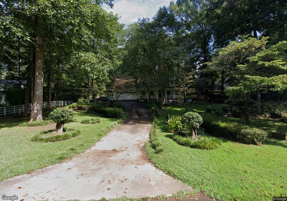
81 Browns Point Dawsonville, GA 30534
Dawson County NeighborhoodEstimated Value: $377,120 - $481,000
3
Beds
2
Baths
1,340
Sq Ft
$311/Sq Ft
Est. Value
About This Home
This home is located at 81 Browns Point, Dawsonville, GA 30534 and is currently estimated at $416,780, approximately $311 per square foot. 81 Browns Point is a home located in Dawson County with nearby schools including Kilough Elementary School, Dawson County Middle School, and Dawson County Junior High School.
Ownership History
Date
Name
Owned For
Owner Type
Purchase Details
Closed on
Jun 20, 2024
Sold by
Cowart Helen J
Bought by
Cowart Helen J and Salazar Kimberly S
Current Estimated Value
Purchase Details
Closed on
Jan 10, 2003
Sold by
Cowart Helen J
Bought by
Cowart Helen J and Michael Edward Fle
Purchase Details
Closed on
Jun 11, 2001
Sold by
Hughes Billy G
Bought by
Edwards Robert M
Purchase Details
Closed on
Mar 30, 1998
Sold by
L L Stone Inc
Bought by
Hughes Billy G
Purchase Details
Closed on
Dec 29, 1997
Sold by
Nicholson Christophe
Bought by
L L Stone Inc
Purchase Details
Closed on
Mar 17, 1992
Sold by
Melissa
Bought by
Nicholson Christophe
Purchase Details
Closed on
Oct 24, 1991
Sold by
Martin Quinn and Martin April
Bought by
Wilkie Larry
Create a Home Valuation Report for This Property
The Home Valuation Report is an in-depth analysis detailing your home's value as well as a comparison with similar homes in the area
Home Values in the Area
Average Home Value in this Area
Purchase History
| Date | Buyer | Sale Price | Title Company |
|---|---|---|---|
| Cowart Helen J | -- | None Listed On Document | |
| Cowart Helen J | -- | -- | |
| Cowart Helen J | $122,000 | -- | |
| Edwards Robert M | $126,500 | -- | |
| Hughes Billy G | $105,000 | -- | |
| L L Stone Inc | $92,000 | -- | |
| Nicholson Christophe | $85,000 | -- | |
| Wilkie Larry | $19,300 | -- | |
| Martin Quinn | $82,500 | -- |
Source: Public Records
Tax History Compared to Growth
Tax History
| Year | Tax Paid | Tax Assessment Tax Assessment Total Assessment is a certain percentage of the fair market value that is determined by local assessors to be the total taxable value of land and additions on the property. | Land | Improvement |
|---|---|---|---|---|
| 2024 | $271 | $128,628 | $30,000 | $98,628 |
| 2023 | $271 | $114,308 | $30,000 | $84,308 |
| 2022 | $1 | $79,148 | $20,000 | $59,148 |
| 2021 | $1,621 | $68,504 | $20,000 | $48,504 |
| 2020 | $1,605 | $67,104 | $20,000 | $47,104 |
| 2019 | $1,426 | $59,624 | $20,000 | $39,624 |
| 2018 | $1,426 | $59,624 | $20,000 | $39,624 |
| 2017 | $0 | $50,973 | $14,400 | $36,573 |
| 2016 | $0 | $47,004 | $12,800 | $34,204 |
| 2015 | -- | $47,004 | $12,800 | $34,204 |
| 2014 | -- | $43,886 | $12,800 | $31,086 |
| 2013 | -- | $33,459 | $10,240 | $23,219 |
Source: Public Records
Map
Nearby Homes
- 307 Robertson Rd
- 104 Waters Edge
- 435 Robertson Rd
- 427 Dawson Pointe Pkwy
- 330 Lake Dr
- 75 Lake Dr
- 604 Oak Forest Dr
- 347 Etowah Pkwy
- 518 Overlook Dr
- 611 Elliott Rd
- 734 Kilough Church Rd
- 66 Chestnut Oak Ln
- 272 Indian Cove Dr
- 246 Overlook Cir
- 3 Henry Pirkle Dr
- 61 View Point Dr
- 1056 Overlook Dr
- 36 Pelican Ct
- 47 Browns Point
- 39 Poplar Trail
- 67 Poplar Trail
- 41 Browns Point
- 147 Poplar Trail
- 96 Browns Point
- 62 Browns Point
- 58 Poplar Trail
- 0 Poplar Trail
- 0 Poplar Trail Unit 7556721
- 0 Poplar Trail Unit 7477756
- 0 Poplar Trail Unit 7374499
- 0 Poplar Trail Unit 7284083
- 0 Poplar Trail Unit 8776193
- 0 Poplar Trail Unit 3137409
- 0 Poplar Trail Unit 7041072
- 0 Poplar Trail Unit 7275040
- 0 Poplar Trail Unit 7287808
- 0 Poplar Trail Unit 7356639
- 0 Poplar Trail Unit 7370086