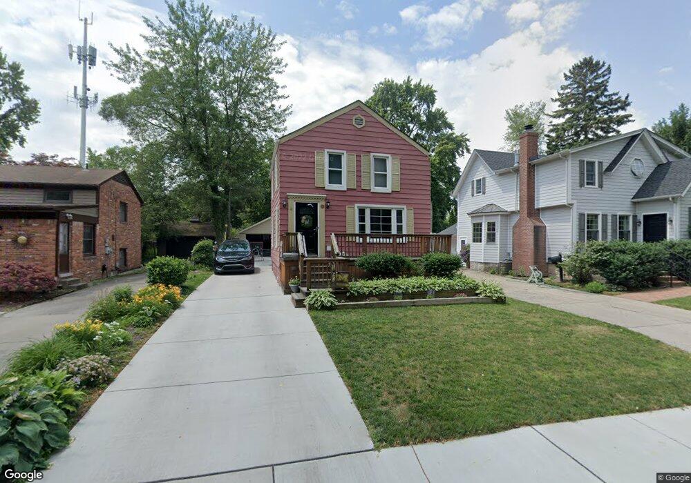
81 Cambridge Rd Grosse Pointe Farms, MI 48236
Estimated Value: $331,448 - $490,000
--
Bed
--
Bath
1,270
Sq Ft
$324/Sq Ft
Est. Value
About This Home
This home is located at 81 Cambridge Rd, Grosse Pointe Farms, MI 48236 and is currently estimated at $410,862, approximately $323 per square foot. 81 Cambridge Rd is a home located in Wayne County with nearby schools including Kerby Elementary School, Brownell Middle School, and Grosse Pointe South High School.
Ownership History
Date
Name
Owned For
Owner Type
Purchase Details
Closed on
Mar 15, 2004
Sold by
Roberts Kathleen and Hartmann Elaine
Bought by
Watson Daniel J
Current Estimated Value
Create a Home Valuation Report for This Property
The Home Valuation Report is an in-depth analysis detailing your home's value as well as a comparison with similar homes in the area
Home Values in the Area
Average Home Value in this Area
Purchase History
| Date | Buyer | Sale Price | Title Company |
|---|---|---|---|
| Watson Daniel J | -- | Greco |
Source: Public Records
Tax History Compared to Growth
Tax History
| Year | Tax Paid | Tax Assessment Tax Assessment Total Assessment is a certain percentage of the fair market value that is determined by local assessors to be the total taxable value of land and additions on the property. | Land | Improvement |
|---|---|---|---|---|
| 2025 | $2,161 | $125,900 | $0 | $0 |
| 2024 | $2,161 | $116,000 | $0 | $0 |
| 2023 | $2,059 | $107,600 | $0 | $0 |
| 2022 | $3,845 | $98,700 | $0 | $0 |
| 2021 | $3,633 | $94,300 | $0 | $0 |
| 2019 | $3,572 | $94,000 | $0 | $0 |
| 2018 | $1,828 | $87,500 | $0 | $0 |
| 2017 | $3,172 | $85,600 | $0 | $0 |
| 2016 | $3,325 | $82,200 | $0 | $0 |
| 2015 | $6,586 | $73,400 | $0 | $0 |
| 2013 | $6,380 | $63,800 | $0 | $0 |
| 2012 | $1,539 | $62,500 | $18,800 | $43,700 |
Source: Public Records
Map
Nearby Homes
- 81 Moross Rd
- 286 Grosse Pointe Blvd
- 273 Ridge Rd
- 257 Ridge Rd
- 189 Cloverly Rd
- 11 Windemere Place Unit 29
- 343 Beaupre Ave
- 216 Ridge Rd
- 130 Merriweather Rd
- 475 Lake Shore Rd
- 218 Merriweather Rd
- 93 Merriweather Rd
- 265 Williams Ave
- 259 Mount Vernon Ave
- 351 Moselle Place
- 59 Fordcroft St
- 302 Mount Vernon Ave
- 194 Charlevoix Ave
- 314 Mount Vernon Ave
- 317 Mount Vernon Ave
- 85 Cambridge Rd
- 75 Cambridge Rd
- 124 Kerby Ln
- 126 Kerby Ln
- 314 Reno Ln
- 122 Kerby Ln Unit Bldg-Unit
- 122 Kerby Ln
- 319 Beaupre Ln
- 88 Cambridge Rd
- 82 Cambridge Rd
- 71 Cambridge Rd
- 78 Cambridge Rd
- 120 Kerby Ln
- 320 Kercheval Ave
- 318 Kercheval Ave
- 322 Kercheval Ave
- 330 Kercheval Ave
- 74 Cambridge Rd
- 314 Kercheval Ave
- 312 Reno Ln