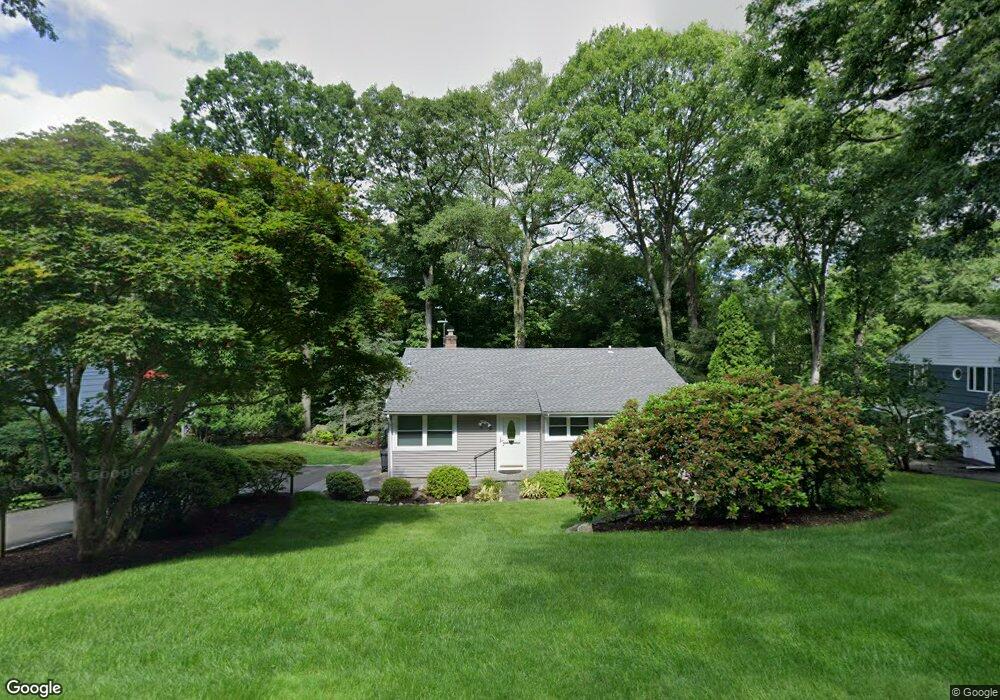
81 Clay Hill Rd Stamford, CT 06905
Turn of the River-Newfield NeighborhoodEstimated Value: $574,000 - $800,000
2
Beds
2
Baths
1,288
Sq Ft
$546/Sq Ft
Est. Value
About This Home
This home is located at 81 Clay Hill Rd, Stamford, CT 06905 and is currently estimated at $703,065, approximately $545 per square foot. 81 Clay Hill Rd is a home located in Fairfield County with nearby schools including Davenport Ridge Elementary School, Rippowam Middle School, and Stamford High School.
Ownership History
Date
Name
Owned For
Owner Type
Purchase Details
Closed on
Jul 1, 1998
Sold by
Friedman Sherry
Bought by
Gindin Boris and Gindin Yana
Current Estimated Value
Home Financials for this Owner
Home Financials are based on the most recent Mortgage that was taken out on this home.
Original Mortgage
$200,000
Interest Rate
7.04%
Mortgage Type
Purchase Money Mortgage
Create a Home Valuation Report for This Property
The Home Valuation Report is an in-depth analysis detailing your home's value as well as a comparison with similar homes in the area
Home Values in the Area
Average Home Value in this Area
Purchase History
| Date | Buyer | Sale Price | Title Company |
|---|---|---|---|
| Gindin Boris | $270,000 | -- | |
| Gindin Boris | $270,000 | -- |
Source: Public Records
Mortgage History
| Date | Status | Borrower | Loan Amount |
|---|---|---|---|
| Closed | Gindin Boris | $172,000 | |
| Closed | Gindin Boris | $200,000 |
Source: Public Records
Tax History Compared to Growth
Tax History
| Year | Tax Paid | Tax Assessment Tax Assessment Total Assessment is a certain percentage of the fair market value that is determined by local assessors to be the total taxable value of land and additions on the property. | Land | Improvement |
|---|---|---|---|---|
| 2025 | $9,438 | $398,920 | $276,230 | $122,690 |
| 2024 | $9,231 | $398,920 | $276,230 | $122,690 |
| 2023 | $9,917 | $398,920 | $276,230 | $122,690 |
| 2022 | $8,317 | $311,030 | $204,940 | $106,090 |
| 2021 | $8,227 | $311,030 | $204,940 | $106,090 |
| 2020 | $8,015 | $311,030 | $204,940 | $106,090 |
| 2019 | $8,015 | $311,030 | $204,940 | $106,090 |
| 2018 | $7,720 | $311,030 | $204,940 | $106,090 |
| 2017 | $7,494 | $288,230 | $188,520 | $99,710 |
| 2016 | $7,284 | $288,230 | $188,520 | $99,710 |
| 2015 | $7,093 | $288,230 | $188,520 | $99,710 |
| 2014 | $6,857 | $288,230 | $188,520 | $99,710 |
Source: Public Records
Map
Nearby Homes
- 160 Wire Mill Rd
- 38 Lancaster Place
- 56 Bradley Place
- 34 Bradley Place
- 88 Rockridge Ln
- 27 Emma Rd
- 21 Nichols Ave
- 400 Wire Mill Rd
- 14 Barmore Dr
- 113 Wood Ridge Dr
- 7 the Reserve at Sterling Ridge
- 31 Rosano Rd
- 506 Roxbury Rd
- 12 Walnut Ridge Ct
- 6 Walnut Ridge Ct
- 31 Woodridge Dr S
- 433 High Ridge Rd
- 122 Brook Run Ln
- 210 Red Fox Rd
- 12 Old Mill Ln
- 89 Clay Hill Rd
- 73 Clay Hill Rd
- 97 Clay Hill Rd
- 67 Clay Hill Rd
- 101 Maltbie Ave
- 86 Clay Hill Rd
- 105 Clay Hill Rd
- 96 Clay Hill Rd
- 70 Clay Hill Rd
- 61 Clay Hill Rd
- 103 Arden Ln
- 46 Hunting Ln
- 104 Clay Hill Rd
- 113 Clay Hill Rd
- 83 Maltbie Ave
- 51 Clay Hill Rd
- 93 Arden Ln
- 50 Hunting Ln
- 54 Clay Hill Rd
- 30 Hunting Ln