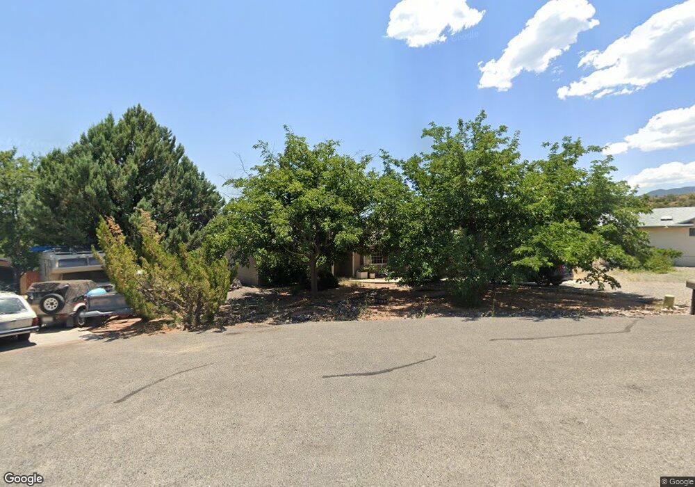
81 E Angus Cir Cottonwood, AZ 86326
Estimated Value: $347,451 - $428,000
Studio
--
Bath
1,576
Sq Ft
$247/Sq Ft
Est. Value
About This Home
This home is located at 81 E Angus Cir, Cottonwood, AZ 86326 and is currently estimated at $389,113, approximately $246 per square foot. 81 E Angus Cir is a home located in Yavapai County with nearby schools including Dr Daniel Bright Elementary School, Cottonwood Elementary School, and Cottonwood Community School.
Ownership History
Date
Name
Owned For
Owner Type
Purchase Details
Closed on
Nov 11, 2004
Sold by
Gaines Kenneth
Bought by
Gaines Addie
Current Estimated Value
Purchase Details
Closed on
Nov 2, 2004
Sold by
Bowser Jan
Bought by
Bowser Leonard
Purchase Details
Closed on
Apr 12, 2004
Sold by
Cook Dave L and Cook Jo Anne H
Bought by
Bowser Leonard D and Bowser Janet S
Home Financials for this Owner
Home Financials are based on the most recent Mortgage that was taken out on this home.
Original Mortgage
$140,900
Interest Rate
5.99%
Mortgage Type
New Conventional
Create a Home Valuation Report for This Property
The Home Valuation Report is an in-depth analysis detailing your home's value as well as a comparison with similar homes in the area
Home Values in the Area
Average Home Value in this Area
Purchase History
| Date | Buyer | Sale Price | Title Company |
|---|---|---|---|
| Gaines Addie | -- | Yavapai Title Agency | |
| Bowser Leonard | -- | Yavapai Title Agency | |
| Bowser Anna Jane | -- | Yavapai Title Agency | |
| Bowser Leonard D | $176,130 | First American Title Ins Co |
Source: Public Records
Mortgage History
| Date | Status | Borrower | Loan Amount |
|---|---|---|---|
| Previous Owner | Bowser Leonard D | $140,900 | |
| Closed | Bowser Leonard D | $35,200 |
Source: Public Records
Tax History
| Year | Tax Paid | Tax Assessment Tax Assessment Total Assessment is a certain percentage of the fair market value that is determined by local assessors to be the total taxable value of land and additions on the property. | Land | Improvement |
|---|---|---|---|---|
| 2026 | $1,214 | $32,917 | -- | -- |
| 2024 | $1,155 | $32,930 | -- | -- |
| 2023 | $1,155 | $26,365 | $3,817 | $22,548 |
| 2022 | $1,133 | $21,735 | $3,082 | $18,653 |
| 2021 | $1,169 | $20,478 | $3,224 | $17,254 |
| 2020 | $1,133 | $0 | $0 | $0 |
| 2019 | $1,100 | $0 | $0 | $0 |
| 2018 | $1,041 | $0 | $0 | $0 |
| 2017 | $980 | $0 | $0 | $0 |
| 2016 | $940 | $0 | $0 | $0 |
| 2015 | $914 | $0 | $0 | $0 |
| 2014 | $812 | $0 | $0 | $0 |
Source: Public Records
Map
Nearby Homes
- 91 E Fox Cir
- 1319 S Monte Tesoro Dr
- 1191 S Vista Grande Dr
- 1203 S Settlers Cir
- 320 E Fir St
- 1474 S Mano Ln
- 250 Kearny Way
- 201 E Papago Ln
- 544 Coyote Trail
- 534 Coyote Trail
- 2109 Sunset Dr
- 2105 Sunset Dr
- 910 S Tigres Trail
- 912 S 6th St
- 0000 Highway 260 --
- 683 Cherry Hills Way
- 743 E Cherry Hills Way
- 743 S 3rd Dr
- 301 E Cottonwood Dr
- 1190 Peila Ave Unit 8
Your Personal Tour Guide
Ask me questions while you tour the home.