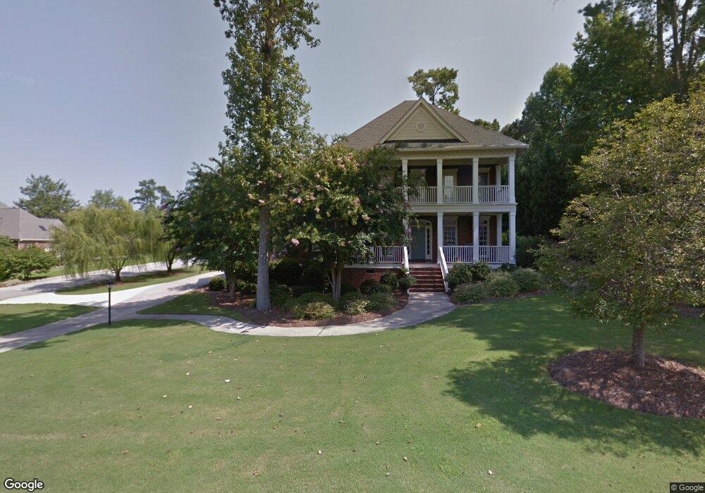
81 Foot Point Rd Columbia, SC 29209
Southeast Columbia NeighborhoodEstimated Value: $947,054 - $1,080,000
4
Beds
5
Baths
3,633
Sq Ft
$278/Sq Ft
Est. Value
About This Home
This home is located at 81 Foot Point Rd, Columbia, SC 29209 and is currently estimated at $1,008,514, approximately $277 per square foot. 81 Foot Point Rd is a home located in Richland County with nearby schools including Brennen Elementary School, Crayton Middle School, and A. C. Flora High School.
Ownership History
Date
Name
Owned For
Owner Type
Purchase Details
Closed on
Oct 21, 2004
Sold by
Cargill Brett J and Cargill Katherine J
Bought by
Lewis David and Lewis Janine
Current Estimated Value
Home Financials for this Owner
Home Financials are based on the most recent Mortgage that was taken out on this home.
Original Mortgage
$333,700
Outstanding Balance
$158,022
Interest Rate
5.12%
Mortgage Type
New Conventional
Estimated Equity
$850,492
Purchase Details
Closed on
Nov 13, 2000
Sold by
Wildcat Creek Development Company
Bought by
Cargill Brett J and Cargill Katherine J
Home Financials for this Owner
Home Financials are based on the most recent Mortgage that was taken out on this home.
Original Mortgage
$68,600
Interest Rate
7.83%
Create a Home Valuation Report for This Property
The Home Valuation Report is an in-depth analysis detailing your home's value as well as a comparison with similar homes in the area
Home Values in the Area
Average Home Value in this Area
Purchase History
| Date | Buyer | Sale Price | Title Company |
|---|---|---|---|
| Lewis David | $525,000 | -- | |
| Cargill Brett J | $70,000 | -- |
Source: Public Records
Mortgage History
| Date | Status | Borrower | Loan Amount |
|---|---|---|---|
| Open | Lewis David | $333,700 | |
| Previous Owner | Cargill Brett J | $68,600 |
Source: Public Records
Tax History Compared to Growth
Tax History
| Year | Tax Paid | Tax Assessment Tax Assessment Total Assessment is a certain percentage of the fair market value that is determined by local assessors to be the total taxable value of land and additions on the property. | Land | Improvement |
|---|---|---|---|---|
| 2024 | $4,866 | $705,600 | $0 | $0 |
| 2023 | $4,866 | $24,540 | $0 | $0 |
| 2022 | $4,449 | $613,500 | $175,000 | $438,500 |
| 2021 | $4,595 | $24,540 | $0 | $0 |
| 2020 | $4,847 | $24,540 | $0 | $0 |
| 2019 | $4,881 | $24,540 | $0 | $0 |
| 2018 | $4,353 | $21,390 | $0 | $0 |
| 2017 | $4,239 | $21,390 | $0 | $0 |
| 2016 | $4,087 | $21,390 | $0 | $0 |
| 2015 | $4,087 | $21,390 | $0 | $0 |
| 2014 | $4,083 | $534,700 | $0 | $0 |
| 2013 | -- | $21,390 | $0 | $0 |
Source: Public Records
Map
Nearby Homes
- 6109 Fitzgibbon Dr
- 114 King Charles Rd
- 1 Cardross Ln
- 6 Cardross Ln
- 22 Archdale Rd
- 241 King Charles Rd
- 1 Culpepper Cir
- 6760 Towhee Dr
- 6768 Towhee Dr
- 1621 Joiner Rd
- 289 King Charles Rd
- 1543 Joiner Rd
- 1525 Joiner Rd
- 30 Peyton Rd
- 111 Village Walk
- 129 Village Walk
- 127 Village Walk
- 59 Garner Springs Ct
- 23 Braiden Manor Rd
- 1008 Haven Dr
- 75 Foot Point Rd
- 600 N Kings Grant Dr
- 1 MacKays Point
- 624 N Kings Grant Dr
- 615 N Kings Grant Dr
- 594 N Kings Grant Dr
- 82 Foot Point Rd
- 23 Huspah Ln
- 78 Foot Point Rd
- 74 Foot Point Rd
- 19 Huspah Ln
- 631 N Kings Grant Dr
- 7 MacKays Point
- 636 N Kings Grant Dr
- 574 N Kings Grant Dr
- 2 MacKays Point
- 70 Foot Point Rd
- 6 Myrtle Bank Place
- 117 Newport Hall Ln
- 117 New Port Hall Ln