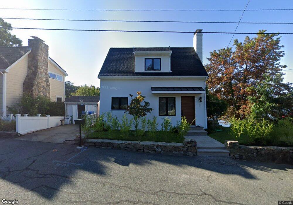
81 Gilmore Rd Wrentham, MA 02093
Estimated Value: $589,000 - $726,178
2
Beds
2
Baths
1,050
Sq Ft
$620/Sq Ft
Est. Value
About This Home
This home is located at 81 Gilmore Rd, Wrentham, MA 02093 and is currently estimated at $650,795, approximately $619 per square foot. 81 Gilmore Rd is a home located in Norfolk County with nearby schools including Delaney Elementary School and Charles E Roderick.
Ownership History
Date
Name
Owned For
Owner Type
Purchase Details
Closed on
Sep 21, 2024
Sold by
Doldt Bryan
Bought by
Derrico Christopher P
Current Estimated Value
Purchase Details
Closed on
Jul 17, 2017
Sold by
Helen S Wade Rt
Bought by
Derrico Christopher P
Home Financials for this Owner
Home Financials are based on the most recent Mortgage that was taken out on this home.
Original Mortgage
$324,000
Interest Rate
3.94%
Mortgage Type
New Conventional
Purchase Details
Closed on
Aug 14, 1987
Sold by
Johns Richard F
Bought by
Wade Helen S
Create a Home Valuation Report for This Property
The Home Valuation Report is an in-depth analysis detailing your home's value as well as a comparison with similar homes in the area
Home Values in the Area
Average Home Value in this Area
Purchase History
| Date | Buyer | Sale Price | Title Company |
|---|---|---|---|
| Derrico Christopher P | -- | None Available | |
| Derrico Christopher P | -- | None Available | |
| Derrico Christopher P | $330,000 | -- | |
| Wade Helen S | $205,000 | -- |
Source: Public Records
Mortgage History
| Date | Status | Borrower | Loan Amount |
|---|---|---|---|
| Previous Owner | Derrico Christopher P | $324,000 |
Source: Public Records
Tax History Compared to Growth
Tax History
| Year | Tax Paid | Tax Assessment Tax Assessment Total Assessment is a certain percentage of the fair market value that is determined by local assessors to be the total taxable value of land and additions on the property. | Land | Improvement |
|---|---|---|---|---|
| 2025 | $8,035 | $693,300 | $425,700 | $267,600 |
| 2024 | $7,789 | $649,100 | $425,700 | $223,400 |
| 2023 | $7,245 | $574,100 | $381,500 | $192,600 |
| 2022 | $6,481 | $474,100 | $313,800 | $160,300 |
| 2021 | $7,027 | $499,400 | $346,800 | $152,600 |
| 2020 | $7,349 | $515,700 | $353,000 | $162,700 |
| 2019 | $7,345 | $520,200 | $365,600 | $154,600 |
| 2018 | $6,062 | $425,700 | $365,900 | $59,800 |
| 2017 | $5,878 | $412,500 | $358,900 | $53,600 |
| 2016 | $5,728 | $401,100 | $348,500 | $52,600 |
| 2015 | $5,712 | $381,300 | $335,000 | $46,300 |
| 2014 | $5,616 | $366,800 | $322,200 | $44,600 |
Source: Public Records
Map
Nearby Homes
- 570 Franklin St
- 131 Creek St Unit 7
- Lot 3 - 14 Earle Stewart Ln
- 11 Earle Stewart Ln
- Lot 1 - Blueberry 2 Car Plan at King Philip Estates
- Lot 8 - Blueberry 2 Car Plan at King Philip Estates
- Lot 5 - Hughes 2 car Plan at King Philip Estates
- Lot 6 - Blueberry 3 Car Plan at King Philip Estates
- Lot 2 - Camden 2 Car Plan at King Philip Estates
- Lot 7 - Cedar Plan at King Philip Estates
- Lot 4 - Hemingway 2 Car Plan at King Philip Estates
- Lot 3 - Blueberry 2 Car Plan at King Philip Estates
- 10 Nature View Dr
- 15 Nature View Dr
- 50 Reed Fulton Ave Unit Lot 61
- 319 Taunton St
- 45 Joshua Rd
- 270 Dedham St
- 791 South St Unit 5
- 1 Lorraine Metcalf Dr
- 75 Gilmore Rd
- 89 Gilmore Rd
- 95 Gilmore Rd
- 80 Gilmore Rd Unit 80
- 71 Gilmore Rd
- 55 Gilmore Rd
- 103 Gilmore Rd
- 100 Gilmore Rd
- 49 Gilmore Rd
- 105 Gilmore Rd
- 110 Gilmore Rd
- 60 Gilmore Rd
- 50 Gilmore Rd
- 113 Gilmore Rd
- 65 Metacomet St
- 55 Metacomet St
- 43 Gilmore Rd
- 45 Metacomet St
- 130 Gilmore Rd
- 75 Metacomet St