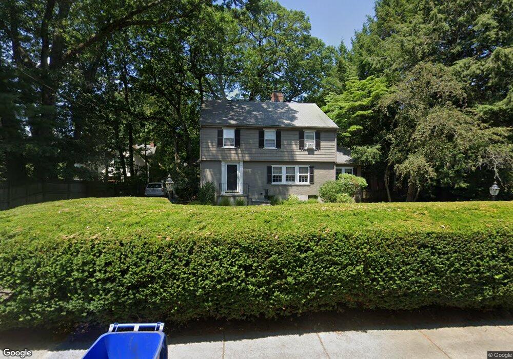
81 Grove St Auburndale, MA 02466
Auburndale NeighborhoodEstimated Value: $1,459,000 - $1,777,000
4
Beds
2
Baths
2,374
Sq Ft
$678/Sq Ft
Est. Value
About This Home
This home is located at 81 Grove St, Auburndale, MA 02466 and is currently estimated at $1,609,570, approximately $677 per square foot. 81 Grove St is a home located in Middlesex County with nearby schools including Williams Elementary School, Charles E Brown Middle School, and Newton South High School.
Ownership History
Date
Name
Owned For
Owner Type
Purchase Details
Closed on
Oct 5, 2017
Sold by
Maloney Karen J
Bought by
Karen J Maloney T
Current Estimated Value
Purchase Details
Closed on
Jun 23, 1987
Sold by
Edmonston Robert P
Bought by
Bruno Robert P
Create a Home Valuation Report for This Property
The Home Valuation Report is an in-depth analysis detailing your home's value as well as a comparison with similar homes in the area
Home Values in the Area
Average Home Value in this Area
Purchase History
| Date | Buyer | Sale Price | Title Company |
|---|---|---|---|
| Karen J Maloney T | -- | -- | |
| Bruno Robert P | $128,464 | -- |
Source: Public Records
Mortgage History
| Date | Status | Borrower | Loan Amount |
|---|---|---|---|
| Previous Owner | Bruno Robert P | $74,200 | |
| Previous Owner | Bruno Robert P | $78,000 |
Source: Public Records
Tax History
| Year | Tax Paid | Tax Assessment Tax Assessment Total Assessment is a certain percentage of the fair market value that is determined by local assessors to be the total taxable value of land and additions on the property. | Land | Improvement |
|---|---|---|---|---|
| 2025 | $14,328 | $1,462,000 | $1,046,400 | $415,600 |
| 2024 | $13,853 | $1,419,400 | $1,015,900 | $403,500 |
| 2023 | $13,006 | $1,277,600 | $799,000 | $478,600 |
| 2022 | $12,445 | $1,183,000 | $739,800 | $443,200 |
| 2021 | $12,008 | $1,116,000 | $697,900 | $418,100 |
| 2020 | $11,651 | $1,116,000 | $697,900 | $418,100 |
| 2019 | $11,323 | $1,083,500 | $677,600 | $405,900 |
| 2018 | $10,659 | $985,100 | $604,700 | $380,400 |
| 2017 | $10,334 | $929,300 | $570,500 | $358,800 |
| 2016 | $9,884 | $868,500 | $533,200 | $335,300 |
| 2015 | $9,424 | $811,700 | $498,300 | $313,400 |
Source: Public Records
Map
Nearby Homes
- 17 Lasell St
- 283 Melrose St
- 226 Auburn St Unit 226
- 194 Auburn St
- 2202 Commonwealth Ave Unit 1
- 232 Melrose St Unit 2
- 12 Oakwood Rd
- 10 Higgins St
- 1919 Commonwealth Ave Unit 1919
- 1917 Commonwealth Ave Unit 1917
- 7 Sharon Ave Unit 7
- 305 Webster St Unit 2
- 160 Pine St Unit 15
- 160 Pine St Unit 12
- 0 Duncan Rd Unit 72925240
- 49 Staniford St
- 27 Tennyson Rd
- 101-103 Lexington St
- 214 River St Unit 214
- 40 Sewall St
- 89 Grove St
- 73 Grove St
- 123 Confidential
- 15 Graydale Cir
- 11 Graydale Cir
- 12 Graydale Cir
- 94 Grove St
- 84 Grove St Unit 86
- 84 Grove St Unit 1
- 84 Grove St Unit 2
- 74 Grove St
- 86 Grove St
- 59 Grove St
- 30 Hancock St
- 30 Hancock St Unit 30
- 30 Hancock St
- 5 Graydale Cir
- 66 Grove St
- 110 Woodland Rd
- 6 Graydale Cir
Your Personal Tour Guide
Ask me questions while you tour the home.