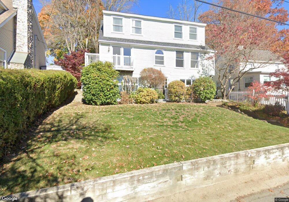
81 Lake Attitash Rd Amesbury, MA 01913
Estimated Value: $592,075 - $686,000
3
Beds
2
Baths
1,428
Sq Ft
$445/Sq Ft
Est. Value
About This Home
This home is located at 81 Lake Attitash Rd, Amesbury, MA 01913 and is currently estimated at $636,019, approximately $445 per square foot. 81 Lake Attitash Rd is a home located in Essex County with nearby schools including Amesbury High School and Amesbury Seventh-Day Adventist School.
Ownership History
Date
Name
Owned For
Owner Type
Purchase Details
Closed on
Aug 13, 1990
Sold by
Sullivan Raymond G
Bought by
Bik Michael
Current Estimated Value
Create a Home Valuation Report for This Property
The Home Valuation Report is an in-depth analysis detailing your home's value as well as a comparison with similar homes in the area
Home Values in the Area
Average Home Value in this Area
Purchase History
| Date | Buyer | Sale Price | Title Company |
|---|---|---|---|
| Bik Michael | $60,000 | -- |
Source: Public Records
Mortgage History
| Date | Status | Borrower | Loan Amount |
|---|---|---|---|
| Open | Bik Michael | $45,000 | |
| Open | Bik Michael | $87,000 | |
| Closed | Bik Michael | $25,000 | |
| Closed | Bik Michael | $116,000 |
Source: Public Records
Tax History Compared to Growth
Tax History
| Year | Tax Paid | Tax Assessment Tax Assessment Total Assessment is a certain percentage of the fair market value that is determined by local assessors to be the total taxable value of land and additions on the property. | Land | Improvement |
|---|---|---|---|---|
| 2025 | $8,111 | $530,100 | $173,700 | $356,400 |
| 2024 | $8,225 | $525,900 | $169,500 | $356,400 |
| 2023 | $7,350 | $449,800 | $154,100 | $295,700 |
| 2022 | $6,512 | $368,100 | $123,200 | $244,900 |
| 2021 | $6,596 | $361,400 | $123,200 | $238,200 |
| 2020 | $6,205 | $361,200 | $123,200 | $238,000 |
| 2019 | $6,093 | $331,700 | $117,500 | $214,200 |
| 2018 | $6,064 | $319,300 | $111,900 | $207,400 |
| 2017 | $6,202 | $310,900 | $130,600 | $180,300 |
| 2016 | $6,155 | $303,500 | $130,600 | $172,900 |
| 2015 | $6,127 | $298,300 | $130,600 | $167,700 |
| 2014 | $5,664 | $270,100 | $130,600 | $139,500 |
Source: Public Records
Map
Nearby Homes
- 4 Acadia Kimball Rd
- 1 Acadia Kimball Rd Unit 1
- 2 Alnette Rd
- 1 Tuxbury Ln
- 3 Greystone Rd
- 152 Kimball Rd
- 160 Haverhill Rd
- 10 Sharon Cir
- 3 B St
- 188 Lions Mouth Rd
- 6 B St
- 5 Moncrief St Unit 5
- 34 Emery St
- 20 Mason Ct
- 61 E Main St
- 10 Mason Ct Unit 10
- 16 Glen Devin St
- 31 Whitter Meadows Dr Unit 31
- 21-23 E Main St
- 129 Friend St
- 79 Lake Attitash Rd
- 83 Lake Attitash Rd
- 9 Beech Ln
- 7 Beech Ln
- 80 Lake Attitash Rd
- 77 1/2 Lake Attitash Rd
- 82 Lake Attitash Rd
- 78 Lake Attitash Rd
- 11 Beech Ln
- 11 Beech Ln Unit 11
- 5 Beech Ln
- 85 Lake Attitash Rd
- 77 Lake Attitash Rd
- 3 Beech Ln
- 76 Lake Attitash Rd
- 84 Lake Attitash Rd
- 87 Lake Attitash Rd
- 12 Mockingbird Hill Rd
- 75 Lake Attitash Rd
- 74 Lake Attitash Rd