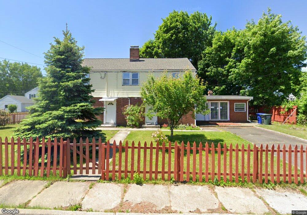
81 Lawn St Unit 83 Bridgeport, CT 06606
Brooklawn-Saint Vincent NeighborhoodEstimated Value: $488,808 - $598,000
5
Beds
3
Baths
2,596
Sq Ft
$212/Sq Ft
Est. Value
About This Home
This home is located at 81 Lawn St Unit 83, Bridgeport, CT 06606 and is currently estimated at $549,702, approximately $211 per square foot. 81 Lawn St Unit 83 is a home located in Fairfield County with nearby schools including Blackham School, Central High School, and Assumption Catholic School.
Ownership History
Date
Name
Owned For
Owner Type
Purchase Details
Closed on
Oct 2, 2000
Sold by
Pinero-Turner Marlene
Bought by
Kondo Astrit
Current Estimated Value
Home Financials for this Owner
Home Financials are based on the most recent Mortgage that was taken out on this home.
Original Mortgage
$114,059
Interest Rate
7.94%
Create a Home Valuation Report for This Property
The Home Valuation Report is an in-depth analysis detailing your home's value as well as a comparison with similar homes in the area
Home Values in the Area
Average Home Value in this Area
Purchase History
| Date | Buyer | Sale Price | Title Company |
|---|---|---|---|
| Kondo Astrit | $115,000 | -- | |
| Kondo Astrit | $115,000 | -- |
Source: Public Records
Mortgage History
| Date | Status | Borrower | Loan Amount |
|---|---|---|---|
| Open | Kondo Astrit | $116,000 | |
| Closed | Kondo Astrit | $114,059 |
Source: Public Records
Tax History Compared to Growth
Tax History
| Year | Tax Paid | Tax Assessment Tax Assessment Total Assessment is a certain percentage of the fair market value that is determined by local assessors to be the total taxable value of land and additions on the property. | Land | Improvement |
|---|---|---|---|---|
| 2025 | $8,371 | $192,660 | $77,150 | $115,510 |
| 2024 | $8,371 | $192,660 | $77,150 | $115,510 |
| 2023 | $8,371 | $192,660 | $77,150 | $115,510 |
| 2022 | $8,371 | $192,660 | $77,150 | $115,510 |
| 2021 | $8,371 | $192,660 | $77,150 | $115,510 |
| 2020 | $7,390 | $136,880 | $40,300 | $96,580 |
| 2019 | $7,390 | $136,880 | $40,300 | $96,580 |
| 2018 | $7,442 | $136,880 | $40,300 | $96,580 |
| 2017 | $7,442 | $136,880 | $40,300 | $96,580 |
| 2016 | $7,442 | $136,880 | $40,300 | $96,580 |
| 2015 | $8,339 | $197,610 | $48,780 | $148,830 |
| 2014 | $8,339 | $197,610 | $48,780 | $148,830 |
Source: Public Records
Map
Nearby Homes
- 150 Alexander Dr
- 11 Myron Ave
- 125 Alexander Dr
- 241 Sampson St
- 201 High Ridge Dr
- 2625 Park Ave Unit 12L
- 2625 Park Ave Unit 5N
- 2675 Park Ave Unit 3
- 2675 Park Ave Unit 22
- 76 Suburban Ave
- 681 Westfield Ave
- 105 Tremont Ave Unit E
- 105 Tremont Ave Unit B
- 2445 Park Ave Unit 23
- 203 Wayne St
- 252 Harlem Ave Unit B6
- 252 Harlem Ave Unit B5
- 485 Westfield Ave
- 631 Fairview Ave
- 1275 Capitol Ave
- 11 Benson St Unit 15
- 26 Benson Terrace Unit 30
- 84 Lawn St
- 44 Benson Terrace Unit 46
- 94 Lawn St
- 88 Lawn St
- 57 Lawn St
- 27 Benson St Unit 29
- 57 Lawn St Unit 59
- 57 Lawn St
- 27-29 Benson St
- 62 Lawn St
- 27 Benson Terrace Unit 29
- 100 Lawn St
- 45 Benson St Unit 49
- 50 Lawn St
- 57 Myron Ave
- 6 Benson St
- 176 Alexander Dr
- 221 Truman St