Estimated Value: $266,000 - $336,000
4
Beds
3
Baths
2,100
Sq Ft
$149/Sq Ft
Est. Value
About This Home
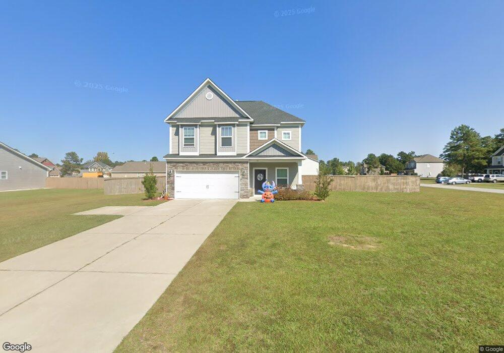
This home is located at 81 Lillie Ln, Elgin, SC 29045 and is currently estimated at $312,494, approximately $148 per square foot. 81 Lillie Ln is a home located in Kershaw County with nearby schools including Wateree Elementary School, Lugoff-Elgin Middle School, and Lugoff-Elgin High School.
Ownership History
Date
Name
Owned For
Owner Type
Purchase Details
Closed on
Jun 27, 2022
Sold by
Meranda Range
Bought by
Salmond Jason Lendell
Current Estimated Value
Home Financials for this Owner
Home Financials are based on the most recent Mortgage that was taken out on this home.
Original Mortgage
$303,030
Outstanding Balance
$287,177
Interest Rate
5.3%
Mortgage Type
New Conventional
Estimated Equity
$25,317
Purchase Details
Closed on
Apr 15, 2020
Sold by
John Baker
Bought by
Range Meranda
Home Financials for this Owner
Home Financials are based on the most recent Mortgage that was taken out on this home.
Original Mortgage
$197,600
Interest Rate
3.2%
Mortgage Type
New Conventional
Purchase Details
Closed on
Dec 13, 2017
Sold by
Great Southern Homes Inc
Bought by
Baker John and Baker Andrea
Home Financials for this Owner
Home Financials are based on the most recent Mortgage that was taken out on this home.
Original Mortgage
$150,221
Interest Rate
3.94%
Mortgage Type
New Conventional
Create a Home Valuation Report for This Property
The Home Valuation Report is an in-depth analysis detailing your home's value as well as a comparison with similar homes in the area
Purchase History
| Date | Buyer | Sale Price | Title Company |
|---|---|---|---|
| Salmond Jason Lendell | $300,000 | Blair Cato Pickren Casterline | |
| Baker John | $187,778 | -- | |
| Range Meranda | $208,000 | Law Offices Of Jared Smith Llc |
Source: Public Records
Mortgage History
| Date | Status | Borrower | Loan Amount |
|---|---|---|---|
| Open | Salmond Jason Lendell | $303,030 | |
| Previous Owner | Range Meranda | $197,600 | |
| Previous Owner | Baker John | $150,221 |
Source: Public Records
Tax History
| Year | Tax Paid | Tax Assessment Tax Assessment Total Assessment is a certain percentage of the fair market value that is determined by local assessors to be the total taxable value of land and additions on the property. | Land | Improvement |
|---|---|---|---|---|
| 2025 | $1,804 | $300,100 | $27,000 | $273,100 |
| 2024 | $1,804 | $300,100 | $27,000 | $273,100 |
| 2023 | $1,816 | $300,100 | $27,000 | $273,100 |
| 2022 | $1,270 | $208,600 | $27,000 | $181,600 |
| 2021 | $1,234 | $208,600 | $27,000 | $181,600 |
| 2020 | $1,117 | $189,000 | $27,000 | $162,000 |
| 2019 | $1,156 | $189,000 | $27,000 | $162,000 |
| 2018 | $1,085 | $189,000 | $27,000 | $162,000 |
| 2017 | $489 | $27,000 | $27,000 | $0 |
Source: Public Records
Map
Nearby Homes
- 1351 Smyrna Rd
- 952 Roberts Dr
- 245 Watts Hill Rd
- 480 Eskie Dixon Rd
- 560 Eskie Dixon Rd
- 93 Falling Leaf Ln
- 517 Watts Hill Rd
- 248 Ashley Creek Dr
- 62 Choctaw Cir
- 91 Choctaw Cir
- 1089 Chestnut Hill Rd
- 0 Rabon Cir
- 776 Wildwood Ln
- 9 Bushnell Ct
- 2140 Highway 1 S
- 2206 Highway 1 S
- 24 Mauser Dr
- 1927 U S 1
- 2011 Highway 1 S
- 1571 Chestnut Rd
Your Personal Tour Guide
Ask me questions while you tour the home.