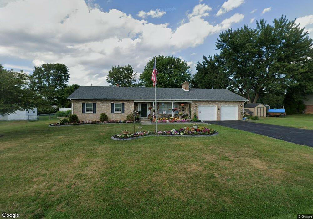
81 Maple St Gettysburg, PA 17325
Estimated Value: $287,000 - $342,342
3
Beds
2
Baths
1,508
Sq Ft
$209/Sq Ft
Est. Value
About This Home
This home is located at 81 Maple St, Gettysburg, PA 17325 and is currently estimated at $315,086, approximately $208 per square foot. 81 Maple St is a home located in Adams County with nearby schools including Rolling Acres El School, Maple Avenue Middle School, and Littlestown Senior High School.
Ownership History
Date
Name
Owned For
Owner Type
Purchase Details
Closed on
May 17, 2021
Sold by
Shorb Scott A
Bought by
Shorb Scott A and Shorb Elizabeth Anne
Current Estimated Value
Home Financials for this Owner
Home Financials are based on the most recent Mortgage that was taken out on this home.
Original Mortgage
$113,000
Outstanding Balance
$68,019
Interest Rate
2.9%
Mortgage Type
New Conventional
Estimated Equity
$247,067
Purchase Details
Closed on
Feb 9, 2015
Sold by
Shorb Scott A
Bought by
Shorb Scott A
Purchase Details
Closed on
Mar 7, 2007
Sold by
Shorb Scott A and Shorb Beth N
Bought by
Shorb Scott A
Home Financials for this Owner
Home Financials are based on the most recent Mortgage that was taken out on this home.
Original Mortgage
$200,000
Interest Rate
6.33%
Mortgage Type
New Conventional
Create a Home Valuation Report for This Property
The Home Valuation Report is an in-depth analysis detailing your home's value as well as a comparison with similar homes in the area
Home Values in the Area
Average Home Value in this Area
Purchase History
| Date | Buyer | Sale Price | Title Company |
|---|---|---|---|
| Shorb Scott A | -- | United One Resources Inc | |
| Shorb Scott A | -- | None Available | |
| Shorb Scott A | -- | -- |
Source: Public Records
Mortgage History
| Date | Status | Borrower | Loan Amount |
|---|---|---|---|
| Open | Shorb Scott A | $113,000 | |
| Previous Owner | Shorb Scott A | $200,000 |
Source: Public Records
Tax History Compared to Growth
Tax History
| Year | Tax Paid | Tax Assessment Tax Assessment Total Assessment is a certain percentage of the fair market value that is determined by local assessors to be the total taxable value of land and additions on the property. | Land | Improvement |
|---|---|---|---|---|
| 2025 | $5,418 | $220,200 | $80,000 | $140,200 |
| 2024 | $4,517 | $220,200 | $80,000 | $140,200 |
| 2023 | $4,383 | $220,200 | $80,000 | $140,200 |
| 2022 | $4,245 | $220,200 | $80,000 | $140,200 |
| 2021 | $4,107 | $220,200 | $80,000 | $140,200 |
| 2020 | $4,307 | $220,200 | $80,000 | $140,200 |
| 2019 | $4,218 | $220,200 | $80,000 | $140,200 |
| 2018 | $3,895 | $220,200 | $80,000 | $140,200 |
| 2017 | $3,785 | $220,200 | $80,000 | $140,200 |
| 2016 | -- | $220,200 | $80,000 | $140,200 |
| 2015 | -- | $220,200 | $80,000 | $140,200 |
| 2014 | -- | $220,200 | $80,000 | $140,200 |
Source: Public Records
Map
Nearby Homes
- 28 Bonniefield Cir Unit 25
- 67 Cedarfield Dr
- 1 Hickory Ave
- 138 Cedarfield Dr Unit 71
- 27 Maple St
- 8 Maple St
- 48 Cannon Ln Unit 105
- 13 N Pine St
- 25 Harvest Dr
- 780 White Hall Rd
- 860 Bon Ox Rd
- 464 Locust Ln
- 549 Grant Dr Unit 549
- 871 Sherman Dr Unit 871
- 3801 Baltimore Pike
- 2746 Baltimore Pike
- 948 Heritage Dr Unit 948
- 0 Littlestown Rd
- 198 Longstreet Dr Unit 198
- 930 Hoffman Rd
- 79 Maple St
- 6 W Bonniefield Dr Unit 78
- 4 W Bonniefield Dr
- 8 W Bonniefield Dr Unit 77
- 76 Maple St Unit 3
- 78 Maple St Unit 2
- 78 Maple St Unit 78
- 10 W Bonniefield Dr Unit 76
- 80 Maple St Unit 1
- 2 W Bonniefield Dr Unit 80
- 74 Maple St Unit 4
- 12 W Bonniefield Dr Unit 75
- 6 Holly Ct Unit 10
- 50 Hickory Ave Unit 4
- 1 Carole Ct Unit 8
- 2 Carole Ct Unit 19
- 46 Hickory Ave Unit 5
- 1461 Hickory Rd Unit 5
- 40 Bonniefield Cir Unit 74