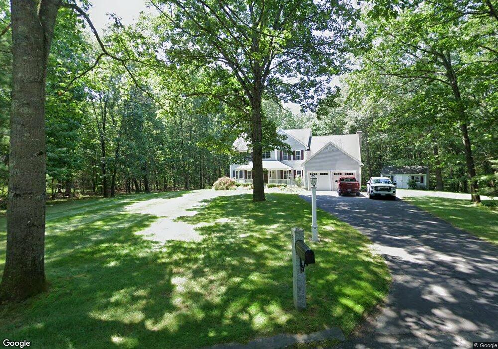
81 Mara Ln Groton, MA 01450
Estimated Value: $805,000 - $1,645,000
4
Beds
3
Baths
2,684
Sq Ft
$396/Sq Ft
Est. Value
About This Home
This home is located at 81 Mara Ln, Groton, MA 01450 and is currently estimated at $1,063,756, approximately $396 per square foot. 81 Mara Ln is a home located in Middlesex County with nearby schools including Groton Dunstable Regional High School, Groton Community School, and Seven Hills At Groton.
Ownership History
Date
Name
Owned For
Owner Type
Purchase Details
Closed on
Jun 9, 2022
Sold by
Trickett Mary D and Trickett John E
Bought by
Mary D Trickett Ret and Trickett
Current Estimated Value
Purchase Details
Closed on
Feb 27, 1998
Sold by
Village Concepts Inc
Bought by
Trickett John E and Trickett Mary D
Home Financials for this Owner
Home Financials are based on the most recent Mortgage that was taken out on this home.
Original Mortgage
$180,000
Interest Rate
6.85%
Mortgage Type
Purchase Money Mortgage
Create a Home Valuation Report for This Property
The Home Valuation Report is an in-depth analysis detailing your home's value as well as a comparison with similar homes in the area
Home Values in the Area
Average Home Value in this Area
Purchase History
| Date | Buyer | Sale Price | Title Company |
|---|---|---|---|
| Mary D Trickett Ret | -- | None Available | |
| Mary D Trickett Ret | -- | None Available | |
| Trickett John E | $325,842 | -- |
Source: Public Records
Mortgage History
| Date | Status | Borrower | Loan Amount |
|---|---|---|---|
| Previous Owner | Trickett John E | $180,000 | |
| Previous Owner | Trickett John E | $180,000 |
Source: Public Records
Tax History
| Year | Tax Paid | Tax Assessment Tax Assessment Total Assessment is a certain percentage of the fair market value that is determined by local assessors to be the total taxable value of land and additions on the property. | Land | Improvement |
|---|---|---|---|---|
| 2025 | $11,563 | $758,200 | $236,200 | $522,000 |
| 2024 | $11,493 | $761,600 | $236,200 | $525,400 |
| 2023 | $10,906 | $697,300 | $236,200 | $461,100 |
| 2022 | $10,262 | $597,000 | $217,500 | $379,500 |
| 2021 | $10,060 | $571,600 | $197,000 | $374,600 |
| 2020 | $10,070 | $579,400 | $209,000 | $370,400 |
| 2019 | $9,421 | $520,200 | $198,700 | $321,500 |
| 2018 | $9,419 | $501,000 | $198,700 | $302,300 |
| 2017 | $9,462 | $518,200 | $215,900 | $302,300 |
| 2016 | $8,845 | $471,000 | $175,900 | $295,100 |
| 2015 | $8,605 | $471,000 | $175,900 | $295,100 |
Source: Public Records
Map
Nearby Homes
Your Personal Tour Guide
Ask me questions while you tour the home.